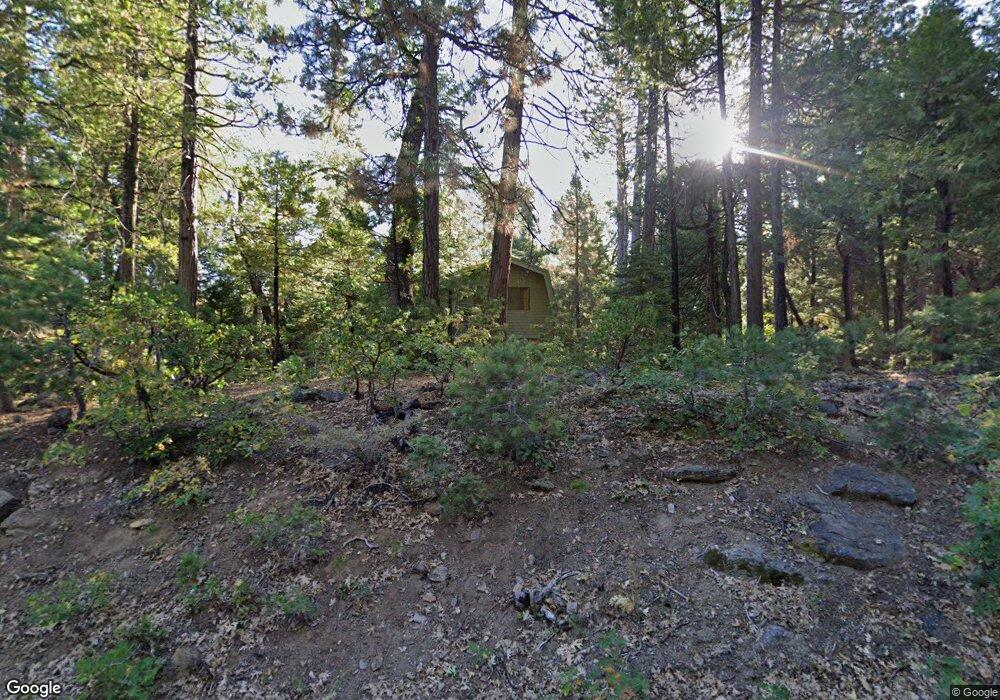
3805 Apache Rd Arnold, CA 95223
Estimated Value: $287,000 - $424,000
3
Beds
2
Baths
1,424
Sq Ft
$247/Sq Ft
Est. Value
About This Home
This home is located at 3805 Apache Rd, Arnold, CA 95223 and is currently estimated at $351,639, approximately $246 per square foot. 3805 Apache Rd is a home with nearby schools including Bret Harte Union High School.
Ownership History
Date
Name
Owned For
Owner Type
Purchase Details
Closed on
Apr 3, 2013
Sold by
Mcdonald Philip and Mcdonald Joan Dore
Bought by
Mcdonald Philip J and Mcdonald Joan D
Current Estimated Value
Purchase Details
Closed on
Jan 3, 2002
Sold by
Wilhelm James C and Wilhelm Olive Dore
Bought by
Mcdonald Philip and Mcdonald Joan Dore
Purchase Details
Closed on
Jan 2, 2001
Sold by
Wilhelm James C and Wilhelm Olive Dore
Bought by
Mcdonald Philip and Mcdonald Joan Dore
Purchase Details
Closed on
Dec 28, 2000
Sold by
Wilhelm James C and Wilhelm Olive Dore
Bought by
Mcdonald Philip and Mcdonald Joan Dore
Create a Home Valuation Report for This Property
The Home Valuation Report is an in-depth analysis detailing your home's value as well as a comparison with similar homes in the area
Purchase History
| Date | Buyer | Sale Price | Title Company |
|---|---|---|---|
| Mcdonald Philip J | -- | None Available | |
| Mcdonald Philip | -- | -- | |
| Mcdonald Philip | -- | -- | |
| Mcdonald Philip | -- | -- |
Source: Public Records
Tax History
| Year | Tax Paid | Tax Assessment Tax Assessment Total Assessment is a certain percentage of the fair market value that is determined by local assessors to be the total taxable value of land and additions on the property. | Land | Improvement |
|---|---|---|---|---|
| 2025 | $1,394 | $75,481 | $11,106 | $64,375 |
| 2023 | $1,357 | $72,552 | $10,676 | $61,876 |
| 2022 | $1,208 | $71,130 | $10,467 | $60,663 |
| 2021 | $1,199 | $69,736 | $10,262 | $59,474 |
| 2020 | $1,184 | $69,022 | $10,157 | $58,865 |
| 2019 | $1,169 | $67,669 | $9,958 | $57,711 |
| 2018 | $1,016 | $66,343 | $9,763 | $56,580 |
| 2017 | $995 | $65,043 | $9,572 | $55,471 |
| 2016 | $993 | $63,769 | $9,385 | $54,384 |
| 2015 | -- | $62,813 | $9,245 | $53,568 |
| 2014 | -- | $61,583 | $9,064 | $52,519 |
Source: Public Records
Map
Nearby Homes
- 2179 Navajo Dr
- 3099 Apache Rd
- 3065 Apache Rd
- 2434 Dardanelle Vista
- 2883 Chinook Way
- 3115 Apache Rd
- 3380 El Camino Boot Strap
- 1385 Topanga Ln
- 392 Boards Crossing Rd
- 3561 Highway 4
- 403 Sierra Pkwy
- 127 Summit Level Rd
- 10 Timber Trail Ct
- 232 Iroquois Dr
- 11 Timber Trail Ct
- 3894 Ottawa Dr
- 3641 Ottawa Dr
- 1650 Shoshone Dr
- 1694 Shoshone Dr
- 3043 Shoshone Dr
- 2720 Tahos Dr
- 2270 Tahos Dr
- 2447 Karock Rd
- 3790 Apache Rd
- 3816 Apache Rd
- 2738 Tahos Dr
- 2738 Tahos Dr Unit 227
- 2701 Tahos Dr
- 2721 Tahos Dr
- 2467 Karock Rd
- 3770 Apache Rd
- 2754 Tahos Dr
- 3845 Apache Rd
- 2483 Karock Rd
- 3834 Apache Rd
- 2407 Karock Rd
- 3861 Apache Rd
- 3695 Apache Rd
- 2861 Sioux Trail
- 2574 Cheyenne Way
Your Personal Tour Guide
Ask me questions while you tour the home.