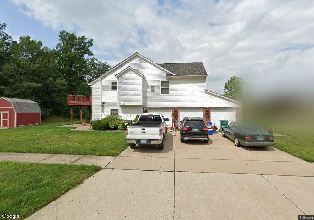
38065 McDonald Dr Romulus, MI 48174
Estimated Value: $373,000 - $462,000
About This Home
This home is located at 38065 McDonald Dr, Romulus, MI 48174 and is currently estimated at $417,771, approximately $133 per square foot. 38065 McDonald Dr is a home located in Wayne County with nearby schools including Wick Elementary School, Romulus Middle School, and Romulus Senior High School.
Ownership History
We collect this data history from publicly available records. To have your information removed, we recommend requesting removal directly through your county’s website.
Purchase Details
Home Financials for this Owner
Home Financials are based on the most recent Mortgage that was taken out on this home.Purchase Details
Home Values in the Area
Average Home Value in this Area
Purchase History
We collect this data history from publicly available records. To have your information removed, we recommend requesting removal directly through your county’s website.
| Date | Buyer | Sale Price | Title Company |
|---|---|---|---|
| -- | Title Connect Llc | ||
| $354,196 | None Available |
Mortgage History
We collect this data history from publicly available records. To have your information removed, we recommend requesting removal directly through your county’s website.
| Date | Status | Borrower | Loan Amount |
|---|---|---|---|
| Open | $83,550 |
Tax History
We collect this data history from publicly available records. To have your information removed, we recommend requesting removal directly through your county’s website.
| Year | Tax Paid | Tax Assessment Tax Assessment Total Assessment is a certain percentage of the fair market value that is determined by local assessors to be the total taxable value of land and additions on the property. | Land | Improvement |
|---|---|---|---|---|
| 2025 | $3,911 | $199,600 | $0 | $0 |
| 2024 | $4,677 | $172,600 | $0 | $0 |
| 2023 | $905 | $159,500 | $0 | $0 |
| 2022 | $4,470 | $147,800 | $0 | $0 |
| 2021 | $4,330 | $138,200 | $0 | $0 |
| 2020 | $4,244 | $122,200 | $0 | $0 |
| 2019 | $4,255 | $101,100 | $0 | $0 |
| 2018 | $2,759 | $109,600 | $0 | $0 |
| 2017 | $2,094 | $108,500 | $0 | $0 |
| 2016 | $3,664 | $101,800 | $0 | $0 |
| 2015 | $7,267 | $73,100 | $0 | $0 |
| 2013 | $7,040 | $76,900 | $0 | $0 |
| 2012 | $2,089 | $74,200 | $5,900 | $68,300 |
Map
- 8805 Cogswell St
- 39025 Buckingham Dr
- 7175 Ozga St
- 37207 Ecorse Rd
- 7065 El Paso Blvd
- 8249 Clocktower Ct
- 9069 Heritage Dr
- 11630 Ozga St
- Wahrman Wahrman
- 35901 Abbey Ct
- 36085 Wick Rd
- 6905 Arlene Ct
- 35793 Concord Dr
- 35773 Surrey Ct
- Waynecorse Wayne Course St
- 36227 Vinewood St
- 000 Waynecorse
- 35526 Abbey Dr
- 36600 Mcbride St
- 35872 Vinewood St
- 38087 McDonald Dr
- 38101 McDonald Dr Unit Bldg-Unit
- 38101 McDonald Dr
- 7980 Amber Dr
- 38123 McDonald Dr
- 7981 Silo Dr
- 7970 Amber Dr
- 38145 McDonald Dr
- 7971 Silo Dr
- 7960 Amber Dr
- 38167 McDonald Dr
- 7961 Silo Dr
- 7984 Silo Dr
- 7950 Amber Dr
- 7974 Silo Dr
- 38189 McDonald Dr
- 7964 Clydesdale Dr
- 7951 Silo Dr
- 7940 Clydesdale Dr
- 7941 Silo Dr
Ask me questions while you tour the home.