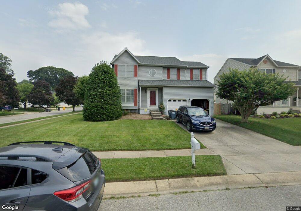
381 Mattapany Ct Arnold, MD 21012
Estimated Value: $572,000 - $695,000
Studio
3
Baths
2,116
Sq Ft
$300/Sq Ft
Est. Value
About This Home
This home is located at 381 Mattapany Ct, Arnold, MD 21012 and is currently estimated at $634,709, approximately $299 per square foot. 381 Mattapany Ct is a home located in Anne Arundel County with nearby schools including Belvedere Elementary School, Severn River Middle School, and Broadneck High School.
Ownership History
Date
Name
Owned For
Owner Type
Purchase Details
Closed on
Sep 24, 1996
Sold by
Mandrin Construction Co Inc
Bought by
Beer Michael C and Beer Karen S
Current Estimated Value
Purchase Details
Closed on
Jun 4, 1992
Sold by
Hock June C
Bought by
Atlantic Utilities, Inc
Home Financials for this Owner
Home Financials are based on the most recent Mortgage that was taken out on this home.
Original Mortgage
$2,639,000
Interest Rate
8.6%
Create a Home Valuation Report for This Property
The Home Valuation Report is an in-depth analysis detailing your home's value as well as a comparison with similar homes in the area
Home Values in the Area
Average Home Value in this Area
Purchase History
| Date | Buyer | Sale Price | Title Company |
|---|---|---|---|
| Beer Michael C | $206,955 | -- | |
| Atlantic Utilities, Inc | $1,976,900 | -- |
Source: Public Records
Mortgage History
| Date | Status | Borrower | Loan Amount |
|---|---|---|---|
| Previous Owner | Atlantic Utilities, Inc | $2,639,000 | |
| Closed | Beer Michael C | -- |
Source: Public Records
Tax History
| Year | Tax Paid | Tax Assessment Tax Assessment Total Assessment is a certain percentage of the fair market value that is determined by local assessors to be the total taxable value of land and additions on the property. | Land | Improvement |
|---|---|---|---|---|
| 2025 | $4,006 | $470,867 | -- | -- |
| 2024 | $4,006 | $448,900 | $229,000 | $219,900 |
| 2023 | $3,900 | $440,467 | $0 | $0 |
| 2022 | $3,652 | $432,033 | $0 | $0 |
| 2020 | $3,483 | $411,667 | $0 | $0 |
| 2019 | $3,420 | $399,733 | $0 | $0 |
| 2018 | $3,932 | $387,800 | $181,800 | $206,000 |
| 2017 | $3,222 | $382,533 | $0 | $0 |
| 2016 | -- | $377,267 | $0 | $0 |
| 2015 | -- | $372,000 | $0 | $0 |
| 2014 | -- | $372,000 | $0 | $0 |
Source: Public Records
Map
Nearby Homes
- 1078 Brightleaf Ct
- 394 Kings College Dr
- 303 Ternwing Dr
- 276 Overleaf Dr
- 342 Buena Vista Ave
- 1232 Taylor Ave
- 243 and 245 Haverton Rd
- 1277 Ritchie Hwy Unit 195
- 539 Greenblades Ct
- 93 Jones Station Rd
- 852 Birchwood Ct
- 404 Alameda Pkwy
- 1199 Asquithpines Place
- 559 Melissa Ct
- 813 Mago Vista Rd
- 1294 Circle Dr
- 201 Mill Ct
- 797 David Dr
- 136 Collington Ct
- 836 Mill Creek Rd
- 383 Mattapany Ct
- 381 Long Meadow Way
- 383 Long Meadow Way
- 385 Mattapany Ct
- 380 Mattapany Ct
- 1005 Tred Avon Ct
- 1003 Tred Avon Ct
- 385 Long Meadow Way
- 1001 Tred Avon Ct
- 382 Mattapany Ct
- 1007 Tred Avon Ct
- 387 Mattapany Ct
- 387 Long Meadow Way
- 1009 Tred Avon Ct
- 384 Mattapany Ct
- 1010 Tred Avon Ct
- 380 Long Meadow Way
- 382 Long Meadow Way
- 378 Long Meadow Way
- 384 Long Meadow Way
Your Personal Tour Guide
Ask me questions while you tour the home.