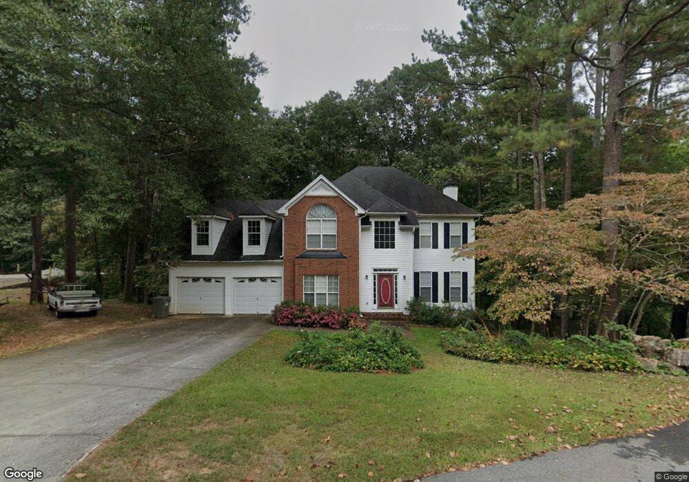
381 New Farm Rd Dallas, GA 30132
Cedarcrest NeighborhoodEstimated Value: $455,000 - $623,000
4
Beds
3
Baths
2,686
Sq Ft
$201/Sq Ft
Est. Value
About This Home
This home is located at 381 New Farm Rd, Dallas, GA 30132 and is currently estimated at $540,361, approximately $201 per square foot. 381 New Farm Rd is a home located in Paulding County with nearby schools including Burnt Hickory Elementary School, Sammy Mcclure Sr. Middle School, and North Paulding High School.
Ownership History
Date
Name
Owned For
Owner Type
Purchase Details
Closed on
Oct 8, 2021
Sold by
Outlook Communities Llc
Bought by
Banks Thomas Matthew and Banks Sheila Diane
Current Estimated Value
Purchase Details
Closed on
Aug 3, 2000
Sold by
S R Golden Homes Inc
Bought by
Lansford William J and Lansford Carolyn F
Home Financials for this Owner
Home Financials are based on the most recent Mortgage that was taken out on this home.
Original Mortgage
$120,000
Interest Rate
8.17%
Mortgage Type
New Conventional
Create a Home Valuation Report for This Property
The Home Valuation Report is an in-depth analysis detailing your home's value as well as a comparison with similar homes in the area
Home Values in the Area
Average Home Value in this Area
Purchase History
| Date | Buyer | Sale Price | Title Company |
|---|---|---|---|
| Banks Thomas Matthew | $397,600 | -- | |
| Lansford William J | $187,000 | -- |
Source: Public Records
Mortgage History
| Date | Status | Borrower | Loan Amount |
|---|---|---|---|
| Previous Owner | Lansford William J | $120,000 |
Source: Public Records
Tax History Compared to Growth
Tax History
| Year | Tax Paid | Tax Assessment Tax Assessment Total Assessment is a certain percentage of the fair market value that is determined by local assessors to be the total taxable value of land and additions on the property. | Land | Improvement |
|---|---|---|---|---|
| 2024 | $1,245 | $181,516 | $20,000 | $161,516 |
| 2023 | $1,464 | $182,000 | $20,000 | $162,000 |
| 2022 | $1,132 | $140,060 | $20,000 | $120,060 |
| 2021 | $2,097 | $113,400 | $20,000 | $93,400 |
| 2020 | $1,912 | $100,840 | $14,000 | $86,840 |
| 2019 | $2,059 | $105,896 | $14,000 | $91,896 |
| 2018 | $2,037 | $105,184 | $14,000 | $91,184 |
| 2017 | $1,922 | $97,748 | $14,000 | $83,748 |
| 2016 | $2,897 | $97,680 | $14,000 | $83,680 |
| 2015 | $2,909 | $96,368 | $14,000 | $82,368 |
| 2014 | $2,721 | $88,052 | $14,000 | $74,052 |
| 2013 | -- | $74,640 | $14,000 | $60,640 |
Source: Public Records
Map
Nearby Homes
- 154 Windlake Path
- 98 Wards Creek Ln
- 7 Pioneer Trail
- 682 Ferguson Place
- 30 Stephen Ct
- TBD Cochran Rd
- 1235 Williams Rd
- 90 Jones Ridge Way
- 224 Celestial Ridge Dr
- 790 Ferguson Place
- 856 Ferguson Place
- 1569 Dabbs Bridge Rd
- 8418 Cartersville Hwy
- 4358 Harmony Grove Church Rd
- 138 Daffodil Landing
- 4243 Harmony Grove Church Rd
- 401 New Farm Rd
- 369 New Farm Rd
- 380 New Farm Rd
- 323 New Farm Rd
- 354 New Farm Rd
- 402 New Farm Rd
- 425 Wildwind Trace
- 420 Wildwind Trace
- 420 Wildwind Trace Unit 76
- 297 New Farm Rd
- 324 New Farm Rd
- 389 Wildwind Trace
- 350 New Farm Rd
- 280 New Farm Rd
- 100 Windchase Ct
- 95 Windchase Ct
- 400 Wildwind Trace
- 277 New Farm Rd
- 80 Windchase Ct Unit N/A
- 80 Windchase Ct