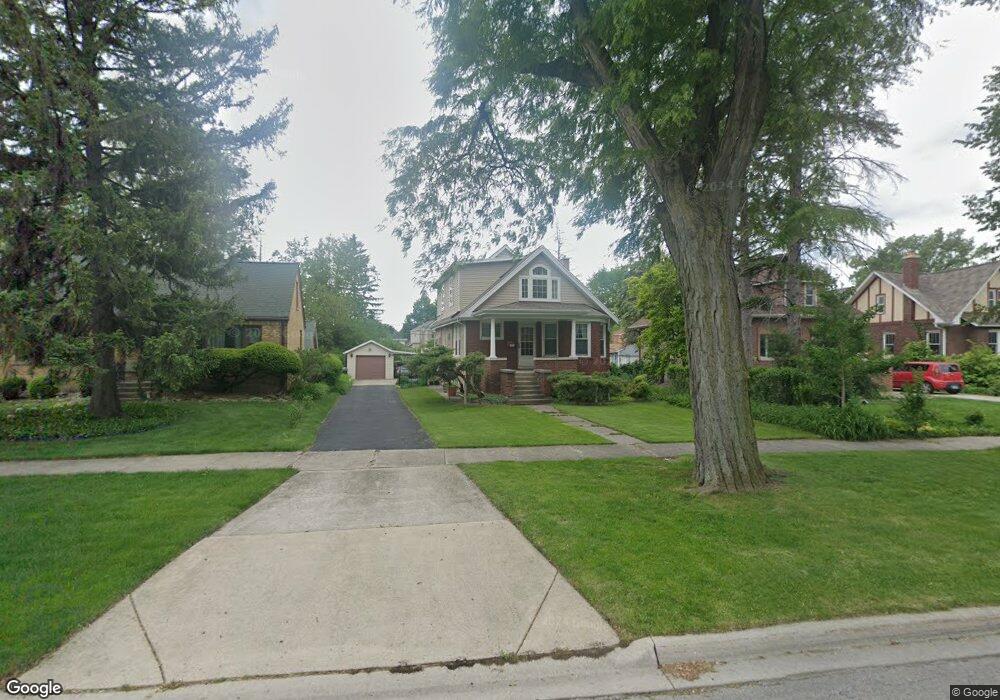
381 Olmsted Rd Riverside, IL 60546
Estimated Value: $404,000 - $553,000
4
Beds
3
Baths
1,307
Sq Ft
$371/Sq Ft
Est. Value
About This Home
This home is located at 381 Olmsted Rd, Riverside, IL 60546 and is currently estimated at $484,280, approximately $370 per square foot. 381 Olmsted Rd is a home located in Cook County with nearby schools including Central Elementary School, L J Hauser Jr High School, and Riverside Brookfield High School.
Ownership History
Date
Name
Owned For
Owner Type
Purchase Details
Closed on
Dec 9, 1994
Sold by
Touhey James R and Touhey Lu Ann
Bought by
Bai Robert Y
Current Estimated Value
Home Financials for this Owner
Home Financials are based on the most recent Mortgage that was taken out on this home.
Original Mortgage
$128,000
Interest Rate
6.75%
Create a Home Valuation Report for This Property
The Home Valuation Report is an in-depth analysis detailing your home's value as well as a comparison with similar homes in the area
Home Values in the Area
Average Home Value in this Area
Purchase History
| Date | Buyer | Sale Price | Title Company |
|---|---|---|---|
| Bai Robert Y | $160,000 | -- |
Source: Public Records
Mortgage History
| Date | Status | Borrower | Loan Amount |
|---|---|---|---|
| Closed | Bai Robert Y | $128,000 |
Source: Public Records
Tax History
| Year | Tax Paid | Tax Assessment Tax Assessment Total Assessment is a certain percentage of the fair market value that is determined by local assessors to be the total taxable value of land and additions on the property. | Land | Improvement |
|---|---|---|---|---|
| 2025 | $4,799 | $41,000 | $10,500 | $30,500 |
| 2024 | $4,799 | $41,000 | $10,500 | $30,500 |
| 2023 | $5,928 | $41,000 | $10,500 | $30,500 |
| 2022 | $5,928 | $30,766 | $9,188 | $21,578 |
| 2021 | $5,546 | $30,764 | $9,187 | $21,577 |
| 2020 | $4,997 | $30,764 | $9,187 | $21,577 |
| 2019 | $5,461 | $24,606 | $8,400 | $16,206 |
| 2018 | $5,310 | $24,606 | $8,400 | $16,206 |
| 2017 | $5,048 | $26,437 | $8,400 | $18,037 |
| 2016 | $6,438 | $23,701 | $7,350 | $16,351 |
| 2015 | $6,608 | $23,701 | $7,350 | $16,351 |
| 2014 | $6,527 | $23,701 | $7,350 | $16,351 |
| 2013 | $6,738 | $26,105 | $7,350 | $18,755 |
Source: Public Records
Map
Nearby Homes
- 303 Lionel Rd
- 7048 35th St
- 280 Blackhawk Rd
- 262 Lionel Rd
- 7336 39th St
- 7330 39th St
- 3829 Wisconsin Ave
- 3723 Home Ave
- 3548 Clinton Ave
- 3742 Clinton Ave
- 7335 Oakwood Ave Unit P-10
- 7335 Oakwood Ave Unit P-12
- 7335 Oakwood Ave Unit P-8
- 7335 Oakwood Ave Unit P-11
- 7335 Oakwood Ave Unit P-14
- 3900 Home Ave
- 7316 40th St Unit 2E
- 7316 40th St Unit P-9
- 7316 40th St Unit P-10
- 7316 40th St Unit P-13
- 385 Olmsted Rd
- 379 Olmsted Rd
- 373 Olmsted Rd
- 389 Olmsted Rd
- 369 Olmsted Rd
- 393 Olmsted Rd
- 3628 Harlem Ave
- 398 Blackhawk Rd
- 400 Blackhawk Rd
- 404 Blackhawk Rd
- 392 Blackhawk Rd
- 3632 Harlem Ave
- 3632 S Harlem Ave
- 365 Olmsted Rd
- 3634 Harlem Ave
- 408 Blackhawk Rd
- 382 Olmsted Rd
- 386 Olmsted Rd
- 3636 Harlem Ave
- 384 Blackhawk Rd
Your Personal Tour Guide
Ask me questions while you tour the home.