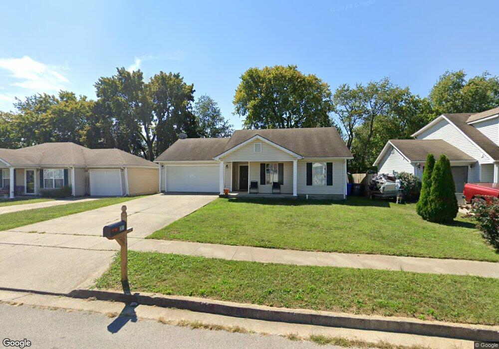
381 Scottsdale Cir Lexington, KY 40511
Winburn-Griffin Gate NeighborhoodEstimated Value: $195,000 - $229,000
3
Beds
2
Baths
1,080
Sq Ft
$191/Sq Ft
Est. Value
About This Home
This home is located at 381 Scottsdale Cir, Lexington, KY 40511 and is currently estimated at $205,830, approximately $190 per square foot. 381 Scottsdale Cir is a home located in Fayette County with nearby schools including Northern Elementary School, Winburn Middle School, and Bryan Station High School.
Ownership History
Date
Name
Owned For
Owner Type
Purchase Details
Closed on
Feb 4, 2011
Sold by
Bank Of Ny Tr Co Na & Tr
Bought by
Lakes Edge Dev Llc
Current Estimated Value
Home Financials for this Owner
Home Financials are based on the most recent Mortgage that was taken out on this home.
Original Mortgage
$68,500
Interest Rate
4.79%
Mortgage Type
Unknown
Purchase Details
Closed on
Sep 29, 2010
Sold by
Crumbie Kim
Bought by
Bank Of Ny Mellon Tr Co Na & Tr
Purchase Details
Closed on
Oct 15, 2009
Sold by
Crumbie Tracie
Bought by
Crumbie Kim
Create a Home Valuation Report for This Property
The Home Valuation Report is an in-depth analysis detailing your home's value as well as a comparison with similar homes in the area
Home Values in the Area
Average Home Value in this Area
Purchase History
| Date | Buyer | Sale Price | Title Company |
|---|---|---|---|
| Lakes Edge Dev Llc | $68,500 | -- | |
| Bank Of Ny Mellon Tr Co Na & Tr | $70,001 | -- | |
| Crumbie Kim | $112,500 | -- |
Source: Public Records
Mortgage History
| Date | Status | Borrower | Loan Amount |
|---|---|---|---|
| Open | Crumbie Kim | $308,500 | |
| Closed | Crumbie Kim | $68,500 |
Source: Public Records
Tax History Compared to Growth
Tax History
| Year | Tax Paid | Tax Assessment Tax Assessment Total Assessment is a certain percentage of the fair market value that is determined by local assessors to be the total taxable value of land and additions on the property. | Land | Improvement |
|---|---|---|---|---|
| 2024 | $1,807 | $146,100 | $0 | $0 |
| 2023 | $1,807 | $146,100 | $0 | $0 |
| 2022 | $1,290 | $101,000 | $0 | $0 |
| 2021 | $1,290 | $101,000 | $0 | $0 |
| 2020 | $1,290 | $101,000 | $0 | $0 |
| 2019 | $1,290 | $101,000 | $0 | $0 |
| 2018 | $1,022 | $80,000 | $0 | $0 |
| 2017 | $974 | $80,000 | $0 | $0 |
| 2015 | $1,027 | $80,000 | $0 | $0 |
| 2014 | $1,027 | $80,000 | $0 | $0 |
| 2012 | $1,027 | $91,800 | $0 | $0 |
Source: Public Records
Map
Nearby Homes
- 364 Scottsdale Cir
- 485 Scottsdale Cir
- 429 Kilpatrick Ct
- 1602 Astaire Ct
- 1706 Cameron Ct
- 1704 Silver Ln
- 1724 Silver Ln
- 1742 Russell Cave Rd
- 917 Dawson Creek Way
- 1372 Sugar Maple Ln
- 642 Bishop Dr
- 500 Southridge Dr
- 1766 Russell Cave Rd
- 501 Dover Rd
- 721 Newtown Springs Dr
- 1801 Russell Cave Rd
- 1437 Sugar Maple Ct
- 1054 Heather Hills Ln
- 1020 Griffin Gate Dr
- 1834 Donco Ct
- 377 Scottsdale Cir
- 385 Scottsdale Cir
- 389 Scottsdale Cir
- 373 Scottsdale Cir
- 0 Scottsdale Cir
- 517 Hollow Creek Rd
- 513 Hollow Creek Rd
- 509 Hollow Creek Rd
- 380 Scottsdale Cir
- 384 Scottsdale Cir
- 369 Scottsdale Cir
- 393 Scottsdale Cir
- 376 Scottsdale Cir
- 388 Scottsdale Cir
- 505 Hollow Creek Rd
- 525 Hollow Creek Rd
- 372 Scottsdale Cir
- 392 Scottsdale Cir
- 365 Scottsdale Cir
- 1505 Rodney Place