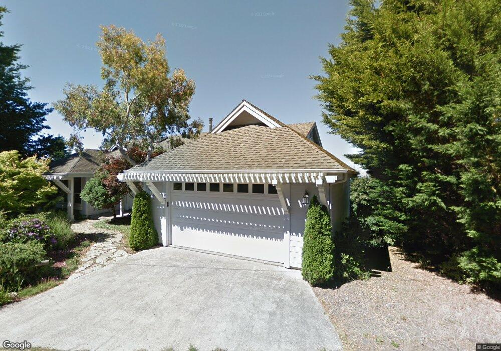
381 Seafoam Rd Whitethorn, CA 95589
Shelter Cove NeighborhoodEstimated Value: $536,000 - $648,000
3
Beds
2
Baths
2,924
Sq Ft
$200/Sq Ft
Est. Value
About This Home
This home is located at 381 Seafoam Rd, Whitethorn, CA 95589 and is currently estimated at $586,068, approximately $200 per square foot. 381 Seafoam Rd is a home located in Humboldt County.
Ownership History
Date
Name
Owned For
Owner Type
Purchase Details
Closed on
Jan 11, 2022
Sold by
Nordell Venture and Dundas Erin
Bought by
Dundas Nordell Living Trust and Nordell
Current Estimated Value
Purchase Details
Closed on
Jan 9, 2017
Sold by
Thompson Kenneth and Thompson Bonnie
Bought by
Nordell Venture Blaze and Dundas Erin Dawn
Home Financials for this Owner
Home Financials are based on the most recent Mortgage that was taken out on this home.
Original Mortgage
$430,000
Interest Rate
4.13%
Mortgage Type
Purchase Money Mortgage
Purchase Details
Closed on
Jul 19, 2012
Sold by
Thompson Kenneth and Thompson Bonnie
Bought by
Thompson Kenneth L and Thompson Bonnie
Purchase Details
Closed on
Aug 16, 2002
Sold by
Long Leo E and Long Nancy J
Bought by
Thompson Kenneth and Thompson Bonnie
Home Financials for this Owner
Home Financials are based on the most recent Mortgage that was taken out on this home.
Original Mortgage
$460,000
Interest Rate
5.37%
Purchase Details
Closed on
Jun 13, 2000
Sold by
Vonderahe Gerald and Vonderahe Kathleen N
Bought by
Long Leo E and Long Nancy J
Home Financials for this Owner
Home Financials are based on the most recent Mortgage that was taken out on this home.
Original Mortgage
$78,000
Interest Rate
8.55%
Mortgage Type
Seller Take Back
Purchase Details
Closed on
Apr 30, 1997
Sold by
Vonderahe Gerald and Vonderahe Kathleen N
Bought by
Vonderahe Gerald and Vonderahe Kathleen N
Home Financials for this Owner
Home Financials are based on the most recent Mortgage that was taken out on this home.
Original Mortgage
$160,000
Interest Rate
6.87%
Purchase Details
Closed on
Apr 23, 1997
Sold by
Strange William F and Strange Vernice E
Bought by
Vonderahe Gerald and Vonderahe Kathleen
Home Financials for this Owner
Home Financials are based on the most recent Mortgage that was taken out on this home.
Original Mortgage
$160,000
Interest Rate
6.87%
Create a Home Valuation Report for This Property
The Home Valuation Report is an in-depth analysis detailing your home's value as well as a comparison with similar homes in the area
Home Values in the Area
Average Home Value in this Area
Purchase History
| Date | Buyer | Sale Price | Title Company |
|---|---|---|---|
| Dundas Nordell Living Trust | -- | None Listed On Document | |
| Nordell Venture Blaze | $430,000 | Humboldt Land Title Company | |
| Thompson Kenneth L | -- | None Available | |
| Thompson Kenneth | $575,000 | First American Title Ins Co | |
| Long Leo E | $380,000 | First American Title Co | |
| Vonderahe Gerald | -- | -- | |
| Vonderahe Gerald | $200,000 | Humboldt Land Title Co |
Source: Public Records
Mortgage History
| Date | Status | Borrower | Loan Amount |
|---|---|---|---|
| Previous Owner | Nordell Venture Blaze | $430,000 | |
| Previous Owner | Thompson Kenneth | $460,000 | |
| Previous Owner | Long Leo E | $78,000 | |
| Previous Owner | Vonderahe Gerald | $160,000 |
Source: Public Records
Tax History Compared to Growth
Tax History
| Year | Tax Paid | Tax Assessment Tax Assessment Total Assessment is a certain percentage of the fair market value that is determined by local assessors to be the total taxable value of land and additions on the property. | Land | Improvement |
|---|---|---|---|---|
| 2025 | $4,942 | $446,819 | $69,632 | $377,187 |
| 2024 | $4,942 | $438,059 | $68,267 | $369,792 |
| 2023 | $4,960 | $429,471 | $66,929 | $362,542 |
| 2022 | $4,885 | $421,051 | $65,617 | $355,434 |
| 2021 | $4,704 | $412,796 | $64,331 | $348,465 |
| 2020 | $4,731 | $408,564 | $63,672 | $344,892 |
| 2019 | $4,616 | $400,554 | $62,424 | $338,130 |
| 2018 | $4,614 | $392,700 | $61,200 | $331,500 |
| 2017 | $7,105 | $630,196 | $93,589 | $536,607 |
| 2016 | $7,097 | $620,860 | $91,754 | $529,106 |
| 2015 | $7,065 | $611,910 | $90,376 | $521,534 |
| 2014 | $6,710 | $600,580 | $88,606 | $511,974 |
Source: Public Records
Map
Nearby Homes
- 37 Spur Ct
- 189 & 177 Hickory Rd
- 26 Rd
- 30 Fir Ct
- 825 Upper Pacific Dr
- 865 Upper Pacific Dr
- 88 Shaker Rd
- 245 Albatross Rd
- 76 Lower Pacific Dr
- 48 Cinch Ct
- 680 Redwood Rd
- 156 Shaker Rd
- 104 Sea View Rd
- 134 Sea View Rd
- 190 Shaker Rd
- 776 Upper Pacific Dr
- 79 Sea View Rd
- 299 Vista Rd
- 541 Redwood Rd
- 170 Wave Dr