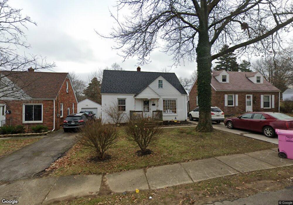
381 Taylor Rd Mansfield, OH 44903
Estimated Value: $131,608 - $166,000
3
Beds
2
Baths
1,533
Sq Ft
$101/Sq Ft
Est. Value
About This Home
This home is located at 381 Taylor Rd, Mansfield, OH 44903 and is currently estimated at $154,152, approximately $100 per square foot. 381 Taylor Rd is a home located in Richland County with nearby schools including Mansfield Elective Academy and Discovery School.
Ownership History
Date
Name
Owned For
Owner Type
Purchase Details
Closed on
Sep 9, 2019
Sold by
Merwine Larry D
Bought by
Sps Properties Of Mansfield Llc
Current Estimated Value
Purchase Details
Closed on
Feb 13, 2018
Sold by
Williams Nancy Mckinnis
Bought by
Merwine Larry D
Purchase Details
Closed on
Mar 22, 1991
Sold by
Mckinnis Charles L
Bought by
Mckinnis Margaret D
Purchase Details
Closed on
Apr 1, 1986
Create a Home Valuation Report for This Property
The Home Valuation Report is an in-depth analysis detailing your home's value as well as a comparison with similar homes in the area
Home Values in the Area
Average Home Value in this Area
Purchase History
| Date | Buyer | Sale Price | Title Company |
|---|---|---|---|
| Sps Properties Of Mansfield Llc | -- | None Available | |
| Merwine Larry D | $18,000 | Southern Title | |
| Mckinnis Margaret D | -- | -- | |
| -- | $34,600 | -- |
Source: Public Records
Tax History Compared to Growth
Tax History
| Year | Tax Paid | Tax Assessment Tax Assessment Total Assessment is a certain percentage of the fair market value that is determined by local assessors to be the total taxable value of land and additions on the property. | Land | Improvement |
|---|---|---|---|---|
| 2024 | $869 | $18,150 | $3,590 | $14,560 |
| 2023 | $869 | $18,150 | $3,590 | $14,560 |
| 2022 | $762 | $13,340 | $3,080 | $10,260 |
| 2021 | $767 | $13,340 | $3,080 | $10,260 |
| 2020 | $785 | $13,340 | $3,080 | $10,260 |
| 2019 | $870 | $13,340 | $3,080 | $10,260 |
| 2018 | $858 | $13,340 | $3,080 | $10,260 |
| 2017 | $1,397 | $21,950 | $3,080 | $18,870 |
| 2016 | $1,419 | $21,980 | $4,240 | $17,740 |
| 2015 | $1,419 | $21,980 | $4,240 | $17,740 |
| 2014 | $1,338 | $21,980 | $4,240 | $17,740 |
| 2012 | $513 | $21,990 | $4,470 | $17,520 |
Source: Public Records
Map
Nearby Homes
- 679 Coleman Rd
- 408 Fairlawn Ave
- 616 Cline Ave
- 538 Broadview Ave
- 191 Fairlawn Ave
- 212 Marlow Rd
- 143 Fairlawn Ave
- 135 Fairlawn Ave
- 129 Fairlawn Ave
- 190 S Linden Rd
- 118 Parkwood Blvd
- 133 Stewart Ave S
- 655 Woodhill Rd
- 126 Dawson Ave
- 143 Kingwood Place
- 78 Glenwood Blvd
- 244 S Trimble Rd Unit 246
- 232 S Trimble Rd Unit 234
- 216 S Trimble Rd Unit 218
- 41 Parkwood Blvd