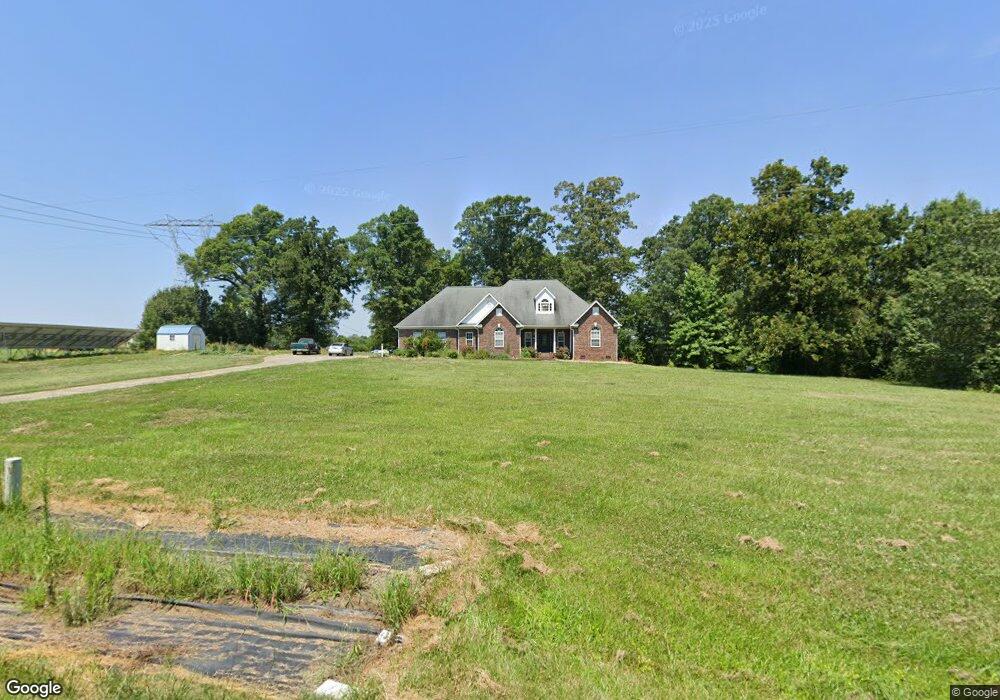
3810 Mcmanus Rd Monroe, NC 28112
Estimated Value: $371,000 - $677,000
3
Beds
2
Baths
2,201
Sq Ft
$248/Sq Ft
Est. Value
About This Home
This home is located at 3810 Mcmanus Rd, Monroe, NC 28112 and is currently estimated at $544,818, approximately $247 per square foot. 3810 Mcmanus Rd is a home located in Union County with nearby schools including Prospect Elementary School, Parkwood Middle School, and Parkwood High School.
Ownership History
Date
Name
Owned For
Owner Type
Purchase Details
Closed on
Jun 3, 2005
Sold by
Nance Paula Jean and Sanders Paula
Bought by
Clarke David and Clarke Rachel
Current Estimated Value
Home Financials for this Owner
Home Financials are based on the most recent Mortgage that was taken out on this home.
Original Mortgage
$239,200
Outstanding Balance
$122,311
Interest Rate
5.74%
Mortgage Type
Fannie Mae Freddie Mac
Estimated Equity
$422,507
Create a Home Valuation Report for This Property
The Home Valuation Report is an in-depth analysis detailing your home's value as well as a comparison with similar homes in the area
Purchase History
| Date | Buyer | Sale Price | Title Company |
|---|---|---|---|
| Clarke David | $299,000 | -- |
Source: Public Records
Mortgage History
| Date | Status | Borrower | Loan Amount |
|---|---|---|---|
| Open | Clarke David | $239,200 | |
| Closed | Clarke David | $44,850 |
Source: Public Records
Tax History
| Year | Tax Paid | Tax Assessment Tax Assessment Total Assessment is a certain percentage of the fair market value that is determined by local assessors to be the total taxable value of land and additions on the property. | Land | Improvement |
|---|---|---|---|---|
| 2025 | $2,282 | $495,100 | $0 | $0 |
| 2024 | $2,027 | $324,200 | $38,900 | $285,300 |
| 2023 | $2,013 | $324,200 | $38,900 | $285,300 |
| 2022 | $2,013 | $324,200 | $38,900 | $285,300 |
| 2021 | $1,968 | $314,100 | $38,900 | $275,200 |
| 2020 | $1,672 | $211,760 | $30,060 | $181,700 |
| 2019 | $1,648 | $211,760 | $30,060 | $181,700 |
| 2018 | $1,648 | $211,760 | $30,060 | $181,700 |
| 2017 | $1,754 | $211,800 | $30,100 | $181,700 |
| 2016 | $1,723 | $211,760 | $30,060 | $181,700 |
| 2015 | $1,745 | $211,760 | $30,060 | $181,700 |
| 2014 | $1,666 | $238,190 | $44,360 | $193,830 |
Source: Public Records
Map
Nearby Homes
- 4120 Mcmanus Rd
- 4114 Mcmanus Rd Unit 1
- 2709 Hattie St Unit 486
- 2605 Plyler Mill Rd
- 2601 Plyler Mill Rd
- 2521 Plyler Mill Rd
- 2517 Plyler Mill Rd
- 2721 Tara Dr
- 3002 Plyler Mill Rd
- 4517 Plyler Mill Rd
- 5916 Griffith Rd
- 3711 Roughedge Dr
- 3707 Roughedge Dr
- 3508 Oasis Dr
- 3512 Oasis Dr
- 3504 Oasis Dr
- 3710 Roughedge Dr
- 1410 Augustus Rd
- 1416 Augustus Rd Unit 1
- 1324 Augustus Rd
- 3809 Mcmanus Rd
- 3709 Mcmanus Rd
- 4805 Griffith Rd
- 3907 Mcmanus Rd
- 4711 Griffith Rd
- 4821 Griffith Rd
- 4806 Griffith Rd
- 4811 Griffith Rd
- 4712 Griffith Rd
- 4814 Griffith Rd
- 3915 Mcmanus Rd
- 4710 Griffith Rd
- 4611 Griffith Rd
- 4613 Griffith Rd
- 4004 Mcmanus Rd
- 4607 Griffith Rd
- 4609 Griffith Rd
- 4605 Griffith Rd
- 4911 Griffith Rd
- 4917 Griffith Rd
Your Personal Tour Guide
Ask me questions while you tour the home.