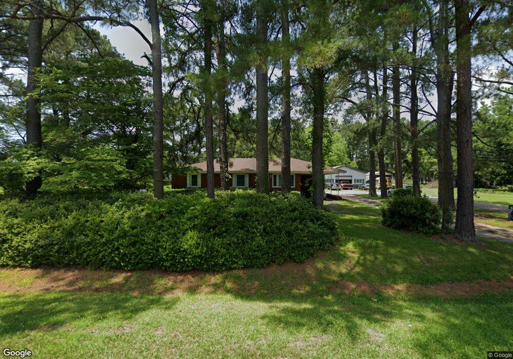
3810 Poole Rd Kinston, NC 28504
Estimated Value: $234,000 - $267,326
4
Beds
4
Baths
2,278
Sq Ft
$112/Sq Ft
Est. Value
About This Home
This home is located at 3810 Poole Rd, Kinston, NC 28504 and is currently estimated at $254,832, approximately $111 per square foot. 3810 Poole Rd is a home located in Lenoir County with nearby schools including Banks Elementary School, E.B. Frink Middle School, and North Lenoir High School.
Ownership History
Date
Name
Owned For
Owner Type
Purchase Details
Closed on
Jul 21, 2011
Sold by
Hoffman Heilig Winslon and Hoffman Blaney Parrish
Bought by
Ormond Garfield D and Ormond Lawana R
Current Estimated Value
Home Financials for this Owner
Home Financials are based on the most recent Mortgage that was taken out on this home.
Original Mortgage
$134,838
Outstanding Balance
$92,808
Interest Rate
4.52%
Mortgage Type
VA
Estimated Equity
$162,024
Create a Home Valuation Report for This Property
The Home Valuation Report is an in-depth analysis detailing your home's value as well as a comparison with similar homes in the area
Home Values in the Area
Average Home Value in this Area
Purchase History
| Date | Buyer | Sale Price | Title Company |
|---|---|---|---|
| Ormond Garfield D | $132,000 | -- |
Source: Public Records
Mortgage History
| Date | Status | Borrower | Loan Amount |
|---|---|---|---|
| Open | Ormond Garfield D | $134,838 |
Source: Public Records
Tax History Compared to Growth
Tax History
| Year | Tax Paid | Tax Assessment Tax Assessment Total Assessment is a certain percentage of the fair market value that is determined by local assessors to be the total taxable value of land and additions on the property. | Land | Improvement |
|---|---|---|---|---|
| 2025 | $1,939 | $267,654 | $29,145 | $238,509 |
| 2024 | $1,258 | $129,404 | $15,820 | $113,584 |
| 2023 | $1,303 | $134,404 | $15,820 | $118,584 |
| 2022 | $1,303 | $134,404 | $15,820 | $118,584 |
| 2021 | $1,300 | $134,404 | $15,820 | $118,584 |
| 2020 | $1,300 | $134,404 | $15,820 | $118,584 |
| 2019 | $1,303 | $134,404 | $15,820 | $118,584 |
| 2018 | $1,283 | $134,404 | $15,820 | $118,584 |
| 2017 | $1,284 | $134,404 | $15,820 | $118,584 |
| 2014 | $1,315 | $139,887 | $15,821 | $124,066 |
| 2013 | -- | $139,887 | $15,821 | $124,066 |
| 2011 | -- | $139,887 | $15,821 | $124,066 |
Source: Public Records
Map
Nearby Homes
- 0 Institute Rd
- 3100 Wheat Swamp Rd
- 3494 Danfield Dr
- 1957 Country Squire Rd
- 3379 Danfield Dr
- 2321 Fred Everett Rd
- 2445 Tammy Dr
- 3178 Alton Phillips Rd
- 2526 Moulton Dr
- 0 Hwy 258 N Unit LotWP001 22409279
- 2671 Brookwood Rd
- 84 Hardy Dr
- 2443 Creekside Rd
- 315 Glenfield Rd
- Lot 3 Branchwood Dr
- Lot 2 Branchwood Dr
- 2100 Hwy 258 N
- 2851 Highway 123 S
- 1426 N Wilshire Ct
- 2330 Villa Dr Unit 14a
- 3788 Poole Rd
- 3799 Poole Rd
- 1487 Lyle Rd
- 1367 Institute Rd
- 3789 Poole Rd
- 1506 Lyle Rd
- 1469 Lyle Rd
- 3764 Poole Rd
- 1327 Institute Rd
- 1455 Lyle Rd
- 1468 Lyle Rd
- 1344 Institute Rd
- 1344 Institute Rd
- 1384 Institute Rd
- 3758 Poole Rd
- 1456 Lyle Rd
- 3759 Poole Rd
- 3 Institute
- 1315 Institute Rd
- 1304 Dawson Station Rd