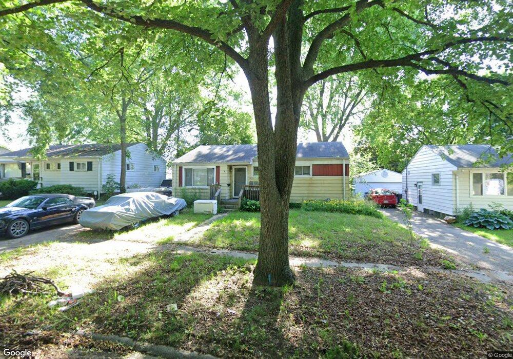
3813 Shawnee Ave Flint, MI 48507
Circle Drive NeighborhoodEstimated Value: $79,572 - $103,000
3
Beds
2
Baths
1,311
Sq Ft
$71/Sq Ft
Est. Value
About This Home
This home is located at 3813 Shawnee Ave, Flint, MI 48507 and is currently estimated at $93,643, approximately $71 per square foot. 3813 Shawnee Ave is a home located in Genesee County with nearby schools including Freeman Elementary School, Flint Southwestern Classical Academy, and Burton Glen Charter Academy.
Ownership History
Date
Name
Owned For
Owner Type
Purchase Details
Closed on
Aug 12, 2011
Sold by
Secretary Of Housing & Urban Development
Bought by
Jensen Michael Patrick and Jenseh Natasha
Current Estimated Value
Purchase Details
Closed on
Dec 2, 2010
Sold by
Wells Fargo Bank Na
Bought by
The Secretary Of Housing & Urban Develop
Purchase Details
Closed on
May 26, 2010
Sold by
Allis Jason and Stone Darcy
Bought by
Wells Fargo Bank Na
Purchase Details
Closed on
Mar 5, 2004
Sold by
Thomason James E and Thomason Dawn E
Bought by
Allis Jason and Stone Darcy
Create a Home Valuation Report for This Property
The Home Valuation Report is an in-depth analysis detailing your home's value as well as a comparison with similar homes in the area
Home Values in the Area
Average Home Value in this Area
Purchase History
| Date | Buyer | Sale Price | Title Company |
|---|---|---|---|
| Jensen Michael Patrick | $14,400 | None Available | |
| The Secretary Of Housing & Urban Develop | -- | None Available | |
| Wells Fargo Bank Na | $104,436 | None Available | |
| Allis Jason | $65,000 | Cislo Title Company |
Source: Public Records
Tax History
| Year | Tax Paid | Tax Assessment Tax Assessment Total Assessment is a certain percentage of the fair market value that is determined by local assessors to be the total taxable value of land and additions on the property. | Land | Improvement |
|---|---|---|---|---|
| 2025 | $834 | $34,700 | $0 | $0 |
| 2024 | $760 | $29,900 | $0 | $0 |
| 2023 | $750 | $24,900 | $0 | $0 |
| 2022 | $0 | $19,100 | $0 | $0 |
| 2021 | $776 | $17,900 | $0 | $0 |
| 2020 | $705 | $17,400 | $0 | $0 |
| 2019 | $1,120 | $11,000 | $0 | $0 |
| 2018 | $679 | $9,900 | $0 | $0 |
| 2017 | $661 | $0 | $0 | $0 |
| 2016 | $657 | $0 | $0 | $0 |
| 2015 | -- | $0 | $0 | $0 |
| 2014 | -- | $0 | $0 | $0 |
| 2012 | -- | $15,800 | $0 | $0 |
Source: Public Records
Map
Nearby Homes
- 3505 Comanche Ave
- 3056 Shaw St
- 630 Buckingham Ave
- 621 Burroughs Ave
- 818 Dell Ave
- 4424 Cheyenne Ave
- 3209 Shawnee Ave
- 621 Lochhead Ave
- 3128 Ludwig St
- 802 McKeighan Ave
- 617 McKeighan Ave
- 3115 Circle Dr
- 2910 Shawnee Ave
- 530 McKeighan Ave
- 3222 Chambers St
- 416 Burroughs Ave
- 4127 Custer Ave
- 4205 Red Arrow Rd
- 361 Buckingham Ave
- 352 Buckingham Ave
- 3901 Shawnee Ave
- 3809 Shawnee Ave
- 3814 Cheyenne Ave
- 3805 Shawnee Ave
- 3902 Cheyenne Ave
- 3810 Cheyenne Ave
- 3806 Cheyenne Ave
- 3906 Cheyenne Ave
- 1102 E Atherton Rd
- 3905 Shawnee Ave
- 3902 Shawnee Ave
- 3911 Shawnee Ave
- 3810 Shawnee Ave
- 1109 Southlawn Ave
- 1110 E Atherton Rd
- 3806 Shawnee Ave
- 3912 Cheyenne Ave
- 3912 Shawnee Ave
- 3906 Shawnee Ave
- 1010 E Atherton Rd
Your Personal Tour Guide
Ask me questions while you tour the home.