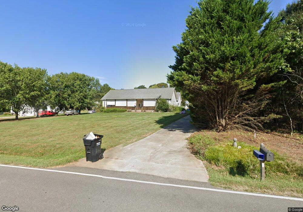
3814 Highway 182 Lincolnton, NC 28092
Estimated Value: $341,000 - $353,000
3
Beds
2
Baths
1,680
Sq Ft
$208/Sq Ft
Est. Value
About This Home
This home is located at 3814 Highway 182, Lincolnton, NC 28092 and is currently estimated at $349,233, approximately $207 per square foot. 3814 Highway 182 is a home located in Lincoln County with nearby schools including Norris S. Childers Elementary School, West Lincoln Middle, and West Lincoln High School.
Ownership History
Date
Name
Owned For
Owner Type
Purchase Details
Closed on
Sep 5, 2019
Sold by
Holmes Charles Henry
Bought by
Holmes Darlene
Current Estimated Value
Purchase Details
Closed on
Nov 6, 2014
Sold by
King Jeanette M
Bought by
Holmes Charles H and Holmes Darlene
Home Financials for this Owner
Home Financials are based on the most recent Mortgage that was taken out on this home.
Original Mortgage
$55,000
Outstanding Balance
$42,532
Interest Rate
4.26%
Mortgage Type
New Conventional
Estimated Equity
$306,701
Purchase Details
Closed on
Feb 8, 1999
Bought by
King David S and King Jeannette M
Create a Home Valuation Report for This Property
The Home Valuation Report is an in-depth analysis detailing your home's value as well as a comparison with similar homes in the area
Home Values in the Area
Average Home Value in this Area
Purchase History
| Date | Buyer | Sale Price | Title Company |
|---|---|---|---|
| Holmes Darlene | -- | None Available | |
| Holmes Charles H | $150,000 | None Available | |
| King David S | $15,000 | -- |
Source: Public Records
Mortgage History
| Date | Status | Borrower | Loan Amount |
|---|---|---|---|
| Open | Holmes Charles H | $55,000 |
Source: Public Records
Tax History Compared to Growth
Tax History
| Year | Tax Paid | Tax Assessment Tax Assessment Total Assessment is a certain percentage of the fair market value that is determined by local assessors to be the total taxable value of land and additions on the property. | Land | Improvement |
|---|---|---|---|---|
| 2025 | $1,904 | $277,998 | $31,510 | $246,488 |
| 2024 | $1,884 | $277,998 | $31,510 | $246,488 |
| 2023 | $1,879 | $277,998 | $31,510 | $246,488 |
| 2022 | $1,486 | $181,659 | $25,808 | $155,851 |
| 2021 | $1,486 | $181,659 | $25,808 | $155,851 |
| 2020 | $1,334 | $181,659 | $25,808 | $155,851 |
| 2019 | $1,334 | $181,659 | $25,808 | $155,851 |
| 2018 | $1,271 | $159,604 | $23,249 | $136,355 |
| 2017 | $1,100 | $150,006 | $23,249 | $126,757 |
| 2016 | $1,100 | $150,006 | $23,249 | $126,757 |
| 2015 | $1,161 | $150,006 | $23,249 | $126,757 |
| 2014 | $629 | $162,528 | $26,217 | $136,311 |
Source: Public Records
Map
Nearby Homes
- 940 Guy Heavner Rd
- 2124 Shoal Rd
- 1495 Leonards Fork Church Rd
- 5740 Crouse Rd
- 2488 Shoal Rd
- 5199 Helms End of Trail
- 00 Flay Rd
- 4850 Gideon Dr
- 5118 Flay Rd
- 1000 Creekside Dr
- 000 Leonards Fork Church Rd
- 4832 Gideon Dr
- 1357 Malden Ct
- 1084 Lyndsey Brook Ct
- 1074 Lyndsey Brook Ct
- 3103 Richview Dr
- 938 Lyndsey Brook Ct
- 508 Shoal Rd
- 2006 Kollege Ln
- 00 McCurry Farm Ln Unit F1 & F2
- 3830 Highway 182
- 3788 Highway 182
- 3817 Highway 182
- 3850 Highway 182
- 3758 Highway 182
- 3748 Highway 182
- 1676 Cowboy Way
- 3742 Highway 182
- 3834 Highway 182
- 1658 Cowboy Way
- 3842 Highway 182
- 3940 Highway 182
- 0 Hwy 182 Hwy Unit 757334
- 0 Hwy 182 Hwy Unit 2 2044955
- 0 Hwy 182 Hwy Unit 3385544
- 0 Hwy 182 Hwy Unit 22C 3553962
- 3963 Highway 182
- 3970 Highway 182
- Lot 1 Shoal Rd
- 1629 Shoal Rd