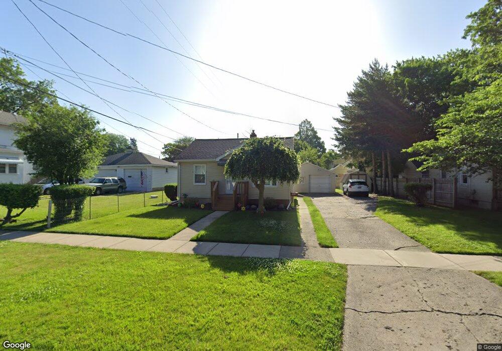
3815 Ogema Ave Flint, MI 48507
Circle Drive NeighborhoodEstimated Value: $69,000 - $78,000
2
Beds
1
Bath
791
Sq Ft
$93/Sq Ft
Est. Value
About This Home
This home is located at 3815 Ogema Ave, Flint, MI 48507 and is currently estimated at $73,443, approximately $92 per square foot. 3815 Ogema Ave is a home located in Genesee County with nearby schools including Freeman Elementary School, Flint Southwestern Classical Academy, and Burton Glen Charter Academy.
Ownership History
Date
Name
Owned For
Owner Type
Purchase Details
Closed on
Mar 21, 2007
Sold by
Murphy Ronda L
Bought by
Lasalle Bank Na and Mlmi Trust Series 2006-Mln1
Current Estimated Value
Purchase Details
Closed on
Jun 2, 2006
Sold by
Schemm Paulla J and Schemm Cassiday Paulla
Bought by
Murphy Ronda L
Create a Home Valuation Report for This Property
The Home Valuation Report is an in-depth analysis detailing your home's value as well as a comparison with similar homes in the area
Home Values in the Area
Average Home Value in this Area
Purchase History
| Date | Buyer | Sale Price | Title Company |
|---|---|---|---|
| Lasalle Bank Na | $26,815 | None Available | |
| Murphy Ronda L | $74,200 | Metropolitan Title Company |
Source: Public Records
Tax History Compared to Growth
Tax History
| Year | Tax Paid | Tax Assessment Tax Assessment Total Assessment is a certain percentage of the fair market value that is determined by local assessors to be the total taxable value of land and additions on the property. | Land | Improvement |
|---|---|---|---|---|
| 2025 | $1,017 | $37,400 | $0 | $0 |
| 2024 | $920 | $33,300 | $0 | $0 |
| 2023 | $904 | $30,800 | $0 | $0 |
| 2022 | $0 | $25,100 | $0 | $0 |
| 2021 | $940 | $22,200 | $0 | $0 |
| 2020 | $833 | $17,700 | $0 | $0 |
| 2019 | $811 | $13,700 | $0 | $0 |
| 2018 | $812 | $12,700 | $0 | $0 |
| 2017 | $789 | $0 | $0 | $0 |
| 2016 | $784 | $0 | $0 | $0 |
| 2015 | -- | $0 | $0 | $0 |
| 2014 | -- | $0 | $0 | $0 |
| 2012 | -- | $15,000 | $0 | $0 |
Source: Public Records
Map
Nearby Homes
- 630 Buckingham Ave
- 621 Burroughs Ave
- 3614 Comanche Ave
- 3505 Comanche Ave
- 454 E Atherton Rd
- 4310 Cheyenne Ave
- 4127 Custer Ave
- 4424 Cheyenne Ave
- 810 Macdonald Ave
- 4205 Red Arrow Rd
- 3115 Circle Dr
- 326 Burroughs Ave
- 2910 Shawnee Ave
- 3343 Cheyenne Ave
- 4010 Milton Dr
- 2618 Pinetree Dr
- 213 E Lakeview Ave
- 115 E Livingston Dr
- 3512 Barcey Ct
- 0000 E Bristol Rd
- 3819 Ogema Ave
- 713 Buckingham Ave
- 702 E Atherton Rd
- 708 E Atherton Rd
- 717 Buckingham Ave
- 712 E Atherton Rd
- 3818 Ogema Ave
- 704 Buckingham Ave
- 721 Buckingham Ave
- 654 E Atherton Rd
- 716 E Atherton Rd
- 714 Buckingham Ave
- 3907 Ogema Ave
- 725 Buckingham Ave
- 718 Buckingham Ave
- 3902 Ogema Ave
- 726 E Atherton Rd
- 648 E Atherton Rd
- 801 Buckingham Ave
- 3908 Ogema Ave