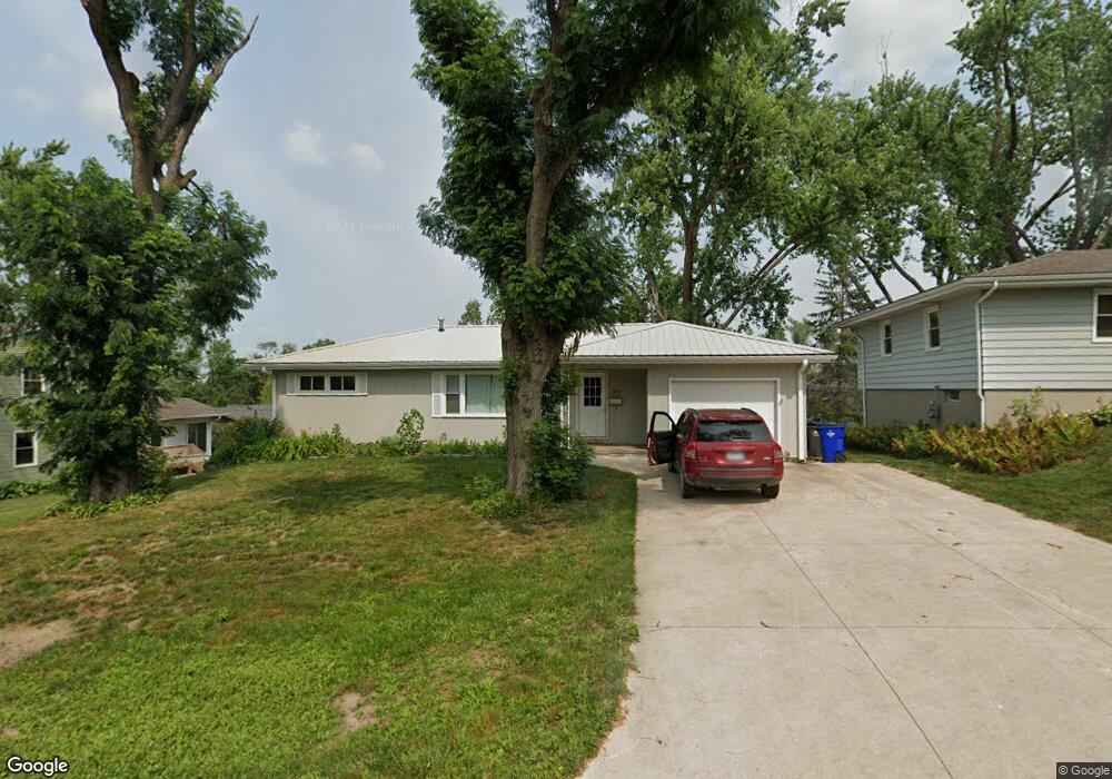
3816 Elmwood Dr NE Cedar Rapids, IA 52402
Estimated Value: $212,000 - $241,000
3
Beds
2
Baths
1,889
Sq Ft
$119/Sq Ft
Est. Value
About This Home
This home is located at 3816 Elmwood Dr NE, Cedar Rapids, IA 52402 and is currently estimated at $224,330, approximately $118 per square foot. 3816 Elmwood Dr NE is a home located in Linn County with nearby schools including Pierce Elementary School, Franklin Middle School, and John F. Kennedy High School.
Ownership History
Date
Name
Owned For
Owner Type
Purchase Details
Closed on
Dec 3, 2021
Sold by
Scottsman Properties Ii Llc
Bought by
Scottsman Properties Llc
Current Estimated Value
Purchase Details
Closed on
Jun 28, 2016
Sold by
Mccurdy Matthew L and Mccurdy Stephanie
Bought by
Scottsman Properties Ii Llc
Home Financials for this Owner
Home Financials are based on the most recent Mortgage that was taken out on this home.
Original Mortgage
$112,000
Outstanding Balance
$89,640
Interest Rate
3.66%
Mortgage Type
Commercial
Estimated Equity
$134,690
Purchase Details
Closed on
Aug 10, 2011
Sold by
Gorsuch Leigh Ann
Bought by
Mccurdy Matthew L
Home Financials for this Owner
Home Financials are based on the most recent Mortgage that was taken out on this home.
Original Mortgage
$84,000
Interest Rate
4.54%
Mortgage Type
New Conventional
Purchase Details
Closed on
May 7, 2008
Sold by
Clay Elizabeth Anne and Clay Leonard Carl
Bought by
Gorsuch Leigh Ann
Home Financials for this Owner
Home Financials are based on the most recent Mortgage that was taken out on this home.
Original Mortgage
$102,240
Interest Rate
5.88%
Mortgage Type
Purchase Money Mortgage
Purchase Details
Closed on
May 2, 2005
Sold by
Frasher Jane Marie
Bought by
Kasner Cherish J
Purchase Details
Closed on
Jul 3, 2003
Sold by
Sirva Relocation Llc
Bought by
Markham Elizabeth A
Home Financials for this Owner
Home Financials are based on the most recent Mortgage that was taken out on this home.
Original Mortgage
$102,400
Interest Rate
5.62%
Mortgage Type
Unknown
Purchase Details
Closed on
Jun 28, 2003
Sold by
Mason Leonard and Mason Marla J
Bought by
Sirva Relocation Llc
Home Financials for this Owner
Home Financials are based on the most recent Mortgage that was taken out on this home.
Original Mortgage
$102,400
Interest Rate
5.62%
Mortgage Type
Unknown
Create a Home Valuation Report for This Property
The Home Valuation Report is an in-depth analysis detailing your home's value as well as a comparison with similar homes in the area
Home Values in the Area
Average Home Value in this Area
Purchase History
| Date | Buyer | Sale Price | Title Company |
|---|---|---|---|
| Scottsman Properties Llc | -- | None Available | |
| Scottsman Properties Ii Llc | -- | None Available | |
| Mccurdy Matthew L | $104,500 | None Available | |
| Gorsuch Leigh Ann | $127,500 | None Available | |
| Kasner Cherish J | -- | -- | |
| Markham Elizabeth A | $120,000 | -- | |
| Sirva Relocation Llc | $120,000 | -- |
Source: Public Records
Mortgage History
| Date | Status | Borrower | Loan Amount |
|---|---|---|---|
| Open | Scottsman Properties Ii Llc | $112,000 | |
| Previous Owner | Mccurdy Matthew L | $84,000 | |
| Previous Owner | Gorsuch Leigh Ann | $102,240 | |
| Previous Owner | Markham Elizabeth A | $102,400 |
Source: Public Records
Tax History Compared to Growth
Tax History
| Year | Tax Paid | Tax Assessment Tax Assessment Total Assessment is a certain percentage of the fair market value that is determined by local assessors to be the total taxable value of land and additions on the property. | Land | Improvement |
|---|---|---|---|---|
| 2025 | $3,404 | $211,800 | $42,400 | $169,400 |
| 2024 | $3,430 | $192,300 | $39,000 | $153,300 |
| 2023 | $3,430 | $192,300 | $39,000 | $153,300 |
| 2022 | $3,292 | $162,600 | $34,000 | $128,600 |
| 2021 | $3,358 | $158,900 | $32,300 | $126,600 |
| 2020 | $3,358 | $152,200 | $28,900 | $123,300 |
| 2019 | $3,108 | $152,200 | $28,900 | $123,300 |
| 2018 | $3,022 | $144,200 | $27,200 | $117,000 |
| 2017 | $2,800 | $137,100 | $27,200 | $109,900 |
| 2016 | $2,843 | $133,800 | $27,200 | $106,600 |
| 2015 | $2,878 | $135,256 | $30,555 | $104,701 |
| 2014 | $2,878 | $135,256 | $30,555 | $104,701 |
| 2013 | $2,816 | $135,256 | $30,555 | $104,701 |
Source: Public Records
Map
Nearby Homes
- 2400 Brookland Dr NE
- 3858 Northwood Dr NE
- 4216 Marilyn Dr NE
- 2520 Falbrook Dr NE
- 2611 Brookland Dr NE
- 2106 42nd St NE
- 2445 Glass Rd NE
- 3604 Heatheridge Dr NE
- 4609 White Pine Dr NE
- 4460 Westchester Dr NE Unit C
- 2041 Birchwood Dr NE
- 4545 Westchester Dr NE Unit D
- 4645 Westchester Dr NE Unit A
- 4433 Coventry Ln NE
- 4761 Westchester Dr NE Unit C
- 4745 Westchester Dr NE Unit A
- 4113 Lark Ct NE Unit 4113
- 3130 Adirondack Dr NE
- 3008 Circle Hill Ct NE
- 4417 Twin Pine Dr NE
- 3830 Elmwood Dr NE
- 2341 Brookland Dr NE
- 3825 Valley Place NE
- 3815 Valley Place NE
- 3800 Elmwood Dr NE
- 3817 Elmwood Dr NE
- 3825 Elmwood Dr NE
- 3807 Valley Place NE
- 3809 Elmwood Dr NE
- 3833 Elmwood Dr NE
- 3752 Elmwood Dr NE
- 3801 Elmwood Dr NE
- 2350 Brookland Dr NE
- 2340 Brookland Dr NE
- 3744 Elmwood Dr NE
- 2354 Brookland Dr NE
- 3753 Elmwood Dr NE
- 3801 Valley Place NE
- 2309 Brookland Dr NE
- 3822 Valley Place NE