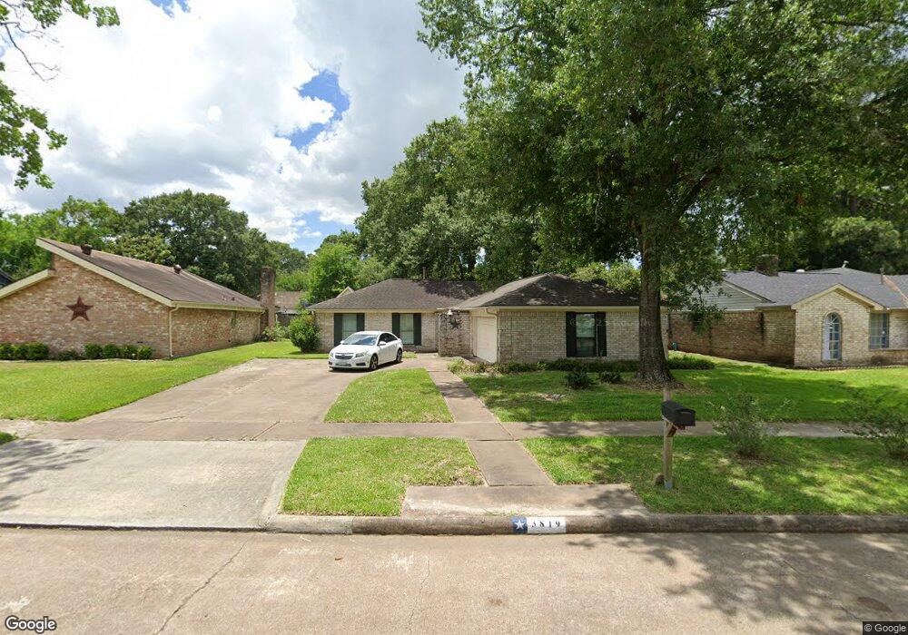
3819 R V Mayfield Dr Unit 1 Houston, TX 77088
Greater Inwood NeighborhoodEstimated Value: $229,000 - $252,000
3
Beds
2
Baths
1,898
Sq Ft
$127/Sq Ft
Est. Value
About This Home
This home is located at 3819 R V Mayfield Dr Unit 1, Houston, TX 77088 and is currently estimated at $240,429, approximately $126 per square foot. 3819 R V Mayfield Dr Unit 1 is a home located in Harris County with nearby schools including Stovall School, Caraway Intermediate School, and Caraway Elementary School.
Ownership History
Date
Name
Owned For
Owner Type
Purchase Details
Closed on
Oct 18, 2019
Sold by
Perez Jose S and Perez Aurelia
Bought by
Perez Jose
Current Estimated Value
Home Financials for this Owner
Home Financials are based on the most recent Mortgage that was taken out on this home.
Original Mortgage
$117,826
Outstanding Balance
$104,232
Interest Rate
3.99%
Mortgage Type
FHA
Estimated Equity
$136,197
Purchase Details
Closed on
Nov 17, 1994
Sold by
Hubbartt Martin R and Hubbartt Claudia S
Bought by
Perez Jose S and Perez Aurelia
Home Financials for this Owner
Home Financials are based on the most recent Mortgage that was taken out on this home.
Original Mortgage
$54,250
Interest Rate
8.88%
Create a Home Valuation Report for This Property
The Home Valuation Report is an in-depth analysis detailing your home's value as well as a comparison with similar homes in the area
Home Values in the Area
Average Home Value in this Area
Purchase History
| Date | Buyer | Sale Price | Title Company |
|---|---|---|---|
| Perez Jose | -- | None Available | |
| Perez Jose S | -- | First American Title |
Source: Public Records
Mortgage History
| Date | Status | Borrower | Loan Amount |
|---|---|---|---|
| Open | Perez Jose | $117,826 | |
| Previous Owner | Perez Jose S | $54,250 |
Source: Public Records
Tax History Compared to Growth
Tax History
| Year | Tax Paid | Tax Assessment Tax Assessment Total Assessment is a certain percentage of the fair market value that is determined by local assessors to be the total taxable value of land and additions on the property. | Land | Improvement |
|---|---|---|---|---|
| 2025 | $3,589 | $223,857 | $51,180 | $172,677 |
| 2024 | $3,589 | $227,139 | $51,180 | $175,959 |
| 2023 | $3,589 | $252,430 | $51,180 | $201,250 |
| 2022 | $4,674 | $214,138 | $42,948 | $171,190 |
| 2021 | $4,449 | $177,136 | $35,790 | $141,346 |
| 2020 | $4,268 | $161,691 | $35,790 | $125,901 |
| 2019 | $3,406 | $131,062 | $18,611 | $112,451 |
| 2018 | $1,248 | $121,341 | $18,611 | $102,730 |
| 2017 | $2,699 | $121,341 | $18,611 | $102,730 |
| 2016 | $2,454 | $121,341 | $18,611 | $102,730 |
| 2015 | $1,642 | $103,538 | $18,611 | $84,927 |
| 2014 | $1,642 | $87,217 | $18,611 | $68,606 |
Source: Public Records
Map
Nearby Homes
- DOVE Plan at Alaia Crossing
- CEDAR Plan at Alaia Crossing
- BOXWOOD Plan at Alaia Crossing
- 7816 Inwood Grove Ln
- 7705 Inwood Grove Ln
- 7707 Inwood Grove Ln
- 7709 Inwood Hills Ln
- 7712 Inwood Grove Ln
- 7716 Inwood Grove Ln
- 7702 Inwood Hills Ln
- 7718 Inwood Grove Ln
- 7717 Inwood Hills Ln
- 7611 Athlone Dr
- 7814 Inwood Grove Ln
- 7808 Inwood Grove Ln
- 7610 Alperton Dr
- 3522 Almington Ln
- 3711 Black Locust Dr
- 4015 Black Locust Dr
- 4206 Saratoga Dr
- 3819 R V Mayfield Dr
- 3819 Mayfield Oaks Ln
- 3815 Mayfield Oaks Ln
- 3903 Mayfield Oaks Ln
- 3818 Saratoga Dr
- 3811 Mayfield Oaks Ln
- 3907 Mayfield Oaks Ln
- 3814 Saratoga Dr
- 3902 Saratoga Dr
- 3810 Saratoga Dr
- 3906 Saratoga Dr
- 3818 Mayfield Oaks Ln
- 3814 Mayfield Oaks Ln
- 3902 Mayfield Oaks Ln
- 3807 Mayfield Oaks Ln
- 3911 Mayfield Oaks Ln
- 3902 R V Mayfield Dr
- 3810 Mayfield Oaks Ln
- 3806 Saratoga Dr
- 3810 R V Mayfield Dr