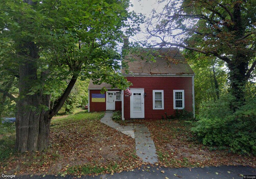
382 S Main St Cohasset, MA 02025
Estimated Value: $788,000 - $884,591
3
Beds
2
Baths
1,304
Sq Ft
$639/Sq Ft
Est. Value
About This Home
This home is located at 382 S Main St, Cohasset, MA 02025 and is currently estimated at $833,398, approximately $639 per square foot. 382 S Main St is a home located in Norfolk County with nearby schools including Joseph Osgood School, Deer Hill School, and Cohasset Middle School.
Ownership History
Date
Name
Owned For
Owner Type
Purchase Details
Closed on
Oct 15, 2023
Sold by
Reddie John and Reddie David
Bought by
Reddie South Main T and Reddie
Current Estimated Value
Create a Home Valuation Report for This Property
The Home Valuation Report is an in-depth analysis detailing your home's value as well as a comparison with similar homes in the area
Home Values in the Area
Average Home Value in this Area
Purchase History
| Date | Buyer | Sale Price | Title Company |
|---|---|---|---|
| Reddie South Main T | -- | None Available |
Source: Public Records
Tax History Compared to Growth
Tax History
| Year | Tax Paid | Tax Assessment Tax Assessment Total Assessment is a certain percentage of the fair market value that is determined by local assessors to be the total taxable value of land and additions on the property. | Land | Improvement |
|---|---|---|---|---|
| 2025 | $10,502 | $906,900 | $704,400 | $202,500 |
| 2024 | $9,002 | $739,700 | $563,300 | $176,400 |
| 2023 | $8,474 | $718,100 | $541,700 | $176,400 |
| 2022 | $7,572 | $602,900 | $438,600 | $164,300 |
| 2021 | $7,630 | $585,100 | $438,600 | $146,500 |
| 2020 | $7,589 | $585,100 | $438,600 | $146,500 |
| 2019 | $7,021 | $544,300 | $397,800 | $146,500 |
| 2018 | $6,962 | $544,300 | $397,800 | $146,500 |
| 2017 | $6,881 | $526,900 | $361,700 | $165,200 |
| 2016 | $6,786 | $526,900 | $361,700 | $165,200 |
| 2015 | $6,697 | $526,900 | $361,700 | $165,200 |
| 2014 | $6,607 | $526,900 | $361,700 | $165,200 |
Source: Public Records
Map
Nearby Homes