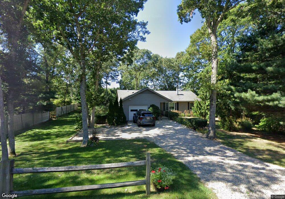
382A Locustfield Rd East Falmouth, MA 02536
Hatchville NeighborhoodEstimated Value: $554,000 - $637,000
3
Beds
2
Baths
1,320
Sq Ft
$445/Sq Ft
Est. Value
About This Home
This home is located at 382A Locustfield Rd, East Falmouth, MA 02536 and is currently estimated at $587,061, approximately $444 per square foot. 382A Locustfield Rd is a home located in Barnstable County with nearby schools including Mullen-Hall School, Morse Pond School, and Lawrence School.
Ownership History
Date
Name
Owned For
Owner Type
Purchase Details
Closed on
Dec 19, 2003
Sold by
Mitchell James R
Bought by
Mitchell Jonathan E
Current Estimated Value
Home Financials for this Owner
Home Financials are based on the most recent Mortgage that was taken out on this home.
Original Mortgage
$200,000
Outstanding Balance
$93,194
Interest Rate
5.96%
Mortgage Type
Purchase Money Mortgage
Estimated Equity
$493,867
Create a Home Valuation Report for This Property
The Home Valuation Report is an in-depth analysis detailing your home's value as well as a comparison with similar homes in the area
Home Values in the Area
Average Home Value in this Area
Purchase History
| Date | Buyer | Sale Price | Title Company |
|---|---|---|---|
| Mitchell Jonathan E | $250,000 | -- |
Source: Public Records
Mortgage History
| Date | Status | Borrower | Loan Amount |
|---|---|---|---|
| Open | Mitchell Jonathan E | $200,000 | |
| Previous Owner | Mitchell Jonathan E | $66,000 | |
| Previous Owner | Mitchell Jonathan E | $25,000 |
Source: Public Records
Tax History Compared to Growth
Tax History
| Year | Tax Paid | Tax Assessment Tax Assessment Total Assessment is a certain percentage of the fair market value that is determined by local assessors to be the total taxable value of land and additions on the property. | Land | Improvement |
|---|---|---|---|---|
| 2025 | $2,809 | $478,600 | $170,200 | $308,400 |
| 2024 | $2,774 | $441,700 | $161,200 | $280,500 |
| 2023 | $2,780 | $401,800 | $161,200 | $240,600 |
| 2022 | $2,644 | $328,400 | $121,500 | $206,900 |
| 2021 | $2,577 | $303,200 | $116,200 | $187,000 |
| 2020 | $2,514 | $292,700 | $105,700 | $187,000 |
| 2019 | $2,276 | $265,900 | $105,700 | $160,200 |
| 2018 | $2,207 | $256,600 | $105,700 | $150,900 |
| 2017 | $2,142 | $251,100 | $105,700 | $145,400 |
| 2016 | $2,098 | $250,700 | $105,700 | $145,000 |
| 2015 | $2,053 | $250,700 | $105,700 | $145,000 |
| 2014 | $2,086 | $256,000 | $111,300 | $144,700 |
Source: Public Records
Map
Nearby Homes
- 12 Beach Plum Path
- 4 Josiah Path
- 7 Josiah Path
- 18 Josiah Path
- 20 Josiah Path
- 21 Josiah Path
- 30 Josiah Path
- 273 Sandwich Rd
- 12 Rock Hollow Dr
- 17 Pinewood Dr
- 149 Brick Kiln Rd
- 32 Jamie Ln
- 68 Deepwood Dr
- 25 Percival Rd
- 59 Whitecaps Dr
- 63 Pine Valley Dr Unit 63 aka 30A
- 34 Mckenna Ridge Rd
- 70 Meredith Dr
- 100 Tanglewood Dr
- 61 Mckenna Ridge Dr
- 382 Locustfield Rd
- 364 Locustfield Rd
- 392 Locustfield Rd
- 376 Locustfield Rd
- 383 Locustfield Rd
- 393 Locustfield Rd
- 372 Locustfield Rd
- 379 Locustfield Rd
- 404 Locustfield Rd
- 373 Locustfield Rd
- 17 Mares Pond Dr
- 25 Mares Pond Dr
- 368 Locustfield Rd
- 11 Mares Pond Dr
- 31 Mares Pond Dr
- 39 Mares Pond Dr
- 369 Locustfield Rd
- 365 Locustfield Rd
- 7 Mares Pond Dr
- 41 Mares Pond Dr