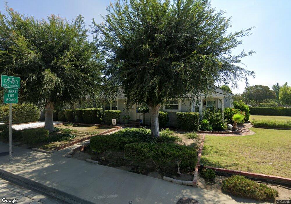
383 Las Tunas Dr Arcadia, CA 91007
Estimated Value: $1,632,000 - $1,930,000
3
Beds
2
Baths
2,041
Sq Ft
$859/Sq Ft
Est. Value
About This Home
This home is located at 383 Las Tunas Dr, Arcadia, CA 91007 and is currently estimated at $1,753,236, approximately $859 per square foot. 383 Las Tunas Dr is a home located in Los Angeles County with nearby schools including Longley Way Elementary School, Richard Henry Dana Middle School, and Arcadia High School.
Ownership History
Date
Name
Owned For
Owner Type
Purchase Details
Closed on
Jan 15, 2026
Sold by
Alexander Daniel A
Bought by
Wang Alice and Lo Maggie
Current Estimated Value
Home Financials for this Owner
Home Financials are based on the most recent Mortgage that was taken out on this home.
Original Mortgage
$1,563,000
Interest Rate
6.17%
Mortgage Type
New Conventional
Purchase Details
Closed on
Dec 8, 2025
Sold by
Alexander Cathleen
Bought by
Alexander Daniel
Home Financials for this Owner
Home Financials are based on the most recent Mortgage that was taken out on this home.
Original Mortgage
$1,563,000
Interest Rate
6.17%
Mortgage Type
New Conventional
Purchase Details
Closed on
May 21, 2024
Sold by
Alexander Family Trust and Alexander Daniel A
Bought by
Alexander Daniel A
Purchase Details
Closed on
Sep 18, 1998
Sold by
Alexander Sam A and Alexander Mary F
Bought by
Alexander Sam A and Alexander Mary F
Home Financials for this Owner
Home Financials are based on the most recent Mortgage that was taken out on this home.
Original Mortgage
$160,000
Interest Rate
6.88%
Purchase Details
Closed on
Jun 15, 1998
Sold by
Alexander Sam A and Alexander Mary F
Bought by
Alexander Sam A and Alexander Mary F
Create a Home Valuation Report for This Property
The Home Valuation Report is an in-depth analysis detailing your home's value as well as a comparison with similar homes in the area
Home Values in the Area
Average Home Value in this Area
Purchase History
| Date | Buyer | Sale Price | Title Company |
|---|---|---|---|
| Wang Alice | $1,700,000 | First American Title Company | |
| Alexander Daniel | -- | Wfg National Title | |
| Alexander Daniel A | -- | None Listed On Document | |
| Alexander Sam A | -- | Southland Title Corporation | |
| Alexander Sam A | -- | Southland Title Corporation | |
| Alexander Sam A | -- | -- |
Source: Public Records
Mortgage History
| Date | Status | Borrower | Loan Amount |
|---|---|---|---|
| Previous Owner | Alexander Daniel | $1,563,000 | |
| Previous Owner | Alexander Sam A | $160,000 |
Source: Public Records
Tax History
| Year | Tax Paid | Tax Assessment Tax Assessment Total Assessment is a certain percentage of the fair market value that is determined by local assessors to be the total taxable value of land and additions on the property. | Land | Improvement |
|---|---|---|---|---|
| 2025 | $2,412 | $486,280 | $314,223 | $172,057 |
| 2024 | $2,412 | $146,669 | $44,432 | $102,237 |
| 2023 | $2,370 | $143,794 | $43,561 | $100,233 |
| 2022 | $2,309 | $140,975 | $42,707 | $98,268 |
| 2021 | $2,261 | $138,212 | $41,870 | $96,342 |
| 2019 | $2,218 | $134,115 | $40,629 | $93,486 |
| 2018 | $2,017 | $131,486 | $39,833 | $91,653 |
| 2016 | $1,895 | $126,382 | $38,287 | $88,095 |
| 2015 | $1,866 | $124,484 | $37,712 | $86,772 |
| 2014 | $1,857 | $122,047 | $36,974 | $85,073 |
Source: Public Records
Map
Nearby Homes
- 468 W Woodruff Ave
- 262 W Palm Dr
- 602 W Woodruff Ave
- 233 Longley Way
- 466 Walnut Ave
- 541 Rosemarie Dr
- 6022 Rowland Ave
- 127 Las Tunas Dr
- 131 Woodruff Place
- 2301 S Baldwin Ave
- 9968 Daines Dr
- 630 W Longden Ave
- 188 W Arthur Ave
- 212 W Las Flores Ave
- 120 W Longden Ave
- 5224 Hallowell Ave
- 6 Bedford Ct
- 5156 Arden Dr
- 27 Miren Place
- 202 W Lemon Ave
- 377 Las Tunas Dr
- 401 Las Tunas Dr
- 371 Las Tunas Dr
- 380 W Woodruff Ave
- 376 W Woodruff Ave
- 409 Las Tunas Dr
- 400 W Woodruff Ave
- 365 Las Tunas Dr
- 370 W Woodruff Ave
- 415 Las Tunas Dr
- 408 W Woodruff Ave
- 2701 Holly Ave
- 362 W Woodruff Ave
- 2708 Holly Ave
- 357 Las Tunas Dr
- 2701 Caroline Way
- 412 W Woodruff Ave
- 419 Las Tunas Dr
- 2709 Holly Ave
- 356 W Woodruff Ave
Your Personal Tour Guide
Ask me questions while you tour the home.