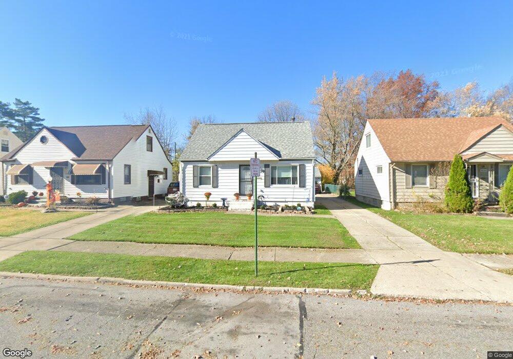
3834 E 190th St Cleveland, OH 44122
Estimated Value: $130,098 - $145,000
3
Beds
2
Baths
1,191
Sq Ft
$114/Sq Ft
Est. Value
About This Home
This home is located at 3834 E 190th St, Cleveland, OH 44122 and is currently estimated at $136,275, approximately $114 per square foot. 3834 E 190th St is a home located in Cuyahoga County with nearby schools including Adlai Stevenson School, Andrew J. Rickoff School, and Bolton.
Ownership History
Date
Name
Owned For
Owner Type
Purchase Details
Closed on
Dec 11, 1998
Sold by
Martez Corp
Bought by
Jefferson Wanda
Current Estimated Value
Home Financials for this Owner
Home Financials are based on the most recent Mortgage that was taken out on this home.
Original Mortgage
$72,653
Outstanding Balance
$16,717
Interest Rate
6.93%
Estimated Equity
$119,558
Purchase Details
Closed on
Dec 15, 1997
Sold by
Hines Michael D
Bought by
Martez Corp
Purchase Details
Closed on
Jan 1, 1975
Bought by
Hines Michael D and Hines Deborah
Create a Home Valuation Report for This Property
The Home Valuation Report is an in-depth analysis detailing your home's value as well as a comparison with similar homes in the area
Home Values in the Area
Average Home Value in this Area
Purchase History
| Date | Buyer | Sale Price | Title Company |
|---|---|---|---|
| Jefferson Wanda | $74,900 | -- | |
| Martez Corp | $37,500 | -- | |
| Hines Michael D | -- | -- |
Source: Public Records
Mortgage History
| Date | Status | Borrower | Loan Amount |
|---|---|---|---|
| Open | Jefferson Wanda | $72,653 |
Source: Public Records
Tax History Compared to Growth
Tax History
| Year | Tax Paid | Tax Assessment Tax Assessment Total Assessment is a certain percentage of the fair market value that is determined by local assessors to be the total taxable value of land and additions on the property. | Land | Improvement |
|---|---|---|---|---|
| 2024 | $2,318 | $45,150 | $6,965 | $38,185 |
| 2023 | $1,657 | $31,020 | $6,060 | $24,960 |
| 2022 | $1,679 | $31,010 | $6,060 | $24,960 |
| 2021 | $2,369 | $31,010 | $6,060 | $24,960 |
| 2020 | $2,341 | $26,500 | $5,180 | $21,320 |
| 2019 | $2,168 | $75,700 | $14,800 | $60,900 |
| 2018 | $1,929 | $26,500 | $5,180 | $21,320 |
| 2017 | $1,711 | $20,240 | $6,760 | $13,480 |
| 2016 | $1,698 | $20,240 | $6,760 | $13,480 |
| 2015 | $1,672 | $20,240 | $6,760 | $13,480 |
| 2014 | $1,672 | $19,850 | $6,620 | $13,230 |
Source: Public Records
Map
Nearby Homes
- 19110 Lanbury Ave
- 19302 Shakerwood Rd
- 19207 Kings Hwy
- 3717 Gridley Rd
- 3696 Tolland Rd
- 19112 Kings Hwy
- 3683 Stoer Rd
- 3656 Latimore Rd
- 19901 Lanbury Ave
- 18107 Scottsdale Blvd
- 19708 Sunset Dr
- 19912 Lanbury Ave
- 19207 Harvard Ave
- 3676 Rawnsdale Rd
- 3853 Lee Heights Blvd
- 3635 Tolland Rd
- 3710 Strandhill Rd
- 18112 Lomond Blvd
- 3609 Stoer Rd
- 3698 Strandhill Rd
- 3838 E 190th St
- 3830 E 190th St
- 3842 E 190th St
- 3826 E 190th St
- 3822 E 190th St
- 3846 E 190th St
- 3839 E 189th St
- 3843 E 189th St
- 19016 Lanbury Ave
- 3835 E 189th St
- 3818 E 190th St
- 3850 E 190th St
- 19017 Lanbury Ave
- 3791 E 188th St
- 3854 E 190th St
- 3787 E 188th St
- 19017 Shakerwood Rd
- 3795 E 188th St
- 19101 Lanbury Ave
- 3851 E 189th St