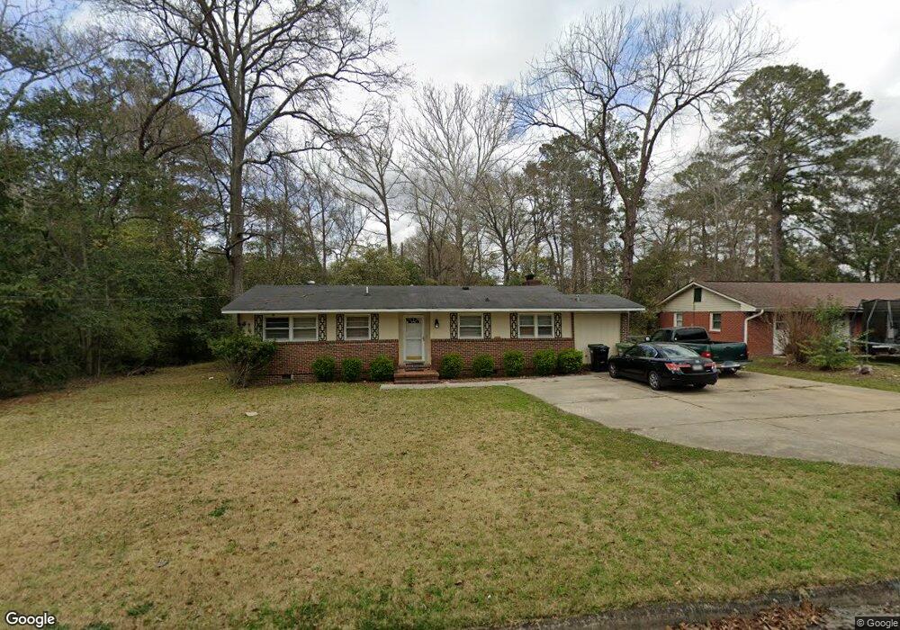
3835 Mulberry Dr Columbus, GA 31907
Eastern Columbus NeighborhoodEstimated Value: $188,000 - $214,542
4
Beds
4
Baths
1,916
Sq Ft
$104/Sq Ft
Est. Value
About This Home
This home is located at 3835 Mulberry Dr, Columbus, GA 31907 and is currently estimated at $198,386, approximately $103 per square foot. 3835 Mulberry Dr is a home located in Muscogee County with nearby schools including Rigdon Road Elementary School, Richards Middle School, and Hardaway High School.
Ownership History
Date
Name
Owned For
Owner Type
Purchase Details
Closed on
Nov 12, 2010
Sold by
Wells Fargo Financial Georgia Inc
Bought by
Mww Family Properties Llc
Current Estimated Value
Purchase Details
Closed on
Oct 5, 2010
Sold by
Wright Nathan Ellis and Wright Connie S
Bought by
Wells Fargo Financial Georgia Inc
Create a Home Valuation Report for This Property
The Home Valuation Report is an in-depth analysis detailing your home's value as well as a comparison with similar homes in the area
Home Values in the Area
Average Home Value in this Area
Purchase History
| Date | Buyer | Sale Price | Title Company |
|---|---|---|---|
| Mww Family Properties Llc | $42,500 | None Available | |
| Wells Fargo Financial Georgia Inc | $30,481 | None Available |
Source: Public Records
Tax History Compared to Growth
Tax History
| Year | Tax Paid | Tax Assessment Tax Assessment Total Assessment is a certain percentage of the fair market value that is determined by local assessors to be the total taxable value of land and additions on the property. | Land | Improvement |
|---|---|---|---|---|
| 2025 | $159 | $40,700 | $8,636 | $32,064 |
| 2024 | $159 | $73,740 | $8,636 | $65,104 |
| 2023 | $1,541 | $62,188 | $8,636 | $53,552 |
| 2022 | $1,597 | $39,116 | $6,484 | $32,632 |
| 2021 | $1,504 | $36,832 | $6,484 | $30,348 |
| 2020 | $1,504 | $36,832 | $6,484 | $30,348 |
| 2019 | $1,509 | $36,832 | $6,484 | $30,348 |
| 2018 | $1,509 | $36,832 | $6,484 | $30,348 |
| 2017 | $1,514 | $36,832 | $6,484 | $30,348 |
| 2016 | $1,489 | $36,106 | $1,949 | $34,157 |
| 2015 | $1,267 | $36,106 | $1,949 | $34,157 |
| 2014 | $1,493 | $36,106 | $1,949 | $34,157 |
| 2013 | -- | $36,106 | $1,949 | $34,157 |
Source: Public Records
Map
Nearby Homes
- 3836 Mulberry Dr
- 3875 Mulberry Dr
- 3760 Mulberry Dr
- 3800 Woodmont Dr
- 8 Kingswood Ct
- 4 Clausen Dr
- 2 Kingswood Ct
- 1618 Forestside Dr
- 1674 Forestside Dr
- 1554 Holland Ave
- 1459 Alta Vista Dr
- 3562 Woodland Dr
- 3560 Woodland Dr
- 4201 Forrest Rd
- 1553 Violet Ave
- 1433 Kevin Ct
- 1918 Watkins Dr
- 1544 Celia Dr
- 911 Lamore St
- 4161 Althea Dr
- 3841 Mulberry Dr
- 3831 Mulberry Dr
- 3847 Mulberry Dr
- 3819 Mulberry Dr
- 1902 Dunwoody Dr
- 3853 Mulberry Dr
- 5 Woodmont Ct
- 1900 Dunwoody Dr
- 3813 Mulberry Dr
- 4 Woodmont Ct
- 6 Woodmont Ct
- 3805 Mulberry Dr
- 3840 Mulberry Dr
- 3859 Mulberry Dr
- 1906 Dunwoody Dr
- 3850 Mulberry Dr
- 7 Woodmont Ct
- 3771 Mulberry Dr
- 1901 Dunwoody Dr
- 3 Woodmont Ct