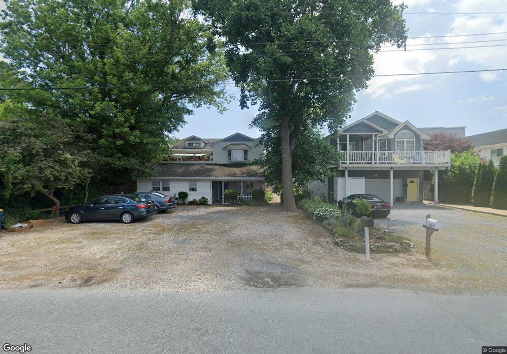
38372 F Benson St Unit 1 Rehoboth Beach, DE 19971
Estimated Value: $520,166 - $615,000
2
Beds
1
Bath
1,020
Sq Ft
$546/Sq Ft
Est. Value
About This Home
This home is located at 38372 F Benson St Unit 1, Rehoboth Beach, DE 19971 and is currently estimated at $557,042, approximately $546 per square foot. 38372 F Benson St Unit 1 is a home located in Sussex County with nearby schools including Rehoboth Elementary School, Mariner Middle School, and Cape Henlopen High School.
Ownership History
Date
Name
Owned For
Owner Type
Purchase Details
Closed on
Nov 22, 2022
Sold by
Federal Home Loan Mtg Corp
Bought by
Hall Edward S and Burns Kevin
Current Estimated Value
Home Financials for this Owner
Home Financials are based on the most recent Mortgage that was taken out on this home.
Original Mortgage
$300,000
Outstanding Balance
$275,700
Interest Rate
1.5%
Mortgage Type
New Conventional
Estimated Equity
$281,342
Purchase Details
Closed on
May 14, 2019
Sold by
Hall Edward S and Burns Kevin P
Bought by
Burns Kevin P
Create a Home Valuation Report for This Property
The Home Valuation Report is an in-depth analysis detailing your home's value as well as a comparison with similar homes in the area
Home Values in the Area
Average Home Value in this Area
Purchase History
| Date | Buyer | Sale Price | Title Company |
|---|---|---|---|
| Hall Edward S | $219,900 | Service Link | |
| Hall Edward S | $219,900 | Service Link | |
| Burns Kevin P | -- | -- |
Source: Public Records
Mortgage History
| Date | Status | Borrower | Loan Amount |
|---|---|---|---|
| Open | Hall Edward S | $300,000 | |
| Closed | Hall Edward S | $300,000 |
Source: Public Records
Tax History Compared to Growth
Tax History
| Year | Tax Paid | Tax Assessment Tax Assessment Total Assessment is a certain percentage of the fair market value that is determined by local assessors to be the total taxable value of land and additions on the property. | Land | Improvement |
|---|---|---|---|---|
| 2025 | $1,433 | $10,300 | $0 | $10,300 |
| 2024 | $908 | $10,300 | $0 | $10,300 |
| 2023 | $907 | $10,300 | $0 | $10,300 |
| 2022 | $887 | $10,300 | $0 | $10,300 |
| 2021 | $881 | $10,300 | $0 | $10,300 |
| 2020 | $879 | $10,300 | $0 | $10,300 |
| 2019 | $858 | $10,300 | $0 | $10,300 |
| 2018 | $525 | $11,950 | $0 | $0 |
| 2017 | $503 | $11,950 | $0 | $0 |
| 2016 | $506 | $11,950 | $0 | $0 |
| 2015 | $485 | $11,950 | $0 | $0 |
| 2014 | $481 | $11,950 | $0 | $0 |
Source: Public Records
Map
Nearby Homes
- 38312 James A St
- 38520 Pine Ln Unit 2
- 114 Chesapeake St
- 0 Route 1 & Old Bay Rd Unit DESU183522
- 20418 Silver Lake Dr
- 21015 Rogers Ave
- 20906 Old Bay Rd
- 37924 Even Tide Ln
- 37926 Even Tide Ln
- 23 Jersey St
- 21095 Elizabeth Ave
- 20857 Windbreaker Dr
- 20884 Spring Lake Dr Unit 316
- 20802 Spring Lake Dr Unit 427
- 20852 Spring Lake Dr Unit 405
- 20861 Windbreaker Dr
- 38183 Terrace Rd
- 1602 Bayard Ave
- 24 West St
- 46 Bay Reach
- 5 Cottage Ln N
- 1 Cottage Ln N
- 12 Cottage Ln N Unit 12
- 38366 F Benson St
- 38376 F Benson St
- 20F Benson St
- 38380 F Benson St
- 38417 George St
- 20909 Coastal Hwy Unit B
- 20909 Coastal Hwy Unit 1
- 0 Benson St Unit 1001156022
- 20913 Coastal Hwy
- 38421 George St
- Lot 8 F Benson
- 20905 Highway One
- 15 F Benson St Unit 15
- 38373 F Benson St Unit 2
- 38373 F Benson St Unit 1
- 38373 F Benson St Unit 4
- 38373 F Benson St Unit 3