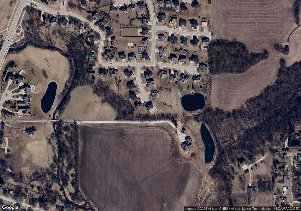
3839 Kensington Ct Bettendorf, IA 52722
Estimated Value: $734,000 - $870,927
5
Beds
5
Baths
3,024
Sq Ft
$265/Sq Ft
Est. Value
About This Home
This home is located at 3839 Kensington Ct, Bettendorf, IA 52722 and is currently estimated at $802,482, approximately $265 per square foot. 3839 Kensington Ct is a home located in Scott County with nearby schools including Pleasant View Elementary, Pleasant Valley Junior High School, and Pleasant Valley High School.
Ownership History
Date
Name
Owned For
Owner Type
Purchase Details
Closed on
Nov 21, 2014
Sold by
Brockmann Thomas C and Brockmann Molly J
Bought by
Brockmann Thomas C and Thomas C Brockmann Family Trust
Current Estimated Value
Purchase Details
Closed on
Jun 9, 2009
Sold by
Advance Homes Inc
Bought by
Brockmann Thomas C and Brockmann Molly J
Home Financials for this Owner
Home Financials are based on the most recent Mortgage that was taken out on this home.
Original Mortgage
$400,000
Outstanding Balance
$253,542
Interest Rate
4.83%
Mortgage Type
Purchase Money Mortgage
Estimated Equity
$548,940
Create a Home Valuation Report for This Property
The Home Valuation Report is an in-depth analysis detailing your home's value as well as a comparison with similar homes in the area
Home Values in the Area
Average Home Value in this Area
Purchase History
| Date | Buyer | Sale Price | Title Company |
|---|---|---|---|
| Brockmann Thomas C | -- | None Available | |
| Brockmann Thomas C | $553,500 | None Available |
Source: Public Records
Mortgage History
| Date | Status | Borrower | Loan Amount |
|---|---|---|---|
| Open | Brockmann Thomas C | $400,000 |
Source: Public Records
Tax History Compared to Growth
Tax History
| Year | Tax Paid | Tax Assessment Tax Assessment Total Assessment is a certain percentage of the fair market value that is determined by local assessors to be the total taxable value of land and additions on the property. | Land | Improvement |
|---|---|---|---|---|
| 2025 | $10,948 | $890,900 | $263,900 | $627,000 |
| 2024 | $11,132 | $721,300 | $111,000 | $610,300 |
| 2023 | $11,228 | $722,500 | $111,000 | $611,500 |
| 2022 | $11,114 | $626,040 | $110,970 | $515,070 |
| 2021 | $11,114 | $626,040 | $110,970 | $515,070 |
| 2020 | $10,046 | $569,390 | $110,970 | $458,420 |
| 2019 | $10,172 | $547,560 | $110,970 | $436,590 |
| 2018 | $9,972 | $547,560 | $110,970 | $436,590 |
| 2017 | $3,046 | $547,560 | $110,970 | $436,590 |
| 2016 | $10,284 | $555,110 | $0 | $0 |
| 2015 | $10,284 | $531,030 | $0 | $0 |
| 2014 | $9,958 | $531,030 | $0 | $0 |
| 2013 | $9,784 | $0 | $0 | $0 |
| 2012 | -- | $535,730 | $73,420 | $462,310 |
Source: Public Records
Map
Nearby Homes
- 5197 Wingate Ct
- 18225 249th
- 3365 E Ridge Dr
- 5567 Crow Creek Rd
- 5767 Evergreen Place
- 3365 Moencks Rd
- 4745 Heatherstone Rd
- 5415 Surrey Dr
- 4790 Woodland Dr
- 4691 Hidden Lake Ct
- 3210 Quail Ridge Rd
- 26 Briarwood Ln
- 3808 Orchard Dr
- 3814 Orchard Dr
- 3820 Orchard Dr
- 3826 Orchard Dr
- Lot 16 Century Heights Ave
- 1153 Fenno Dr
- 5256 Red Fox Rd
- 4471 Slate Creek Dr
- 3838 Kensington Ct
- 3884 Kensington Ct
- 3927 Kensington Ct
- 3926 Kensington Ct
- 3973 Kensington Ct
- 5151 Auburn Ct
- 5173 Auburn Ct
- 3972 Kensington Ct
- 5217 Auburn Ct
- Lot 14 Auburn Ave
- Lot 15 Auburn Ave
- 5057 Auburn Ave
- 5078 Auburn Ave
- 5066 Auburn Ave
- 5178 Auburn Ct
- 5055 Auburn Ave
- 5058 Auburn Ave
- 5235 Auburn Ct
- 5216 Auburn Ct
- 4018 Wyndham
