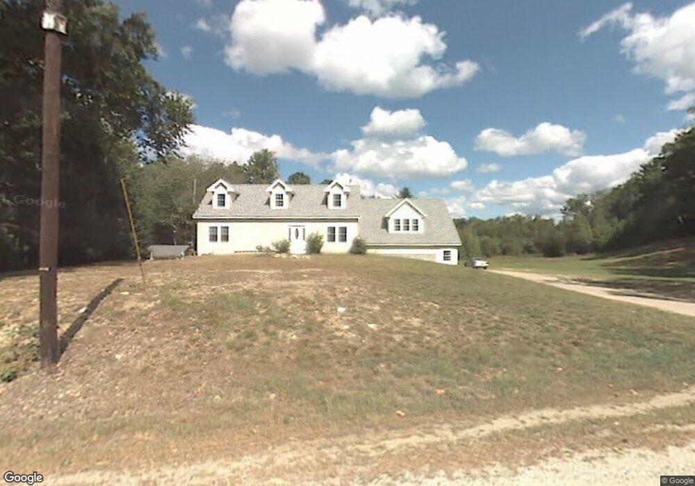
384 Emerson Ave Hampstead, NH 03841
Estimated Value: $623,766 - $686,000
3
Beds
1
Bath
2,958
Sq Ft
$222/Sq Ft
Est. Value
About This Home
This home is located at 384 Emerson Ave, Hampstead, NH 03841 and is currently estimated at $657,442, approximately $222 per square foot. 384 Emerson Ave is a home located in Rockingham County with nearby schools including Hampstead Central School, Hampstead Middle School, and Pinkerton Academy.
Ownership History
Date
Name
Owned For
Owner Type
Purchase Details
Closed on
Jun 1, 1998
Sold by
Fischer Andrew J and Fischer Christine J
Bought by
Getchell Daniel W
Current Estimated Value
Home Financials for this Owner
Home Financials are based on the most recent Mortgage that was taken out on this home.
Original Mortgage
$105,300
Interest Rate
7.12%
Create a Home Valuation Report for This Property
The Home Valuation Report is an in-depth analysis detailing your home's value as well as a comparison with similar homes in the area
Home Values in the Area
Average Home Value in this Area
Purchase History
| Date | Buyer | Sale Price | Title Company |
|---|---|---|---|
| Getchell Daniel W | $117,000 | -- |
Source: Public Records
Mortgage History
| Date | Status | Borrower | Loan Amount |
|---|---|---|---|
| Open | Getchell Daniel W | $325,400 | |
| Closed | Getchell Daniel W | $350,000 | |
| Closed | Getchell Daniel W | $100,000 | |
| Closed | Getchell Daniel W | $105,300 |
Source: Public Records
Tax History
| Year | Tax Paid | Tax Assessment Tax Assessment Total Assessment is a certain percentage of the fair market value that is determined by local assessors to be the total taxable value of land and additions on the property. | Land | Improvement |
|---|---|---|---|---|
| 2024 | $10,049 | $542,000 | $190,600 | $351,400 |
| 2023 | $9,504 | $373,600 | $161,200 | $212,400 |
| 2022 | $8,847 | $373,600 | $161,200 | $212,400 |
| 2021 | $8,499 | $373,600 | $161,200 | $212,400 |
| 2020 | $8,051 | $373,600 | $161,200 | $212,400 |
| 2016 | $7,212 | $298,000 | $103,300 | $194,700 |
| 2015 | $6,684 | $298,000 | $103,300 | $194,700 |
| 2014 | $6,684 | $298,000 | $103,300 | $194,700 |
| 2006 | $4,863 | $268,400 | $132,300 | $136,100 |
Source: Public Records
Map
Nearby Homes
Your Personal Tour Guide
Ask me questions while you tour the home.