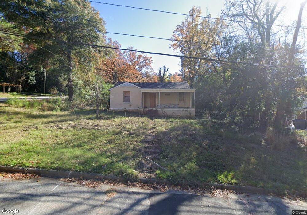
3842 Calhoun Dr Columbus, GA 31903
Southern Columbus NeighborhoodEstimated Value: $40,000 - $93,000
2
Beds
2
Baths
1,038
Sq Ft
$56/Sq Ft
Est. Value
About This Home
This home is located at 3842 Calhoun Dr, Columbus, GA 31903 and is currently estimated at $58,060, approximately $55 per square foot. 3842 Calhoun Dr is a home located in Muscogee County with nearby schools including Dorothy Height Elementary School, Eddy Middle School, and Spencer High School.
Ownership History
Date
Name
Owned For
Owner Type
Purchase Details
Closed on
Sep 28, 2020
Sold by
Lowery Armard Rashard
Bought by
Guzman Miguel Angel Gomez
Current Estimated Value
Purchase Details
Closed on
Apr 8, 2019
Sold by
Lowery Courtney D
Bought by
Lowery Armard R
Purchase Details
Closed on
Jan 10, 2018
Sold by
Ray Steven W
Bought by
Newton Jimmy R
Purchase Details
Closed on
Feb 4, 2015
Sold by
Baumgardner George William
Bought by
Baumgardner Patsy Jean Estate and Ray Steven W
Create a Home Valuation Report for This Property
The Home Valuation Report is an in-depth analysis detailing your home's value as well as a comparison with similar homes in the area
Home Values in the Area
Average Home Value in this Area
Purchase History
| Date | Buyer | Sale Price | Title Company |
|---|---|---|---|
| Guzman Miguel Angel Gomez | $15,000 | -- | |
| Lowery Armard R | -- | -- | |
| Newton Jimmy R | $9,000 | -- | |
| Lowery-Johnson Courtney | $13,000 | -- | |
| Baumgardner Patsy Jean Estate | -- | -- |
Source: Public Records
Tax History Compared to Growth
Tax History
| Year | Tax Paid | Tax Assessment Tax Assessment Total Assessment is a certain percentage of the fair market value that is determined by local assessors to be the total taxable value of land and additions on the property. | Land | Improvement |
|---|---|---|---|---|
| 2025 | $1,617 | $20,420 | $4,704 | $15,716 |
| 2024 | $671 | $17,148 | $3,476 | $13,672 |
| 2023 | $675 | $17,148 | $3,476 | $13,672 |
| 2022 | $714 | $17,488 | $3,476 | $14,012 |
| 2021 | $274 | $6,000 | $1,800 | $4,200 |
| 2020 | $608 | $14,888 | $3,476 | $11,412 |
| 2019 | $213 | $5,200 | $1,200 | $4,000 |
| 2018 | $569 | $13,892 | $3,476 | $10,416 |
| 2017 | $1,576 | $13,892 | $3,476 | $10,416 |
| 2016 | $377 | $9,128 | $2,840 | $6,288 |
| 2015 | $151 | $9,128 | $2,840 | $6,288 |
| 2014 | $377 | $9,128 | $2,840 | $6,288 |
| 2013 | -- | $9,128 | $2,840 | $6,288 |
Source: Public Records
Map
Nearby Homes
- 3838 Calhoun Dr
- 1813 Penn Ave
- 3908 Calhoun Dr
- 3822 Calhoun Dr
- 1821 Penn Ave
- 1727 Penn Ave
- 3827 Calhoun Dr
- 3820 Calhoun Dr
- 3910 Calhoun Dr
- 3821 Calhoun Dr
- 3911 Calhoun Dr
- 29 Muscogee Dr
- 1719 Penn Ave
- 1829 Penn Ave
- 3818 Calhoun Dr
- 3913 Calhoun Dr
- 3915 Mosley Dr
- 3918 Calhoun Dr
- 21 Muscogee Dr
- 1738 Fort Benning Rd