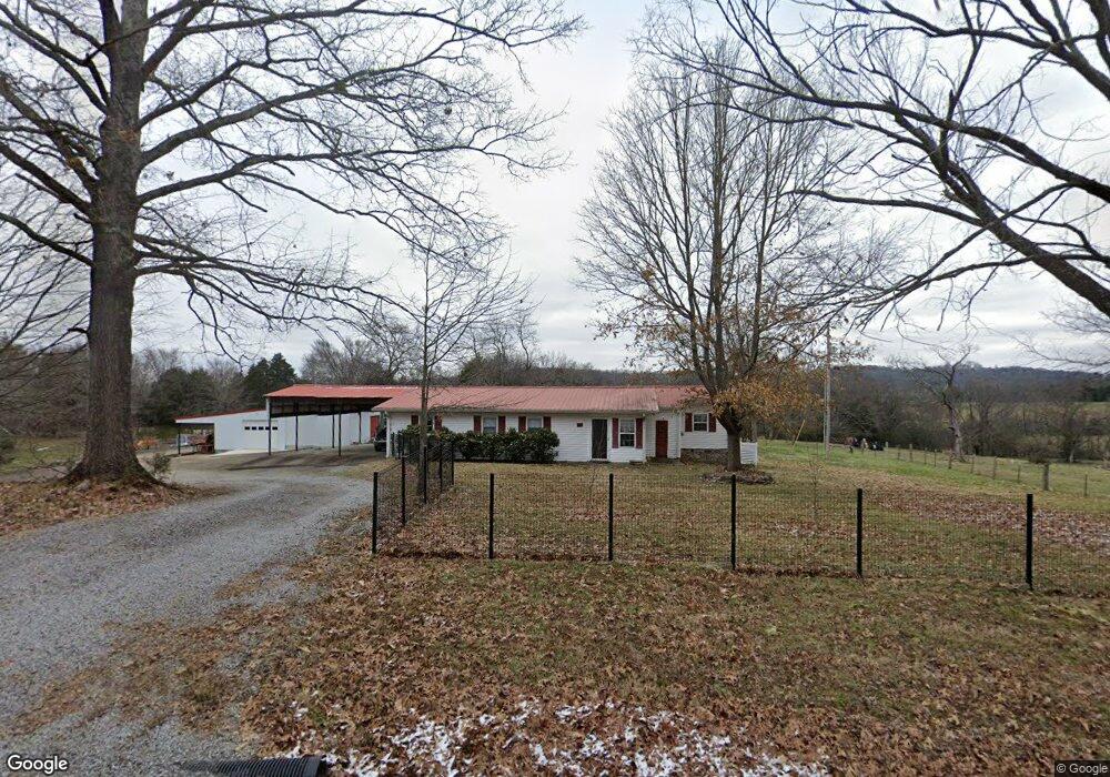
385 Coe Ln Lebanon, TN 37087
Estimated Value: $169,535 - $276,000
--
Bed
2
Baths
1,176
Sq Ft
$190/Sq Ft
Est. Value
About This Home
This home is located at 385 Coe Ln, Lebanon, TN 37087 and is currently estimated at $222,884, approximately $189 per square foot. 385 Coe Ln is a home located in Wilson County with nearby schools including Tuckers Crossroads School and Watertown High School.
Ownership History
Date
Name
Owned For
Owner Type
Purchase Details
Closed on
Oct 30, 2006
Sold by
Mcpeak Joseph Earl Exec
Bought by
Cherry Tim L
Current Estimated Value
Home Financials for this Owner
Home Financials are based on the most recent Mortgage that was taken out on this home.
Original Mortgage
$59,400
Interest Rate
6.27%
Purchase Details
Closed on
Aug 25, 1997
Bought by
Mcpeak James R and Mcpeak Myra M
Create a Home Valuation Report for This Property
The Home Valuation Report is an in-depth analysis detailing your home's value as well as a comparison with similar homes in the area
Home Values in the Area
Average Home Value in this Area
Purchase History
| Date | Buyer | Sale Price | Title Company |
|---|---|---|---|
| Cherry Tim L | $66,000 | -- | |
| Mcpeak James R | $5,000 | -- |
Source: Public Records
Mortgage History
| Date | Status | Borrower | Loan Amount |
|---|---|---|---|
| Closed | Mcpeak James R | $59,400 |
Source: Public Records
Tax History Compared to Growth
Tax History
| Year | Tax Paid | Tax Assessment Tax Assessment Total Assessment is a certain percentage of the fair market value that is determined by local assessors to be the total taxable value of land and additions on the property. | Land | Improvement |
|---|---|---|---|---|
| 2024 | $690 | $36,125 | $19,150 | $16,975 |
| 2022 | $690 | $36,125 | $19,150 | $16,975 |
| 2021 | $690 | $36,125 | $19,150 | $16,975 |
| 2020 | $686 | $36,125 | $19,150 | $16,975 |
| 2019 | $686 | $27,250 | $15,625 | $11,625 |
| 2018 | $686 | $27,250 | $15,625 | $11,625 |
| 2017 | $680 | $27,250 | $15,625 | $11,625 |
| 2016 | $680 | $27,000 | $15,625 | $11,375 |
| 2015 | $694 | $27,000 | $15,625 | $11,375 |
| 2014 | $664 | $25,817 | $0 | $0 |
Source: Public Records
Map
Nearby Homes
- 0 Bluebird Rd Unit RTC3035961
- 745 Spring Creek Ln
- 9245 Trousdale Ferry Pike
- 346 Spring Creek Ln
- 1544 Eastover Rd
- 1039 Quail Meadow Dr
- 1024 Quail Meadow Dr
- 905 Mill Rd
- 667 Eastover Rd
- 1295 Sugar Flat Rd
- 1545 Carthage Hwy Unit 1545
- 7658 Linwood Rd
- 717 Peyton Rd
- 1266 Poplar Hill Rd
- 1180 Poplar Hill Rd
- 795 Sugar Flat Rd
- 234 Draper Ln
- 124 Mill Rd
- 4780 Big Springs Rd
- 1556 Sparta Pike
- 4249 Bluebird Rd
- 4212 Bluebird Rd
- 645 Coe Ln
- 2241 Locust Grove Rd
- 715 Coe Ln
- 3980 Bluebird Rd
- 3980 Bluebird Rd
- 4640 Bluebird Rd
- 2101 Locust Grove Rd
- 195 Bluebird Extension
- 4714 Bluebird Rd
- 3792 Bluebird Rd
- 774 Bethany Ln
- 3400 Trousdale Ferry Pike
- 2071 Locust Grove Rd
- 2104 Locust Grove Rd
- 3762 Bluebird Rd
- 3740 Bluebird Rd
- 175 Bluebird Extension
- 0 Bethany Ln