Estimated Value: $552,283 - $629,000
4
Beds
4
Baths
3,535
Sq Ft
$170/Sq Ft
Est. Value
About This Home
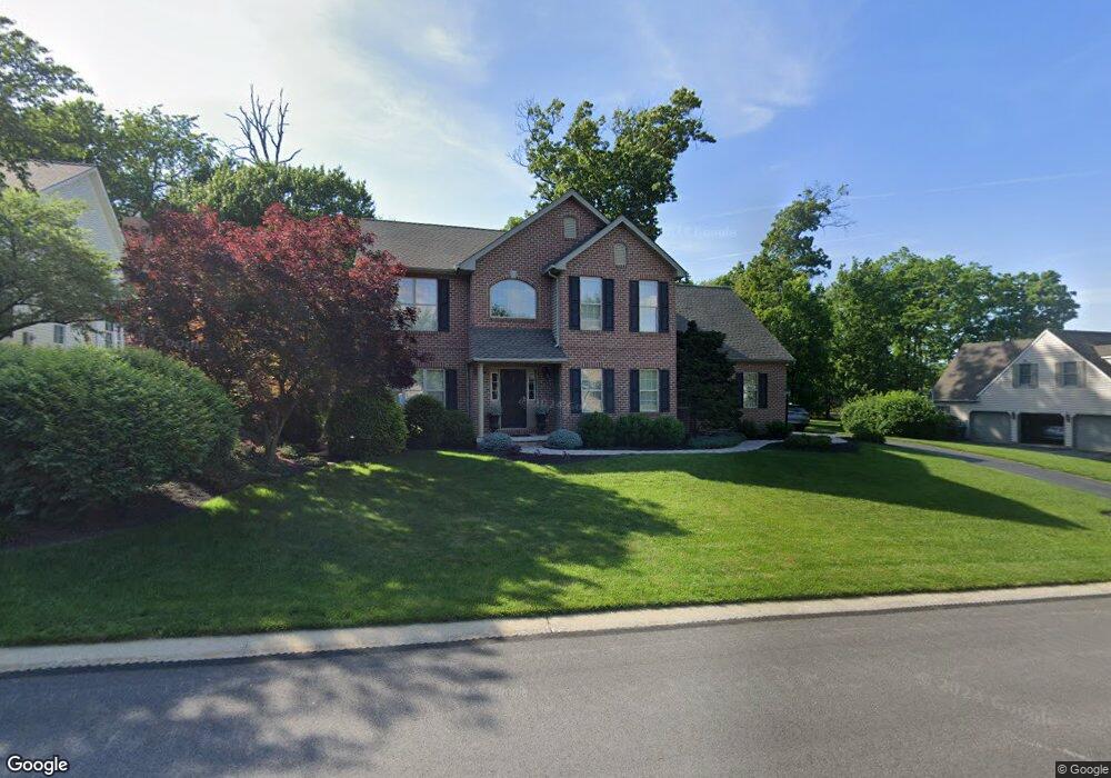
This home is located at 385 Dew Drop Rd, York, PA 17402 and is currently estimated at $601,321, approximately $170 per square foot. 385 Dew Drop Rd is a home located in York County with nearby schools including York Township Elementary School, Dallastown Area Middle School, and Dallastown Area High School.
Ownership History
Date
Name
Owned For
Owner Type
Purchase Details
Closed on
Dec 31, 1999
Sold by
Timothy F Pasch Inc
Bought by
Sheaffer James M and Sheaffer Laura Collins
Current Estimated Value
Home Financials for this Owner
Home Financials are based on the most recent Mortgage that was taken out on this home.
Original Mortgage
$231,350
Outstanding Balance
$72,898
Interest Rate
7.73%
Estimated Equity
$528,423
Create a Home Valuation Report for This Property
The Home Valuation Report is an in-depth analysis detailing your home's value as well as a comparison with similar homes in the area
Home Values in the Area
Average Home Value in this Area
Purchase History
| Date | Buyer | Sale Price | Title Company |
|---|---|---|---|
| Sheaffer James M | $243,933 | -- |
Source: Public Records
Mortgage History
| Date | Status | Borrower | Loan Amount |
|---|---|---|---|
| Open | Sheaffer James M | $231,350 |
Source: Public Records
Tax History Compared to Growth
Tax History
| Year | Tax Paid | Tax Assessment Tax Assessment Total Assessment is a certain percentage of the fair market value that is determined by local assessors to be the total taxable value of land and additions on the property. | Land | Improvement |
|---|---|---|---|---|
| 2025 | $10,045 | $292,620 | $56,960 | $235,660 |
| 2024 | $9,574 | $283,040 | $56,960 | $226,080 |
| 2023 | $9,574 | $283,040 | $56,960 | $226,080 |
| 2022 | $9,261 | $283,040 | $56,960 | $226,080 |
| 2021 | $8,822 | $283,040 | $56,960 | $226,080 |
| 2020 | $8,822 | $283,040 | $56,960 | $226,080 |
| 2019 | $8,794 | $283,040 | $56,960 | $226,080 |
| 2018 | $8,698 | $281,840 | $56,960 | $224,880 |
| 2017 | $8,351 | $281,840 | $56,960 | $224,880 |
| 2016 | $0 | $281,840 | $56,960 | $224,880 |
| 2015 | -- | $281,840 | $56,960 | $224,880 |
| 2014 | -- | $281,840 | $56,960 | $224,880 |
Source: Public Records
Map
Nearby Homes
- 2214 S Queen St
- 2458 Schultz Way Unit 30
- 146 Lexington Rd
- 119 Lexington Rd
- 110 Oak Ridge Ln Unit 110
- 224 Wheatfield Way Unit 71D
- 229 Wheatfield Way Unit 76C
- 114 Dew Drop Ct Unit 114
- 1818 Roxboro Rd
- 30 Fox Run Dr
- 2178 Springwood Rd
- 519 Middleview Dr
- 1899 Powder Mill Rd Unit B
- 245 Leaders Heights Rd
- 553 Green Spring Rd
- Kipling Plan at The Views at Bridgewater
- Woodford Plan at The Views at Bridgewater
- Sebastian Plan at The Views at Bridgewater
- Savannah Plan at The Views at Bridgewater
- Parker Plan at The Views at Bridgewater
- 389 Dew Drop Rd
- 370 Dew Drop Rd
- 375 Dew Drop Rd
- 360 Dew Drop Rd
- 2236 Old Colony Rd
- 380 Dew Drop Rd
- 365 Dew Drop Rd
- 395 Dew Drop Rd
- 2280 Ashleigh Dr
- 2165 May Apple Dr
- 2232 Old Colony Rd
- 2205 May Apple Dr
- 355 Dew Drop Rd
- 2145 May Apple Dr
- 2233 Old Colony Rd
- 390 Dew Drop Rd
- 2250 Ashleigh Dr
- 2235 May Apple Dr
- 2240 Ashleigh Dr
- 2265 May Apple Dr