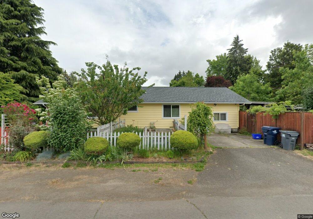
385 Hatton Ave Eugene, OR 97404
River Road NeighborhoodEstimated Value: $399,419 - $444,000
3
Beds
2
Baths
1,644
Sq Ft
$261/Sq Ft
Est. Value
About This Home
This home is located at 385 Hatton Ave, Eugene, OR 97404 and is currently estimated at $429,855, approximately $261 per square foot. 385 Hatton Ave is a home located in Lane County with nearby schools including Howard Elementary School, Kelly Middle School, and North Eugene High School.
Ownership History
Date
Name
Owned For
Owner Type
Purchase Details
Closed on
Jul 15, 2002
Sold by
Buschelman Carolyn Jo
Bought by
Zsiga Janet E
Current Estimated Value
Home Financials for this Owner
Home Financials are based on the most recent Mortgage that was taken out on this home.
Original Mortgage
$64,500
Outstanding Balance
$27,041
Interest Rate
6.69%
Estimated Equity
$402,815
Purchase Details
Closed on
Aug 26, 1998
Sold by
Buschelman Bruce W
Bought by
Buschelman Carolyn Jo
Create a Home Valuation Report for This Property
The Home Valuation Report is an in-depth analysis detailing your home's value as well as a comparison with similar homes in the area
Home Values in the Area
Average Home Value in this Area
Purchase History
| Date | Buyer | Sale Price | Title Company |
|---|---|---|---|
| Zsiga Janet E | $124,500 | Western Pioneer Title Co | |
| Buschelman Carolyn Jo | -- | -- |
Source: Public Records
Mortgage History
| Date | Status | Borrower | Loan Amount |
|---|---|---|---|
| Open | Zsiga Janet E | $64,500 |
Source: Public Records
Tax History
| Year | Tax Paid | Tax Assessment Tax Assessment Total Assessment is a certain percentage of the fair market value that is determined by local assessors to be the total taxable value of land and additions on the property. | Land | Improvement |
|---|---|---|---|---|
| 2025 | $3,223 | $218,183 | -- | -- |
| 2024 | $3,189 | $211,829 | -- | -- |
| 2023 | $3,189 | $205,660 | $0 | $0 |
| 2022 | $2,999 | $199,670 | $0 | $0 |
| 2021 | $2,789 | $193,855 | $0 | $0 |
| 2020 | $2,809 | $188,209 | $0 | $0 |
| 2019 | $2,693 | $182,728 | $0 | $0 |
| 2018 | $2,473 | $172,239 | $0 | $0 |
| 2017 | $2,324 | $172,239 | $0 | $0 |
| 2016 | $2,197 | $167,222 | $0 | $0 |
| 2015 | $2,118 | $162,351 | $0 | $0 |
| 2014 | $2,110 | $157,622 | $0 | $0 |
Source: Public Records
Map
Nearby Homes
- 1483 Barton St
- 1487 Barton St
- 1360 Andersen Ln
- 1420 Evergreen Dr
- 1555 Escalante St
- 1314 Dalton Dr
- 1685 Evergreen Dr
- 389 Maxwell Rd
- 1010 Horn Ln
- 172 Norman Ave
- 154 Norman Ave
- 1880 Manihi Dr
- 1920 River Rd
- 1566 Maywood Ave
- 260 Greenleaf Ave
- 1682 Hemlock St
- 1010 N Park Ave
- 788 Cornwall Ave
- 1633 Zoe Ave
- 1755 Brentwood Ave
- 1425 Parnell Dr
- 1433 Parnell Dr
- 1409 Parnell Dr
- 1406 Barton Dr
- 378 Hatton Ave
- 1418 Barton Dr
- 1412 Parnell Dr
- 362 Hatton Ave
- 1410 Parnell Dr
- 1439 Parnell Dr
- 1430 Barton Dr
- 1430 Parnell Dr
- 295 Harvey Ave
- 289 Harvey Ave
- 1436 Parnell Dr
- 1408 Parnell Dr
- 340 Hatton Ave
- 1442 Barton Dr
- 1451 Parnell Dr
- 1521 Golden Ave
Your Personal Tour Guide
Ask me questions while you tour the home.