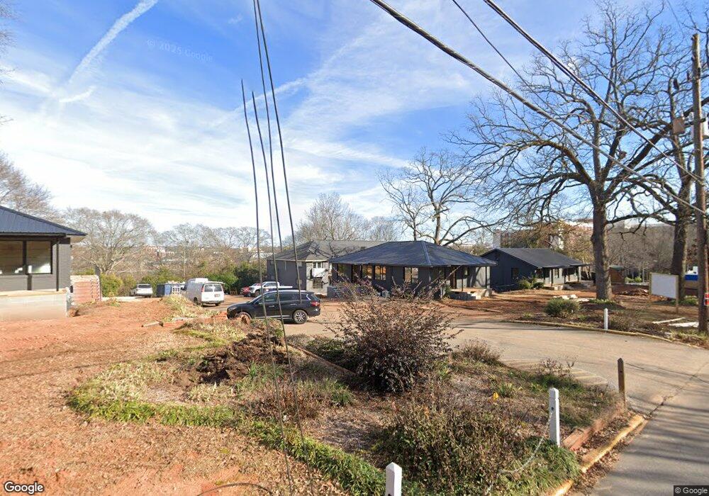
385 S Pope St Unit 19 Athens, GA 30605
Rock Springs NeighborhoodEstimated Value: $8,055,851
2
Beds
2
Baths
760
Sq Ft
$10,600/Sq Ft
Est. Value
About This Home
This home is located at 385 S Pope St Unit 19, Athens, GA 30605 and is currently estimated at $8,055,851, approximately $10,599 per square foot. 385 S Pope St Unit 19 is a home located in Clarke County with nearby schools including Barrow Elementary School, Clarke Middle School, and Clarke Central High School.
Ownership History
Date
Name
Owned For
Owner Type
Purchase Details
Closed on
Oct 1, 2024
Sold by
Swope Michael C
Bought by
Butler Athens Llc
Current Estimated Value
Purchase Details
Closed on
Mar 8, 2016
Sold by
Bromsgrove Management Llc
Bought by
Unified Government Of Athens C
Purchase Details
Closed on
Dec 29, 2014
Sold by
Butler Management Llc
Bought by
Bromsgrove Management Llc
Purchase Details
Closed on
Dec 10, 1998
Sold by
Cobb Gloria B
Bought by
Butler Management Llp
Create a Home Valuation Report for This Property
The Home Valuation Report is an in-depth analysis detailing your home's value as well as a comparison with similar homes in the area
Home Values in the Area
Average Home Value in this Area
Purchase History
Date | Buyer | Sale Price | Title Company |
---|---|---|---|
Butler Athens Llc | -- | -- | |
Swope Michael C | -- | -- | |
Austin Bryan E | -- | -- | |
Unified Government Of Athens C | -- | -- | |
Bromsgrove Management Llc | -- | -- | |
Butler Management Llp | -- | -- |
Source: Public Records
Mortgage History
Date | Status | Borrower | Loan Amount |
---|---|---|---|
Previous Owner | 810 Mlk Llc | $2,000,000 | |
Previous Owner | Bromsgrove Management Llc | $700,000 |
Source: Public Records
Tax History Compared to Growth
Tax History
Year | Tax Paid | Tax Assessment Tax Assessment Total Assessment is a certain percentage of the fair market value that is determined by local assessors to be the total taxable value of land and additions on the property. | Land | Improvement |
---|---|---|---|---|
2024 | $88,712 | $1,316,221 | $438,200 | $878,021 |
2023 | $54,658 | $1,298,067 | $438,200 | $859,867 |
2022 | $42,617 | $1,097,475 | $438,200 | $659,275 |
2021 | $39,291 | $1,080,048 | $438,200 | $641,848 |
2020 | $39,039 | $1,080,048 | $438,200 | $641,848 |
2019 | $38,241 | $1,060,082 | $438,200 | $621,882 |
2018 | $35,312 | $1,060,082 | $438,200 | $621,882 |
2017 | $35,247 | $1,038,214 | $438,200 | $600,014 |
2016 | $35,247 | $1,038,214 | $438,200 | $600,014 |
2015 | $31,577 | $928,734 | $438,200 | $490,534 |
2014 | $28,273 | $830,349 | $438,200 | $392,149 |
Source: Public Records
Map
Nearby Homes
- 365 S Church St Unit 1A
- 365 S Church St Unit 1B
- 365 S Church St Unit 1C
- 365 S Church #1c St
- 365 S Church #1b St
- 365 S Church #1a St
- 174 Talmadge St Unit 11
- 198 Dearing St
- 255 Bloomfield St
- 935 Baxter St Unit 6
- 131 E Broad St Unit 506
- 475 Meigs St
- 485 Meigs St
- 1226 W Broad St
- 257 Hill St
- 382 N Chase St
- 170 Stanton Way
- 385 S Pope St Unit 19
- 385 S Pope St
- 389 S Pope St
- 360 Baxter St
- 360 S Pope St
- 394 S Pope St Unit 5
- 394 S Pope St
- 394 S Pope St Unit 1
- 394 S Pope St
- 494 Baxter St Unit 56
- 494 Baxter St Unit 36
- 494 Baxter St Unit 52
- 494 Baxter St Unit 44
- 494 Baxter St Unit 43
- 494 Baxter St Unit 32
- 494 Baxter St Unit 46
- 494 Baxter St Unit 26
- 494 Baxter St Unit 31
- 494 Baxter St
- 494 Baxter St