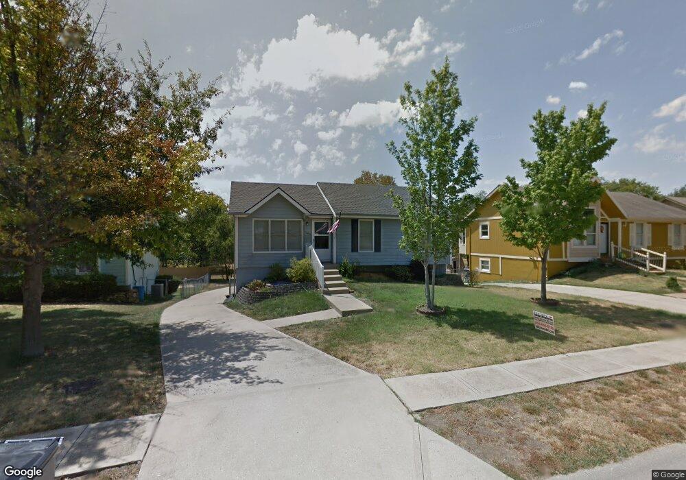
385 W Johnston St Olathe, KS 66061
Estimated Value: $310,000 - $330,000
3
Beds
3
Baths
1,048
Sq Ft
$303/Sq Ft
Est. Value
About This Home
This home is located at 385 W Johnston St, Olathe, KS 66061 and is currently estimated at $317,187, approximately $302 per square foot. 385 W Johnston St is a home located in Johnson County with nearby schools including Ravenwood Elementary School, Summit Trail Middle School, and Olathe Northwest High School.
Ownership History
Date
Name
Owned For
Owner Type
Purchase Details
Closed on
Jun 29, 2006
Sold by
Pipkin Rachelle D
Bought by
Quick Thomas
Current Estimated Value
Home Financials for this Owner
Home Financials are based on the most recent Mortgage that was taken out on this home.
Original Mortgage
$121,200
Outstanding Balance
$71,874
Interest Rate
6.63%
Mortgage Type
New Conventional
Estimated Equity
$245,313
Create a Home Valuation Report for This Property
The Home Valuation Report is an in-depth analysis detailing your home's value as well as a comparison with similar homes in the area
Home Values in the Area
Average Home Value in this Area
Purchase History
| Date | Buyer | Sale Price | Title Company |
|---|---|---|---|
| Quick Thomas | -- | Coffelt Land Title Inc |
Source: Public Records
Mortgage History
| Date | Status | Borrower | Loan Amount |
|---|---|---|---|
| Open | Quick Thomas | $121,200 |
Source: Public Records
Tax History Compared to Growth
Tax History
| Year | Tax Paid | Tax Assessment Tax Assessment Total Assessment is a certain percentage of the fair market value that is determined by local assessors to be the total taxable value of land and additions on the property. | Land | Improvement |
|---|---|---|---|---|
| 2024 | $3,325 | $30,038 | $4,184 | $25,854 |
| 2023 | $3,231 | $28,439 | $3,805 | $24,634 |
| 2022 | $2,823 | $24,230 | $3,459 | $20,771 |
| 2021 | $2,885 | $23,448 | $3,459 | $19,989 |
| 2020 | $2,785 | $22,436 | $3,007 | $19,429 |
| 2019 | $2,607 | $20,884 | $3,007 | $17,877 |
| 2018 | $2,504 | $19,930 | $2,407 | $17,523 |
| 2017 | $2,312 | $18,239 | $2,407 | $15,832 |
| 2016 | $2,162 | $17,503 | $2,407 | $15,096 |
| 2015 | $1,948 | $15,813 | $2,407 | $13,406 |
| 2013 | -- | $15,456 | $2,190 | $13,266 |
Source: Public Records
Map
Nearby Homes
- 397 W Johnston St
- 540 W Northview St
- 619 N Walnut St
- 631 N Willie St
- 612 N Logan St
- 1012 N Troost Ave
- 500 E Johnston St
- 12525 S Lincoln St
- 925 N Walker Ln
- 500 E Harold St
- 11588 S Houston St
- 821 N Hamilton St
- 1009 N Walker Ln
- 1002 N Parker Terrace
- 955 N Parker Terrace
- 21205 W 125th Terrace
- 12386 S Lincoln St
- 501 E Spruce St
- 1124 N Curtis St
- 801 E Piatt Ln
- 363 W Johnston St
- 349 W Johnston St
- 415 W Johnston St
- 427 W Johnston St
- 327 W Johnston St
- 390 W Johnston St
- 378 W Johnston St
- 354 W Johnston St
- 449 W Johnston St
- 400 W Johnston St
- 332 W Johnston St
- 432 W Johnston St
- 818 N Pine St
- 305 W Johnston St
- 463 W Johnston St
- 300 W Johnston St
- 816 N Pine St
- 310 W Johnston St
- 561 W Northview St
- 557 W Northview St