Estimated Value: $435,000 - $512,000
4
Beds
3
Baths
3,444
Sq Ft
$141/Sq Ft
Est. Value
About This Home
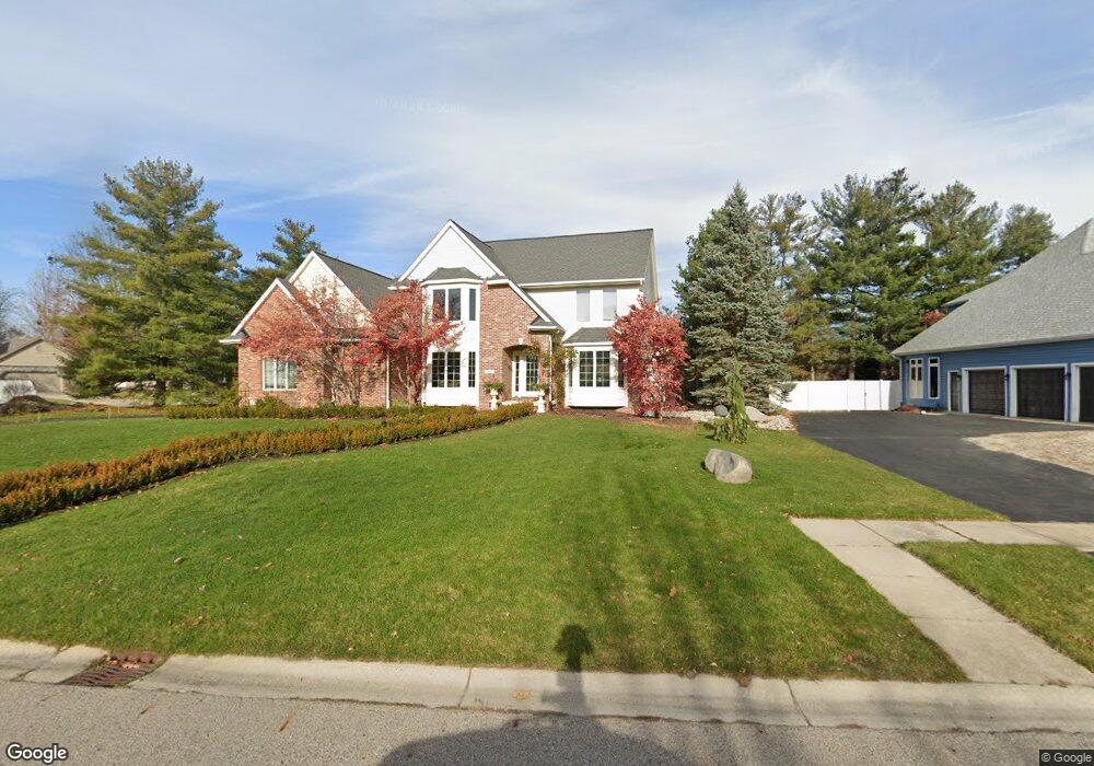
This home is located at 3850 Ashbrook Dr, Holt, MI 48842 and is currently estimated at $485,587, approximately $140 per square foot. 3850 Ashbrook Dr is a home located in Ingham County with nearby schools including Elliott Elementary School, Hope Middle School, and Holt Junior High School.
Ownership History
Date
Name
Owned For
Owner Type
Purchase Details
Closed on
Oct 26, 2002
Sold by
Brunner Roger E and Brunner Diane D
Bought by
Kraushaar Mark D and Kraushaar Leigh
Current Estimated Value
Purchase Details
Closed on
Nov 15, 2001
Sold by
Bondarenko Todd L and Bondarenko Marcia L
Bought by
Brunner Roger E and Brunner Diane D
Home Financials for this Owner
Home Financials are based on the most recent Mortgage that was taken out on this home.
Original Mortgage
$323,950
Interest Rate
6.64%
Mortgage Type
Purchase Money Mortgage
Purchase Details
Closed on
Sep 8, 2000
Sold by
Vandeventer Forest T and Vandeventer Dianna Lynne
Bought by
Bondarenko Todd L
Home Financials for this Owner
Home Financials are based on the most recent Mortgage that was taken out on this home.
Original Mortgage
$236,400
Interest Rate
8.14%
Mortgage Type
Purchase Money Mortgage
Create a Home Valuation Report for This Property
The Home Valuation Report is an in-depth analysis detailing your home's value as well as a comparison with similar homes in the area
Home Values in the Area
Average Home Value in this Area
Purchase History
| Date | Buyer | Sale Price | Title Company |
|---|---|---|---|
| Kraushaar Mark D | $342,000 | Trans | |
| Brunner Roger E | $341,000 | -- | |
| Bondarenko Todd L | $50,000 | -- |
Source: Public Records
Mortgage History
| Date | Status | Borrower | Loan Amount |
|---|---|---|---|
| Previous Owner | Brunner Roger E | $323,950 | |
| Previous Owner | Bondarenko Todd L | $236,400 |
Source: Public Records
Tax History Compared to Growth
Tax History
| Year | Tax Paid | Tax Assessment Tax Assessment Total Assessment is a certain percentage of the fair market value that is determined by local assessors to be the total taxable value of land and additions on the property. | Land | Improvement |
|---|---|---|---|---|
| 2025 | $9,428 | $257,800 | $31,900 | $225,900 |
| 2024 | $22 | $245,000 | $27,800 | $217,200 |
| 2023 | $8,815 | $230,600 | $25,900 | $204,700 |
| 2022 | $8,494 | $209,000 | $22,700 | $186,300 |
| 2021 | $8,064 | $183,400 | $15,200 | $168,200 |
| 2020 | $7,548 | $167,100 | $15,200 | $151,900 |
| 2019 | $7,276 | $160,500 | $15,200 | $145,300 |
| 2018 | $7,236 | $141,800 | $15,200 | $126,600 |
| 2017 | $6,759 | $141,800 | $15,200 | $126,600 |
| 2016 | $6,202 | $136,400 | $15,500 | $120,900 |
| 2015 | $6,074 | $131,600 | $31,242 | $100,358 |
| 2014 | $6,074 | $126,700 | $30,581 | $96,119 |
Source: Public Records
Map
Nearby Homes
- 0 Dell Rd Unit 290382
- 2683 Dellridge Dr
- 2986 Beech Ridge Dr
- 2835 Fontaine Trail
- 3990 Camperdown Dr
- 3836 Sandhill Rd
- 3708 David Ln
- 3742 Observatory Ln
- 2584 Varsity Ln
- 4094 Sebring Dr
- 2611 Navigator
- 4106 Sebring Dr
- 2650 Navigator Ln
- 3980 Applegrove Ln
- 4118 Sebring Dr
- 2655 Navigator Ln
- 2645 Navigator Ln
- 2635 Navigator Ln
- 2617 Navigator Ln
- 2712 Galiot Ct
- 3840 Ashbrook Dr
- 2828 River Pointe Dr
- 2815 River Pointe Dr
- 3855 Ashbrook Dr
- 3845 Ashbrook Dr
- 2825 River Pointe Dr
- 3830 Ashbrook Dr
- 2805 River Pointe Dr
- 3835 Ashbrook Dr
- 2795 River Pointe Dr
- 2850 River Pointe Dr
- 2831 River Pointe Dr
- 3825 Ashbrook Dr
- 3820 Ashbrook Dr
- 3840 Royale Dr
- 3850 Royale Dr
- 3830 Royale Dr
- 2837 River Pointe Dr
- 2822 Dellridge Dr
- 2832 Dellridge Dr