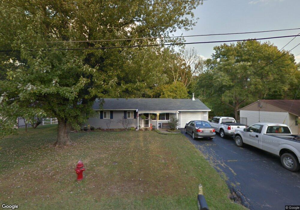
3856 Michael Dr Cincinnati, OH 45255
Estimated Value: $190,000 - $233,000
3
Beds
2
Baths
1,254
Sq Ft
$168/Sq Ft
Est. Value
About This Home
This home is located at 3856 Michael Dr, Cincinnati, OH 45255 and is currently estimated at $210,342, approximately $167 per square foot. 3856 Michael Dr is a home located in Clermont County with nearby schools including Withamsville-Tobasco Elementary School, West Clermont Middle School, and West Clermont High School.
Ownership History
Date
Name
Owned For
Owner Type
Purchase Details
Closed on
Oct 15, 2002
Sold by
Schneider Jill Anne
Bought by
Schneider Jill Anne and Sheldon Paul E
Current Estimated Value
Home Financials for this Owner
Home Financials are based on the most recent Mortgage that was taken out on this home.
Original Mortgage
$103,500
Interest Rate
6.07%
Mortgage Type
Purchase Money Mortgage
Purchase Details
Closed on
Nov 30, 1999
Sold by
Ditchen Ronald C
Bought by
Schneider Jill A
Home Financials for this Owner
Home Financials are based on the most recent Mortgage that was taken out on this home.
Original Mortgage
$83,600
Interest Rate
7%
Mortgage Type
New Conventional
Purchase Details
Closed on
Oct 1, 1985
Create a Home Valuation Report for This Property
The Home Valuation Report is an in-depth analysis detailing your home's value as well as a comparison with similar homes in the area
Home Values in the Area
Average Home Value in this Area
Purchase History
| Date | Buyer | Sale Price | Title Company |
|---|---|---|---|
| Schneider Jill Anne | -- | -- | |
| Schneider Jill A | $92,900 | -- | |
| -- | $47,500 | -- |
Source: Public Records
Mortgage History
| Date | Status | Borrower | Loan Amount |
|---|---|---|---|
| Closed | Schneider Jill Anne | $103,500 | |
| Closed | Schneider Jill A | $83,600 |
Source: Public Records
Tax History
| Year | Tax Paid | Tax Assessment Tax Assessment Total Assessment is a certain percentage of the fair market value that is determined by local assessors to be the total taxable value of land and additions on the property. | Land | Improvement |
|---|---|---|---|---|
| 2024 | $2,807 | $55,650 | $15,260 | $40,390 |
| 2023 | $2,811 | $55,650 | $15,260 | $40,390 |
| 2022 | $2,460 | $42,210 | $11,550 | $30,660 |
| 2021 | $2,470 | $42,210 | $11,550 | $30,660 |
| 2020 | $2,472 | $42,210 | $11,550 | $30,660 |
| 2019 | $1,677 | $33,470 | $11,030 | $22,440 |
| 2018 | $1,694 | $33,470 | $11,030 | $22,440 |
| 2017 | $1,716 | $33,470 | $11,030 | $22,440 |
| 2016 | $1,780 | $31,850 | $10,500 | $21,350 |
| 2015 | $1,728 | $31,850 | $10,500 | $21,350 |
| 2014 | $1,728 | $31,850 | $10,500 | $21,350 |
| 2013 | $1,841 | $33,570 | $9,800 | $23,770 |
Source: Public Records
Map
Nearby Homes
- 595 Davis Rd
- 537 Davis Rd
- 541 Davis Rd
- 637 Ellen Dr
- 671 Mccormick Ln
- 3904 Columbard Ln
- 488 Madeira Ct
- 551 Hal Cor Ln
- 807 Nordyke Rd
- 496 Mapleleaf Dr
- 492 Mapleleaf Dr
- 4047 Mclean Dr
- 686 Loda Dr
- 4077 Mclean Dr
- 793 Greenwood Ln
- 4133 Brandonmore Dr
- 3703 Nine Mile Tobasco Rd
- 682 Hyacinth Rd
- 425 Mcintosh Dr Unit 22A
- 3914 Dieckman Ln
- 3854 Michael Dr
- 3860 Michael Dr
- 3850 Michael Dr
- 3862 Michael Dr
- 3851 Michael Dr
- 3859 Michael Dr
- 3864 Michael Dr
- 3845 Mark Ct
- 3846 Michael Dr
- 3845 Michael Dr
- 3868 Michael Dr
- 3865 Michael Dr
- 3842 Michael Dr
- 594 Davis Rd
- 576 Davis Rd
- 3851 Mark Ct
- 3870 Michael Dr
- 3871 Michael Dr
- 572 Davis Rd
- 3872 Michael Dr
Your Personal Tour Guide
Ask me questions while you tour the home.