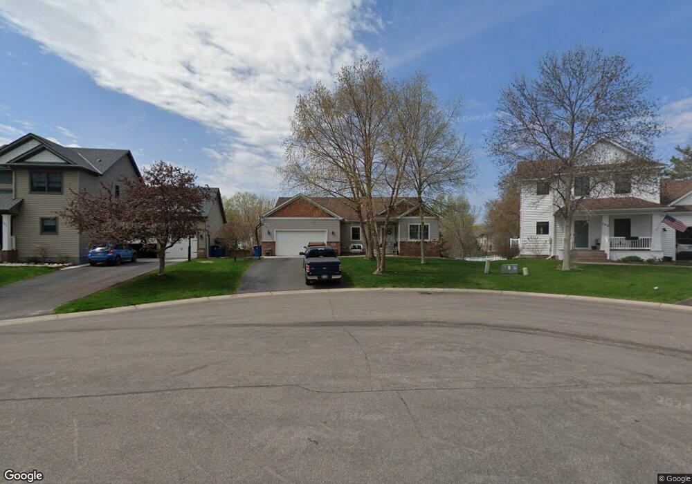
386 Lancaster Ln N Champlin, MN 55316
Estimated Value: $529,189 - $573,000
6
Beds
3
Baths
1,722
Sq Ft
$319/Sq Ft
Est. Value
About This Home
This home is located at 386 Lancaster Ln N, Champlin, MN 55316 and is currently estimated at $549,297, approximately $318 per square foot. 386 Lancaster Ln N is a home located in Hennepin County with nearby schools including Champlin-Brooklyn Park Academy, Jackson Middle School, and Champlin Park High School.
Ownership History
Date
Name
Owned For
Owner Type
Purchase Details
Closed on
Dec 15, 2017
Sold by
Jones George E
Bought by
Martin Joseph K and Martin Peggy K
Current Estimated Value
Home Financials for this Owner
Home Financials are based on the most recent Mortgage that was taken out on this home.
Original Mortgage
$266,000
Outstanding Balance
$223,717
Interest Rate
3.9%
Mortgage Type
New Conventional
Estimated Equity
$325,580
Purchase Details
Closed on
Jun 29, 2015
Sold by
Sanford Ronald Ellis and Sanford Theoline
Bought by
Jones George E
Home Financials for this Owner
Home Financials are based on the most recent Mortgage that was taken out on this home.
Original Mortgage
$327,606
Interest Rate
3.75%
Mortgage Type
FHA
Purchase Details
Closed on
Nov 12, 2004
Sold by
Mega Homes Inc
Bought by
Sanford Ron and Sanford Oksana
Create a Home Valuation Report for This Property
The Home Valuation Report is an in-depth analysis detailing your home's value as well as a comparison with similar homes in the area
Home Values in the Area
Average Home Value in this Area
Purchase History
| Date | Buyer | Sale Price | Title Company |
|---|---|---|---|
| Martin Joseph K | $356,000 | Liberty Title Inc | |
| Jones George E | $333,652 | Trademark Title Services Inc | |
| Sanford Ron | $368,498 | -- |
Source: Public Records
Mortgage History
| Date | Status | Borrower | Loan Amount |
|---|---|---|---|
| Open | Martin Joseph K | $266,000 | |
| Previous Owner | Jones George E | $327,606 |
Source: Public Records
Tax History Compared to Growth
Tax History
| Year | Tax Paid | Tax Assessment Tax Assessment Total Assessment is a certain percentage of the fair market value that is determined by local assessors to be the total taxable value of land and additions on the property. | Land | Improvement |
|---|---|---|---|---|
| 2024 | $6,109 | $509,100 | $101,200 | $407,900 |
| 2023 | $5,678 | $495,500 | $82,800 | $412,700 |
| 2022 | $4,984 | $474,000 | $76,000 | $398,000 |
| 2021 | $4,798 | $396,000 | $56,000 | $340,000 |
| 2020 | $5,015 | $381,000 | $55,000 | $326,000 |
| 2019 | $4,939 | $387,000 | $61,000 | $326,000 |
| 2018 | $4,705 | $375,000 | $53,000 | $322,000 |
| 2017 | $4,418 | $329,000 | $67,000 | $262,000 |
| 2016 | $4,039 | $293,000 | $61,000 | $232,000 |
| 2015 | $3,928 | $285,000 | $50,000 | $235,000 |
| 2014 | -- | $251,000 | $50,000 | $201,000 |
Source: Public Records
Map
Nearby Homes
- 701 Parkview Ln N
- 516 Dayton Rd
- 535 W River Pkwy
- 712 Keniston St N
- 12941 Saratoga Ln N
- 251 Revere Ln N
- 13041 Union Terrace Ln N
- 687 Independence Ave N
- 540 S Creek Dr N
- 13217 Union Terrace Ln N
- 1167 Benton St
- 12972 Bauer Dr N
- 210 Dean Ave E
- 12726 Lake Vista Ln
- 1102 Benton St
- 825 Elm Creek Cir
- 1032 Fremont St
- 13348 Linwood Forest Cir
- 12816 Cedar Ridge Ln
- 13480 Wellington Ct
- 380 Lancaster Ln N
- 392 Lancaster Ln N
- 550 131st Ave N
- 398 Lancaster Ln N
- 558 131st Ave N
- 381 Lancaster Ln N
- 383 Nathan Ln N
- 542 131st Ave N
- 359 Nathan Ln N
- 387 Nathan Ln N
- 379 Nathan Ln N
- 363 Nathan Ln N
- 375 Nathan Ln N
- 404 Lancaster Ln N
- 367 Nathan Ln N
- 371 Nathan Ln N
- 393 Lancaster Ln N
- 387 Lancaster Ln N
- 355 Nathan Ln N
- 401 Nathan Ln N