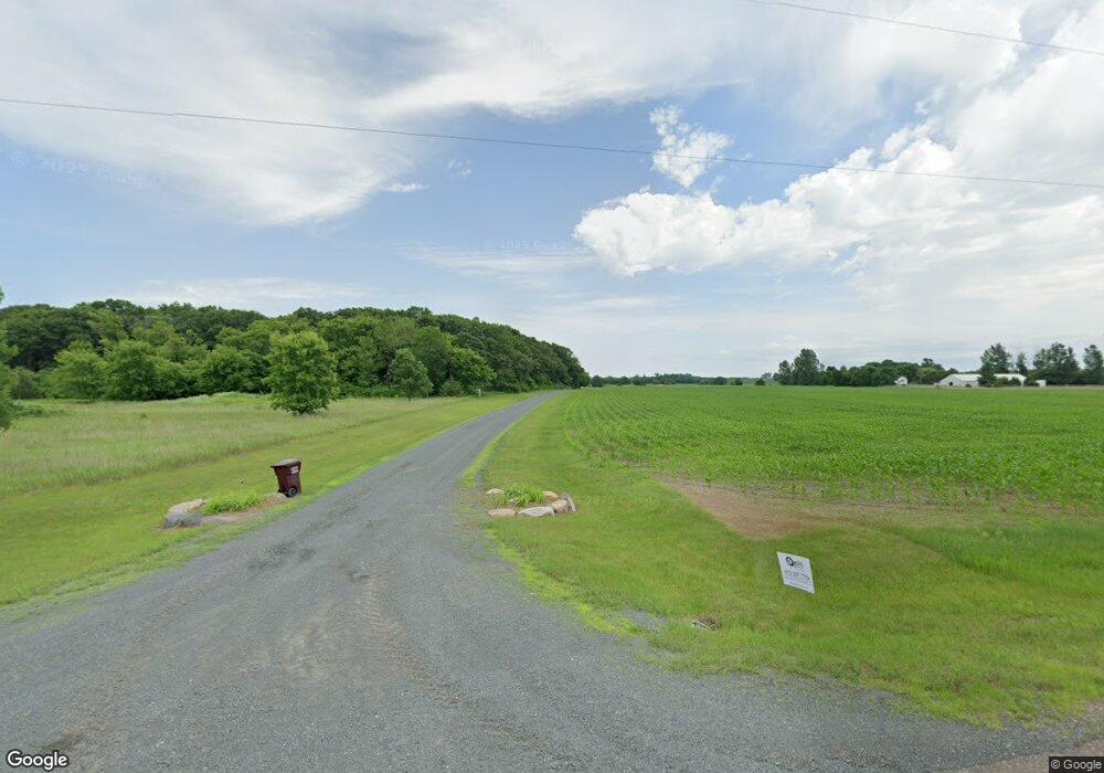
38655 Oasis Rd Lindstrom, MN 55045
Estimated Value: $478,000 - $657,000
--
Bed
1
Bath
1,350
Sq Ft
$415/Sq Ft
Est. Value
About This Home
This home is located at 38655 Oasis Rd, Lindstrom, MN 55045 and is currently estimated at $560,732, approximately $415 per square foot. 38655 Oasis Rd is a home located in Chisago County with nearby schools including North Branch Middle School, Sunrise River Elementary School, and North Branch Senior High School.
Ownership History
Date
Name
Owned For
Owner Type
Purchase Details
Closed on
Apr 28, 2000
Sold by
G & K Development
Bought by
Olson Thomas E and Wallace Mona G
Current Estimated Value
Purchase Details
Closed on
Aug 12, 1999
Sold by
G & K Development
Bought by
Olson Thomas E and Wallace Mona G
Purchase Details
Closed on
Dec 3, 1996
Sold by
Raygor Betty Ruth
Bought by
G & K Development
Create a Home Valuation Report for This Property
The Home Valuation Report is an in-depth analysis detailing your home's value as well as a comparison with similar homes in the area
Home Values in the Area
Average Home Value in this Area
Purchase History
| Date | Buyer | Sale Price | Title Company |
|---|---|---|---|
| Olson Thomas E | $99,000 | -- | |
| Olson Thomas E | $99,900 | -- | |
| G & K Development | $31,167 | -- | |
| G & K Development | $5,500 | -- | |
| Ranger Martin A | $49,900 | -- | |
| Boyer Ralph | $34,500 | -- |
Source: Public Records
Mortgage History
| Date | Status | Borrower | Loan Amount |
|---|---|---|---|
| Closed | Ranger Martin A | -- |
Source: Public Records
Tax History Compared to Growth
Tax History
| Year | Tax Paid | Tax Assessment Tax Assessment Total Assessment is a certain percentage of the fair market value that is determined by local assessors to be the total taxable value of land and additions on the property. | Land | Improvement |
|---|---|---|---|---|
| 2023 | $3,778 | $468,500 | $0 | $0 |
| 2022 | $3,538 | $391,900 | $0 | $0 |
| 2021 | $3,382 | $324,000 | $0 | $0 |
| 2020 | $3,440 | $323,200 | $123,900 | $199,300 |
| 2019 | $3,212 | $0 | $0 | $0 |
| 2018 | $3,040 | $0 | $0 | $0 |
| 2017 | $2,732 | $0 | $0 | $0 |
| 2016 | $2,896 | $0 | $0 | $0 |
| 2015 | $2,934 | $0 | $0 | $0 |
| 2014 | -- | $219,400 | $0 | $0 |
Source: Public Records
Map
Nearby Homes
- 39529 Trulson Rd
- 10869 Haycreek Rd
- 11019 Haycreek Rd
- TBD Keystone Ave
- 15535 375th St
- 35887 Oasis Rd
- 12214 Sunrise Rd
- 38621 July Ave
- 149xx 360th St
- 35420 Oasis Rd
- 16030 Maple Ln
- 15260 360th St
- Parcel C Keystone Ave
- 35647 Oxford Ave
- 35713 Patriot Ave
- TBD Keystone Ave
- 8222 Hummingbird Ln
- TBD Joywood Ave
- 7893 384th Trail
- 37417 Hallmark Dr
- 38548 Oasis Rd
- 38505 Oasis Rd
- 13165 Saint Croix Trail
- 38891 Oasis Rd
- 13295 Saint Croix Trail
- 38760 Oasis Rd
- 13221 Saint Croix Trail
- 395XX Poor Farm Rd
- 38250 Oasis Rd
- 12715 Saint Croix Trail
- 12810 Saint Croix Trail
- 39081 Sunrise Rd
- 13258 382nd St
- 13355 Saint Croix Trail
- 13167 382nd St
- 38162 Oasis Rd
- 13487 Saint Croix Trail
- 13368 382nd St
- 12585 Saint Croix Trail
- 39179 Sunrise Rd
