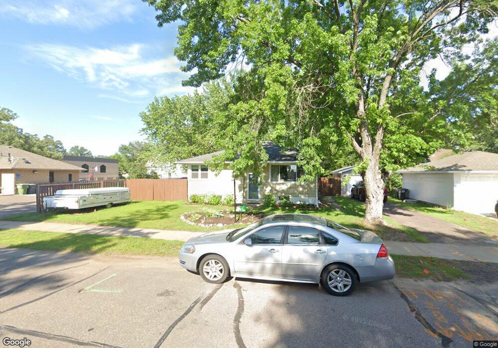
38801 6th Ave North Branch, MN 55056
Estimated Value: $262,000 - $302,000
3
Beds
2
Baths
2,036
Sq Ft
$134/Sq Ft
Est. Value
About This Home
This home is located at 38801 6th Ave, North Branch, MN 55056 and is currently estimated at $273,100, approximately $134 per square foot. 38801 6th Ave is a home located in Chisago County with nearby schools including North Branch Middle School, Sunrise River Elementary School, and North Branch Senior High School.
Ownership History
Date
Name
Owned For
Owner Type
Purchase Details
Closed on
Jul 22, 2022
Sold by
Sclavi Daniel and Sclavi Kristin
Bought by
Crothers Mitchel and Crothers Emily
Current Estimated Value
Home Financials for this Owner
Home Financials are based on the most recent Mortgage that was taken out on this home.
Original Mortgage
$228,150
Outstanding Balance
$217,010
Interest Rate
5.23%
Mortgage Type
New Conventional
Estimated Equity
$56,090
Purchase Details
Closed on
Aug 29, 2017
Sold by
Lukas Charles
Bought by
Sclavi Daniel and Sclavi Kristin E
Home Financials for this Owner
Home Financials are based on the most recent Mortgage that was taken out on this home.
Original Mortgage
$126,000
Interest Rate
3.93%
Mortgage Type
New Conventional
Purchase Details
Closed on
Nov 24, 2010
Sold by
Us Bank Na
Bought by
Charles Lukas
Create a Home Valuation Report for This Property
The Home Valuation Report is an in-depth analysis detailing your home's value as well as a comparison with similar homes in the area
Home Values in the Area
Average Home Value in this Area
Purchase History
| Date | Buyer | Sale Price | Title Company |
|---|---|---|---|
| Crothers Mitchel | $250,000 | -- | |
| Sclavi Daniel | $140,000 | -- | |
| Charles Lukas | $78,400 | -- |
Source: Public Records
Mortgage History
| Date | Status | Borrower | Loan Amount |
|---|---|---|---|
| Open | Crothers Mitchel | $228,150 | |
| Previous Owner | Sclavi Daniel | $126,000 |
Source: Public Records
Tax History Compared to Growth
Tax History
| Year | Tax Paid | Tax Assessment Tax Assessment Total Assessment is a certain percentage of the fair market value that is determined by local assessors to be the total taxable value of land and additions on the property. | Land | Improvement |
|---|---|---|---|---|
| 2024 | $2,240 | $169,600 | $0 | $0 |
| 2023 | $2,240 | $192,300 | $0 | $0 |
| 2022 | $2,348 | $157,100 | $0 | $0 |
| 2021 | $1,836 | $117,600 | $0 | $0 |
| 2020 | $1,802 | $139,200 | $40,000 | $99,200 |
| 2019 | $1,672 | $0 | $0 | $0 |
| 2018 | $1,534 | $0 | $0 | $0 |
| 2017 | $1,440 | $0 | $0 | $0 |
| 2016 | $1,342 | $0 | $0 | $0 |
| 2015 | $1,286 | $0 | $0 | $0 |
| 2014 | -- | $83,300 | $0 | $0 |
Source: Public Records
Map
Nearby Homes
- XXXXX Maple St
- 38946 7th Ave
- 36XXX Forest Blvd
- 38558 Grand Ave
- 38958 Elm Ct
- 39183 Grand Ave
- 38470 Glacier Dr
- 38725 12th Ave Unit 83
- 38xxx Oakview Ave
- 38632 Oakview Ave
- 38280 Great Oaks Ct
- XXX Ash St
- 6231 Red Fox Run
- 38692 Hawthorne Ave
- 38578 Hawthorne Ave
- 7255 Hawthorne Ct
- 7222 Hawthorne Ct
- 7246 385th St
- TBD Saint Croix Trail
- 39590 Hemingway Ave
- 6497 Main St
- 6484 Maple St
- 6500 Maple St
- 6457 Main St
- Lot 2 First St
- 6515 Main St
- 5360 Farmstead Place
- 5380 Farmstead Place
- 5403 Farmstead Place
- 5399 Farmstead Place
- 5389 Farmstead Place
- 5379 Farmstead Place
- 6518 Maple St
- 6445 & 6457 Main St
- 6445 & 645 Main St
- 6529 Main St
- 6445 Main St
- 6530 Maple St
- 6448 Main St
- 6448 Main St Unit 1