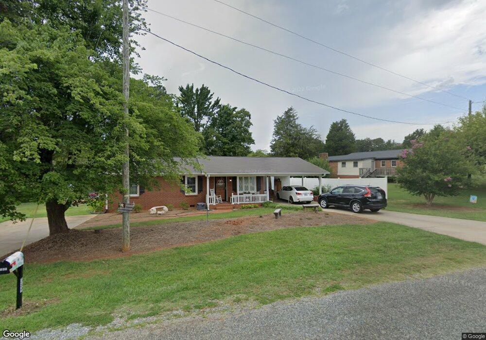
389 Boaze Rd Lexington, NC 27295
Estimated Value: $217,000 - $273,000
2
Beds
2
Baths
2,505
Sq Ft
$95/Sq Ft
Est. Value
About This Home
This home is located at 389 Boaze Rd, Lexington, NC 27295 and is currently estimated at $236,831, approximately $94 per square foot. 389 Boaze Rd is a home located in Davidson County with nearby schools including South Lexington School, Lexington Middle School, and Lexington Senior High School.
Ownership History
Date
Name
Owned For
Owner Type
Purchase Details
Closed on
Jun 12, 2006
Sold by
Prince Randall W and Prince Alicia K
Bought by
Curry Roger F and Curry Frances K
Current Estimated Value
Home Financials for this Owner
Home Financials are based on the most recent Mortgage that was taken out on this home.
Original Mortgage
$90,000
Interest Rate
6.5%
Mortgage Type
Purchase Money Mortgage
Purchase Details
Closed on
Jul 1, 1983
Purchase Details
Closed on
Jan 2, 1969
Create a Home Valuation Report for This Property
The Home Valuation Report is an in-depth analysis detailing your home's value as well as a comparison with similar homes in the area
Home Values in the Area
Average Home Value in this Area
Purchase History
| Date | Buyer | Sale Price | Title Company |
|---|---|---|---|
| Curry Roger F | $115,000 | None Available | |
| -- | $1,000 | -- | |
| -- | -- | -- |
Source: Public Records
Mortgage History
| Date | Status | Borrower | Loan Amount |
|---|---|---|---|
| Closed | Curry Roger F | $90,000 |
Source: Public Records
Tax History Compared to Growth
Tax History
| Year | Tax Paid | Tax Assessment Tax Assessment Total Assessment is a certain percentage of the fair market value that is determined by local assessors to be the total taxable value of land and additions on the property. | Land | Improvement |
|---|---|---|---|---|
| 2025 | $1,096 | $142,640 | $0 | $0 |
| 2024 | $1,096 | $142,640 | $0 | $0 |
| 2023 | $1,113 | $142,640 | $0 | $0 |
| 2022 | $1,096 | $142,640 | $0 | $0 |
| 2021 | $1,068 | $142,640 | $0 | $0 |
| 2020 | $814 | $108,790 | $0 | $0 |
| 2019 | $827 | $108,790 | $0 | $0 |
| 2018 | $827 | $108,790 | $0 | $0 |
| 2017 | $827 | $108,790 | $0 | $0 |
| 2016 | $827 | $108,790 | $0 | $0 |
| 2015 | $619 | $81,440 | $0 | $0 |
| 2014 | $650 | $85,550 | $0 | $0 |
Source: Public Records
Map
Nearby Homes
- 103 Markwood Ln
- 300 Hillside Dr
- 309 Hillside Dr
- 340 Ovada Ave
- 397 Ovada Ave
- Off Swing Dairg Rd
- 113 Habersham Ct
- 116 Saintsbury Place
- 0 Swing Dairy Rd
- 385 Harper Mill Cir
- 381 Harper Mill Cir
- 109 Forest Hill Rd
- 1 Knob Dr
- 816 Olympia St Unit 292
- 816 Olympia St
- 106 Emlee St
- 300 W 8th St
- 8 Hames St
- 10 Hames St
- 00 Forest Hill Rd