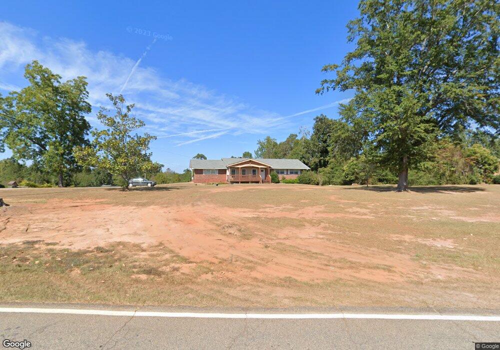
389 Grove St Barnesville, GA 30204
Estimated Value: $217,000 - $388,000
4
Beds
2
Baths
2,193
Sq Ft
$131/Sq Ft
Est. Value
About This Home
This home is located at 389 Grove St, Barnesville, GA 30204 and is currently estimated at $286,460, approximately $130 per square foot. 389 Grove St is a home located in Lamar County with nearby schools including Lamar County Primary School, Lamar County Elementary School, and Lamar County Middle School.
Ownership History
Date
Name
Owned For
Owner Type
Purchase Details
Closed on
Jun 30, 2016
Sold by
Freida S
Bought by
Albert Everett
Current Estimated Value
Home Financials for this Owner
Home Financials are based on the most recent Mortgage that was taken out on this home.
Original Mortgage
$142,182
Outstanding Balance
$115,896
Interest Rate
4.5%
Mortgage Type
FHA
Estimated Equity
$170,564
Purchase Details
Closed on
Nov 30, 1990
Sold by
Ham William J
Bought by
Ham Freida S
Create a Home Valuation Report for This Property
The Home Valuation Report is an in-depth analysis detailing your home's value as well as a comparison with similar homes in the area
Purchase History
| Date | Buyer | Sale Price | Title Company |
|---|---|---|---|
| Albert Everett | $104,000 | -- | |
| Ham Freida S | -- | -- |
Source: Public Records
Mortgage History
| Date | Status | Borrower | Loan Amount |
|---|---|---|---|
| Open | Albert Everett | $142,182 |
Source: Public Records
Tax History
| Year | Tax Paid | Tax Assessment Tax Assessment Total Assessment is a certain percentage of the fair market value that is determined by local assessors to be the total taxable value of land and additions on the property. | Land | Improvement |
|---|---|---|---|---|
| 2025 | $2,344 | $96,664 | $8,950 | $87,714 |
| 2024 | $2,043 | $79,832 | $8,950 | $70,882 |
| 2023 | $2,039 | $73,854 | $8,950 | $64,904 |
| 2022 | $1,842 | $66,718 | $7,560 | $59,158 |
| 2021 | $1,149 | $38,210 | $4,831 | $33,379 |
| 2020 | $1,210 | $38,210 | $4,831 | $33,379 |
| 2019 | $1,213 | $38,210 | $4,831 | $33,379 |
| 2018 | $1,164 | $38,210 | $4,831 | $33,379 |
| 2017 | $1,158 | $38,210 | $4,831 | $33,379 |
| 2016 | $1,158 | $38,210 | $4,831 | $33,379 |
| 2015 | $1,157 | $38,210 | $4,831 | $33,379 |
| 2014 | $1,121 | $38,210 | $4,831 | $33,379 |
| 2013 | -- | $38,210 | $4,831 | $33,379 |
Source: Public Records
Map
Nearby Homes
- 178 Barnesville Ave
- 121 Westchester Dr
- 163 Grove St
- 109 Barnesville Ave
- 13 Brown St
- 407 Westchester Dr
- 696 Georgia 18
- 696 Highway 18 W
- 149 Akins St
- 746 Highway 18 W
- 339 Atlanta St
- 144 U S 341
- 0 Piedmont Rd Unit 10600733
- 250 Mill St
- 270 Cannafax Rd
- 233 Old 41 Hwy
- 107 1st St
- 275 Rose Ave
- 7 Jackson St
- 642 Greenwood St
Your Personal Tour Guide
Ask me questions while you tour the home.