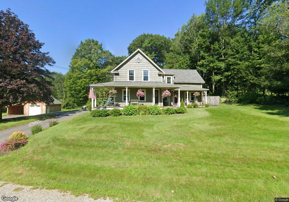
389 Pattee Hill Rd Goffstown, NH 03045
Estimated Value: $524,000 - $600,000
3
Beds
2
Baths
1,758
Sq Ft
$316/Sq Ft
Est. Value
About This Home
This home is located at 389 Pattee Hill Rd, Goffstown, NH 03045 and is currently estimated at $555,349, approximately $315 per square foot. 389 Pattee Hill Rd is a home with nearby schools including Mountain View Middle School and Goffstown High School.
Ownership History
Date
Name
Owned For
Owner Type
Purchase Details
Closed on
May 3, 2021
Sold by
Vachon Matthew
Bought by
Gocht Russell C and Gocht Nancy K
Current Estimated Value
Purchase Details
Closed on
Nov 21, 2005
Sold by
Dwyer Robert L and Dwyer Carolyn
Bought by
Vachon Matthew
Home Financials for this Owner
Home Financials are based on the most recent Mortgage that was taken out on this home.
Original Mortgage
$184,000
Interest Rate
6.07%
Mortgage Type
Purchase Money Mortgage
Create a Home Valuation Report for This Property
The Home Valuation Report is an in-depth analysis detailing your home's value as well as a comparison with similar homes in the area
Home Values in the Area
Average Home Value in this Area
Purchase History
| Date | Buyer | Sale Price | Title Company |
|---|---|---|---|
| Gocht Russell C | $425,000 | None Available | |
| Vachon Matthew | $230,000 | -- |
Source: Public Records
Mortgage History
| Date | Status | Borrower | Loan Amount |
|---|---|---|---|
| Previous Owner | Vachon Matthew | $190,604 | |
| Previous Owner | Vachon Matthew | $200,000 | |
| Previous Owner | Vachon Matthew | $184,000 |
Source: Public Records
Tax History Compared to Growth
Tax History
| Year | Tax Paid | Tax Assessment Tax Assessment Total Assessment is a certain percentage of the fair market value that is determined by local assessors to be the total taxable value of land and additions on the property. | Land | Improvement |
|---|---|---|---|---|
| 2024 | $8,546 | $418,100 | $184,700 | $233,400 |
| 2023 | $7,885 | $418,100 | $184,700 | $233,400 |
| 2022 | $7,012 | $266,500 | $114,900 | $151,600 |
| 2021 | $6,185 | $249,200 | $114,900 | $134,300 |
| 2020 | $6,092 | $249,200 | $114,900 | $134,300 |
| 2019 | $3,934 | $249,200 | $114,900 | $134,300 |
| 2018 | $827 | $249,200 | $114,900 | $134,300 |
| 2017 | $6,038 | $220,200 | $103,800 | $116,400 |
| 2016 | $3,823 | $220,200 | $103,800 | $116,400 |
| 2015 | $5,483 | $194,700 | $87,000 | $107,700 |
| 2014 | $5,257 | $194,700 | $87,000 | $107,700 |
Source: Public Records
Map
Nearby Homes
- 22 Fairway Dr
- 0 Fairway Dr Unit 11
- 88 Saunders Rd
- 602 Black Brook Rd
- 30 Horizon Dr
- 45 Range Rd
- 3 Stephanie Rd
- 22 Winter Hill Rd
- 99 Elm St
- 137 Elm St
- 25 Pleasant St
- 39 S Mast St
- 12 S Mast St
- 2 Larch St Unit 1
- 12 Maplewood Ave
- 16 Palmer Rd
- 120 S Mast St
- 152 S Mast St
- 78 Rangeway Rd
- 174 S Stark Hwy Unit 13
- 371 Pattee Hill Rd
- 496 Paige Hill Rd
- 490 Paige Hill Rd
- 451 Paige Hill Rd
- 468 Paige Hill Rd
- 466 Paige Hill Rd
- 430 Paige Hill Rd
- 458 Paige Hill Rd
- 61 Up-A-way Farm Rd
- 447 Paige Hill Rd
- 2 Up A Way Farm Rd
- 327 Pattee Hill Rd
- 435 Paige Hill Rd
- 3 Martin Farm Rd
- 463 Pattee Hill Rd
- 442 Paige Hill Rd
- 421 Paige Hill Rd
- 31 Martin Farm Rd
- 427 Paige Hill Rd
- 438 Paige Hill Rd