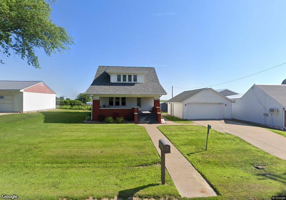
3896 Highway 136 Bryant, IA 52727
Estimated Value: $161,000 - $270,000
4
Beds
2
Baths
1,488
Sq Ft
$135/Sq Ft
Est. Value
About This Home
This home is located at 3896 Highway 136, Bryant, IA 52727 and is currently estimated at $200,363, approximately $134 per square foot. 3896 Highway 136 is a home located in Clinton County with nearby schools including Northeast Elementary School and Northeast Middle/High School.
Ownership History
Date
Name
Owned For
Owner Type
Purchase Details
Closed on
Feb 23, 2009
Sold by
Farrell Jacob P and Farrell Enily E
Bought by
Farrell Jacob P
Current Estimated Value
Purchase Details
Closed on
Nov 10, 2006
Sold by
Voss Helen M
Bought by
Farrell Jacob P
Home Financials for this Owner
Home Financials are based on the most recent Mortgage that was taken out on this home.
Original Mortgage
$92,000
Outstanding Balance
$55,028
Interest Rate
6.41%
Mortgage Type
New Conventional
Estimated Equity
$145,335
Create a Home Valuation Report for This Property
The Home Valuation Report is an in-depth analysis detailing your home's value as well as a comparison with similar homes in the area
Home Values in the Area
Average Home Value in this Area
Purchase History
| Date | Buyer | Sale Price | Title Company |
|---|---|---|---|
| Farrell Jacob P | -- | None Available | |
| Farrell Jacob P | $88,000 | None Available |
Source: Public Records
Mortgage History
| Date | Status | Borrower | Loan Amount |
|---|---|---|---|
| Open | Farrell Jacob P | $92,000 |
Source: Public Records
Tax History Compared to Growth
Tax History
| Year | Tax Paid | Tax Assessment Tax Assessment Total Assessment is a certain percentage of the fair market value that is determined by local assessors to be the total taxable value of land and additions on the property. | Land | Improvement |
|---|---|---|---|---|
| 2025 | $1,706 | $140,810 | $23,180 | $117,630 |
| 2024 | $1,706 | $134,930 | $23,180 | $111,750 |
| 2023 | $1,686 | $134,930 | $23,180 | $111,750 |
| 2022 | $1,520 | $125,620 | $23,180 | $102,440 |
| 2021 | $1,514 | $101,810 | $11,500 | $90,310 |
| 2020 | $1,514 | $97,510 | $11,500 | $86,010 |
| 2019 | $1,388 | $97,510 | $0 | $0 |
| 2018 | $1,360 | $97,510 | $0 | $0 |
| 2017 | $1,360 | $97,510 | $0 | $0 |
| 2016 | $1,540 | $110,200 | $0 | $0 |
| 2015 | $1,540 | $101,090 | $0 | $0 |
| 2014 | $1,406 | $101,090 | $0 | $0 |
| 2013 | $1,380 | $0 | $0 | $0 |
Source: Public Records
Map
Nearby Homes
- 3898 Highway 136
- 3894 Highway 136
- 3897 Highway 136
- 3895 Highway 136
- 3892 Highway 136
- 1596 390th Ave
- 3912 Highway 136
- 3919 Highway 136
- 3903 Highway 136
- 1610 390th Ave
- 3889 Highway 136
- 3879 Highway 136
- 1619 390th Ave
- 3875 Highway 136
- 3885 Highway 136
- 3873 Highway 136
- 3872 Highway 136
- 3870 Highway 136
- 3923 Highway 136
- 1558 390th Ave