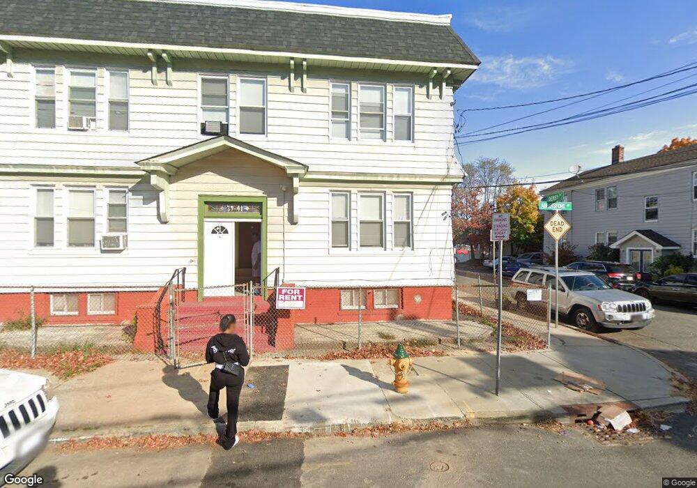
39 Abbotsford Ave Unit 1 Newark, NJ 07106
Upper Vailsburg NeighborhoodEstimated Value: $719,164 - $895,000
2
Beds
1
Bath
4,400
Sq Ft
$182/Sq Ft
Est. Value
About This Home
This home is located at 39 Abbotsford Ave Unit 1, Newark, NJ 07106 and is currently estimated at $802,291, approximately $182 per square foot. 39 Abbotsford Ave Unit 1 is a home located in Essex County with nearby schools including Lincoln Elementary School, Mt. Vernon School, and Hawthorne Avenue Elementary School.
Ownership History
Date
Name
Owned For
Owner Type
Purchase Details
Closed on
Nov 9, 2021
Sold by
Pierre-Louis Chesnel and Pierre-Louis Rositha
Bought by
Pierre-Louis Nadege and Etienne Josue
Current Estimated Value
Home Financials for this Owner
Home Financials are based on the most recent Mortgage that was taken out on this home.
Original Mortgage
$306,000
Outstanding Balance
$280,396
Interest Rate
2.99%
Mortgage Type
New Conventional
Estimated Equity
$521,895
Purchase Details
Closed on
Nov 21, 1990
Sold by
Charles Nathaniel and Charles Edith
Bought by
Pierre Louis C and Pierre Jean M
Purchase Details
Closed on
Oct 10, 1990
Sold by
Bryant Lee G
Bought by
Charles Nathaniel and Charles Edith
Purchase Details
Closed on
Feb 1, 1989
Sold by
Bryant Lee
Bought by
Charles Nathaniel and Charles Deith
Purchase Details
Closed on
Dec 27, 1988
Sold by
Crowder Samuel
Bought by
Bryant Lee
Create a Home Valuation Report for This Property
The Home Valuation Report is an in-depth analysis detailing your home's value as well as a comparison with similar homes in the area
Home Values in the Area
Average Home Value in this Area
Purchase History
| Date | Buyer | Sale Price | Title Company |
|---|---|---|---|
| Pierre-Louis Nadege | $408,000 | New Title Company Name | |
| Pierre Louis C | $200,000 | -- | |
| Charles Nathaniel | $160,000 | -- | |
| Charles Nathaniel | $160,000 | -- | |
| Bryant Lee | -- | -- |
Source: Public Records
Mortgage History
| Date | Status | Borrower | Loan Amount |
|---|---|---|---|
| Open | Pierre-Louis Nadege | $306,000 |
Source: Public Records
Tax History Compared to Growth
Tax History
| Year | Tax Paid | Tax Assessment Tax Assessment Total Assessment is a certain percentage of the fair market value that is determined by local assessors to be the total taxable value of land and additions on the property. | Land | Improvement |
|---|---|---|---|---|
| 2025 | $10,718 | $287,500 | $23,800 | $263,700 |
| 2024 | $10,718 | $287,500 | $23,800 | $263,700 |
| 2022 | $10,741 | $287,500 | $23,800 | $263,700 |
| 2021 | $10,735 | $287,500 | $23,800 | $263,700 |
| 2020 | $10,925 | $287,500 | $23,800 | $263,700 |
| 2019 | $10,813 | $287,500 | $23,800 | $263,700 |
| 2018 | $10,617 | $287,500 | $23,800 | $263,700 |
| 2017 | $10,235 | $287,500 | $23,800 | $263,700 |
| 2016 | $9,890 | $287,500 | $23,800 | $263,700 |
| 2015 | $9,513 | $287,500 | $23,800 | $263,700 |
| 2014 | $8,915 | $287,500 | $23,800 | $263,700 |
Source: Public Records
Map
Nearby Homes
- 362 Sanford Ave
- 82 Palm St
- 85 Smith St
- 335 Tremont Ave
- 32 Palm St
- 106 Halstead St Unit 110
- 207 Tremont Ave
- 31 Halstead St
- 149 Smith St
- 50 Halstead St
- 95 Crawford St
- 510 Halsted St
- 491 Norwood St
- 129 Holland Rd
- 72 Elliot Place
- 499 S Clinton St
- 992 S Orange Ave
- 552 Norwood St
- 312 Rhode Island Ave
- 510 Finlay Place
- 39 Abbotsford Ave Unit 2
- 39 Abbotsford Ave
- 39-41 Abbotsford Ave
- 7 Derby St D
- 1 Derby St A
- 43 Abbotsford Ave Unit 45
- 31 Abbotsford Ave Unit 33
- 11 Derby St Unit F
- 9 Derby St Unit E
- 7 Derby St
- 7 Derby St Unit D
- 47 Abbotsford Ave Unit 49
- 5 Derby St Unit C
- 38 Abbotsford Ave Unit 40
- 3 Derby St Unit B
- 1 Derby St Unit A
- 27 Abbotsford Ave Unit 29
- 42 Abbotsford Ave
- 8 Derby St Unit 4
- 44 Abbotsford Ave Unit 46