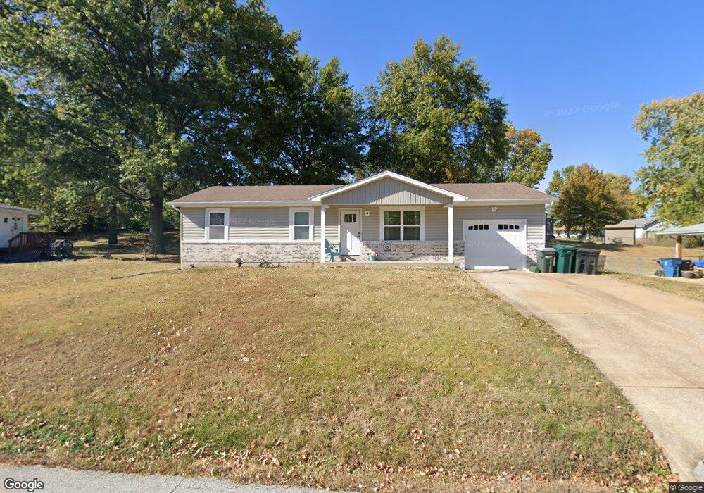
39 Anthony Ct Arnold, MO 63010
Estimated Value: $177,151 - $235,000
Studio
1
Bath
1,040
Sq Ft
$208/Sq Ft
Est. Value
About This Home
This home is located at 39 Anthony Ct, Arnold, MO 63010 and is currently estimated at $216,788, approximately $208 per square foot. 39 Anthony Ct is a home located in Jefferson County with nearby schools including Clyde Hamrick Elementary School, Ridgewood Middle School, and Fox Senior High School.
Ownership History
Date
Name
Owned For
Owner Type
Purchase Details
Closed on
Nov 23, 2009
Sold by
Manuel Herman E and Manuel Pamela S
Bought by
Perkins Nicholas C and Perkins Jennifer L
Current Estimated Value
Home Financials for this Owner
Home Financials are based on the most recent Mortgage that was taken out on this home.
Original Mortgage
$113,600
Outstanding Balance
$73,910
Interest Rate
4.93%
Mortgage Type
New Conventional
Estimated Equity
$142,878
Purchase Details
Closed on
Mar 11, 2005
Sold by
Manuel Pamela S and Manuel Herman E
Bought by
Manuel Herman E and Manuel Pamela S
Home Financials for this Owner
Home Financials are based on the most recent Mortgage that was taken out on this home.
Original Mortgage
$59,000
Interest Rate
5.66%
Mortgage Type
New Conventional
Purchase Details
Closed on
Aug 6, 2002
Sold by
Morton John V and Morton Marilyn S
Bought by
Allen Pamela S
Create a Home Valuation Report for This Property
The Home Valuation Report is an in-depth analysis detailing your home's value as well as a comparison with similar homes in the area
Home Values in the Area
Average Home Value in this Area
Purchase History
| Date | Buyer | Sale Price | Title Company |
|---|---|---|---|
| Perkins Nicholas C | -- | Pulaski Title Company | |
| Manuel Herman E | -- | -- | |
| Allen Pamela S | -- | -- |
Source: Public Records
Mortgage History
| Date | Status | Borrower | Loan Amount |
|---|---|---|---|
| Open | Perkins Nicholas C | $113,600 | |
| Previous Owner | Manuel Herman E | $59,000 |
Source: Public Records
Tax History
| Year | Tax Paid | Tax Assessment Tax Assessment Total Assessment is a certain percentage of the fair market value that is determined by local assessors to be the total taxable value of land and additions on the property. | Land | Improvement |
|---|---|---|---|---|
| 2025 | $1,280 | $19,200 | $2,500 | $16,700 |
| 2024 | $1,280 | $18,300 | $2,500 | $15,800 |
| 2023 | $1,280 | $18,300 | $2,500 | $15,800 |
| 2022 | $1,304 | $18,300 | $2,500 | $15,800 |
| 2021 | $1,305 | $18,300 | $2,500 | $15,800 |
| 2020 | $1,240 | $16,500 | $2,100 | $14,400 |
| 2019 | $1,244 | $16,500 | $2,100 | $14,400 |
| 2018 | $1,236 | $16,500 | $2,100 | $14,400 |
| 2017 | $1,255 | $16,500 | $2,100 | $14,400 |
| 2016 | $1,071 | $15,100 | $2,100 | $13,000 |
| 2015 | $1,074 | $15,100 | $2,100 | $13,000 |
| 2013 | -- | $14,600 | $2,100 | $12,500 |
Source: Public Records
Map
Nearby Homes
- 1806 Melody Ln
- 1713 Rhythm Ln
- 1636 Polly Dr
- 1756 Old Lemay Ferry Rd
- 2061 Ridgeway Dr
- 1924 Jennifer Lynn Ln
- 1859 Engle Dr
- 1763 Lisa Dr
- 1627 Trinity Cir
- 1402 Scenic Dr
- 1973 Ronnie
- 532 Blackberry Path
- 2121 Blossom Ln
- 3.5 Acres - Ridge Dr
- 0000 Botanical Dr
- 2558 Frederitzi Ln
- 1294 Windcrest Cir
- 2107 Henley Woods Dr
- 2282 Benton Dr
- 2123 Berrywood Ct
Your Personal Tour Guide
Ask me questions while you tour the home.