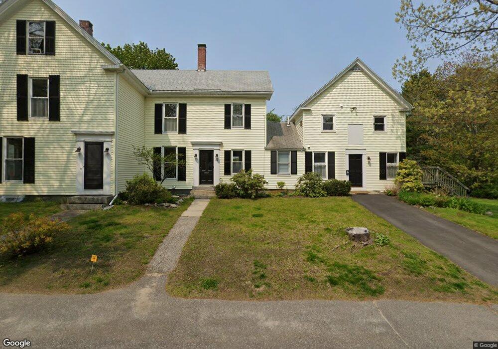
39 Bow St Freeport, ME 04032
Estimated Value: $618,000 - $993,000
5
Beds
3
Baths
3,244
Sq Ft
$264/Sq Ft
Est. Value
About This Home
This home is located at 39 Bow St, Freeport, ME 04032 and is currently estimated at $856,667, approximately $264 per square foot. 39 Bow St is a home located in Cumberland County with nearby schools including Morse Street School, Mast Landing School, and Freeport Middle School.
Create a Home Valuation Report for This Property
The Home Valuation Report is an in-depth analysis detailing your home's value as well as a comparison with similar homes in the area
Home Values in the Area
Average Home Value in this Area
Tax History
| Year | Tax Paid | Tax Assessment Tax Assessment Total Assessment is a certain percentage of the fair market value that is determined by local assessors to be the total taxable value of land and additions on the property. | Land | Improvement |
|---|---|---|---|---|
| 2025 | $7,443 | $537,400 | $186,000 | $351,400 |
| 2024 | $7,055 | $528,500 | $177,100 | $351,400 |
| 2023 | $6,403 | $465,700 | $161,000 | $304,700 |
| 2022 | $6,121 | $448,400 | $143,700 | $304,700 |
| 2021 | $5,986 | $448,400 | $143,700 | $304,700 |
| 2020 | $5,796 | $414,000 | $133,100 | $280,900 |
| 2019 | $5,630 | $393,700 | $125,600 | $268,100 |
| 2018 | $5,204 | $345,800 | $103,900 | $241,900 |
| 2017 | $4,972 | $332,600 | $101,800 | $230,800 |
| 2016 | $4,835 | $306,000 | $91,900 | $214,100 |
| 2015 | $4,176 | $248,600 | $83,900 | $164,700 |
| 2014 | $3,928 | $248,600 | $83,900 | $164,700 |
| 2013 | $4,167 | $262,900 | $83,900 | $179,000 |
Source: Public Records
Map
Nearby Homes
- 5 Holbrook St
- 212 Main St
- 11 Orchard Hill Rd
- 10 Durham Rd
- 15 Linwood Rd Unit 15
- 42 Durham Rd
- 39 Hunter Rd
- 26 Harvest Ridge Rd Unit 24
- 20 Harvest Ridge Rd Unit 23
- 52 Birch Point Rd
- 1260 Us Route 1
- 15 Tinkers Way
- 1 Wardtown Rd
- 10 Prout Rd
- 8 Statler Ln
- 0 Prout Rd
- 143 Bragdon Rd
- 21 Renee Rd
- 62 Webster Rd
- 4 Harper's Trail
Your Personal Tour Guide
Ask me questions while you tour the home.