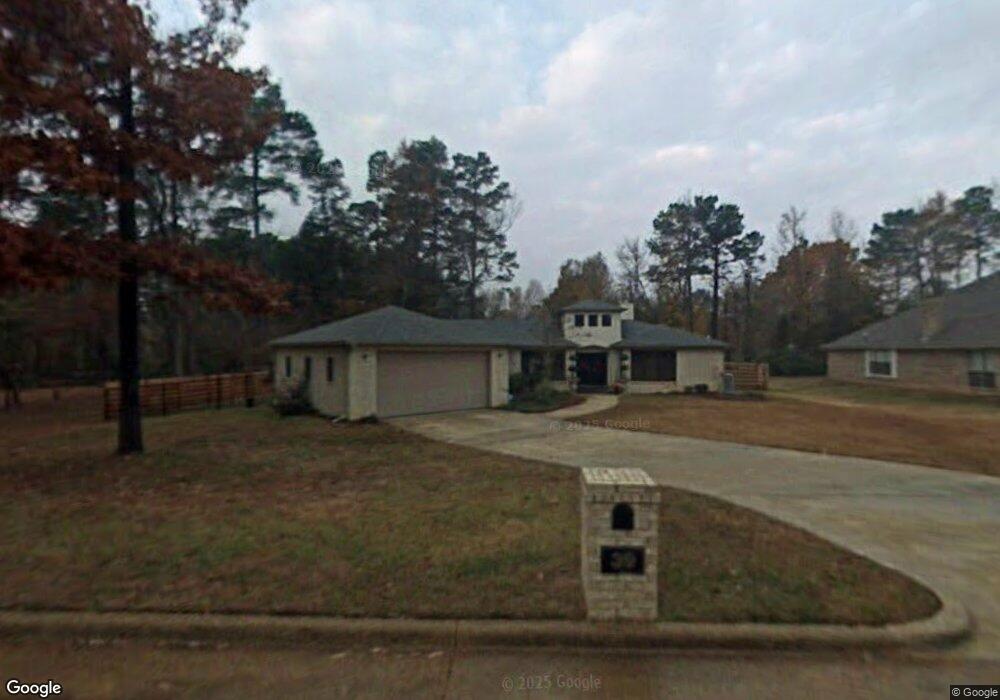
39 Brookside Dr Texarkana, AR 71854
Estimated Value: $300,000 - $457,000
Studio
3
Baths
2,350
Sq Ft
$150/Sq Ft
Est. Value
About This Home
This home is located at 39 Brookside Dr, Texarkana, AR 71854 and is currently estimated at $352,663, approximately $150 per square foot. 39 Brookside Dr is a home located in Miller County with nearby schools including Arkansas High School and Washington Academy.
Ownership History
Date
Name
Owned For
Owner Type
Purchase Details
Closed on
Oct 23, 2013
Sold by
Bryant Barry and Bryant Mary
Bought by
Jones David A and Jones Pamela
Current Estimated Value
Home Financials for this Owner
Home Financials are based on the most recent Mortgage that was taken out on this home.
Original Mortgage
$224,677
Outstanding Balance
$112,718
Interest Rate
4.37%
Mortgage Type
New Conventional
Estimated Equity
$239,945
Purchase Details
Closed on
Nov 16, 2006
Sold by
Romero Karen
Bought by
Bryant Barry and Bryant Mary
Home Financials for this Owner
Home Financials are based on the most recent Mortgage that was taken out on this home.
Original Mortgage
$160,000
Interest Rate
6.37%
Mortgage Type
New Conventional
Purchase Details
Closed on
Apr 3, 2003
Bought by
Romero Karen
Create a Home Valuation Report for This Property
The Home Valuation Report is an in-depth analysis detailing your home's value as well as a comparison with similar homes in the area
Purchase History
| Date | Buyer | Sale Price | Title Company |
|---|---|---|---|
| Jones David A | $230,000 | -- | |
| Bryant Barry | $203,000 | Twin City Title Company | |
| Romero Karen | $15,000 | -- |
Source: Public Records
Mortgage History
| Date | Status | Borrower | Loan Amount |
|---|---|---|---|
| Open | Jones David A | $224,677 | |
| Previous Owner | Bryant Barry | $160,000 |
Source: Public Records
Tax History
| Year | Tax Paid | Tax Assessment Tax Assessment Total Assessment is a certain percentage of the fair market value that is determined by local assessors to be the total taxable value of land and additions on the property. | Land | Improvement |
|---|---|---|---|---|
| 2025 | $2,573 | $73,850 | $3,990 | $69,860 |
| 2024 | $2,522 | $52,640 | $3,990 | $48,650 |
| 2023 | $2,293 | $49,510 | $3,990 | $45,520 |
| 2022 | $2,343 | $49,510 | $3,990 | $45,520 |
| 2021 | $2,343 | $49,510 | $3,990 | $45,520 |
| 2020 | $2,343 | $49,510 | $3,990 | $45,520 |
| 2019 | $2,221 | $47,290 | $3,990 | $43,300 |
| 2018 | $2,246 | $47,290 | $3,990 | $43,300 |
| 2017 | $2,140 | $47,290 | $3,990 | $43,300 |
| 2016 | $2,031 | $43,374 | $3,762 | $39,612 |
| 2015 | $1,923 | $41,402 | $3,591 | $37,811 |
| 2014 | $1,815 | $39,430 | $3,420 | $36,010 |
Source: Public Records
Map
Nearby Homes
- 6 Country Club Ln Unit 6 Pine Grove
- 6 Country Club Ln
- 2708 Rose St
- 321 Orleans St
- TBD Dudley Ave
- 2301-240 Dudley St
- 1702 Lowell St
- 509 East St
- TBD U S Highway 71
- 802 Ida Ave
- 315 Charles St
- 317 Charles St
- 2214 Line Ferry Rd
- 523 Logan St
- 708 Belmont St
- 2125 Walter St
- 608 Thatcher St
- 923 California St
- 3730 Genoa Rd
- n/a E Moore Rd
- 43 Brookside Dr
- 2405 Mitchell St
- 21 Brookside Dr
- 31 Brookside Dr
- 47 Brookside Dr
- 55 Brookside Dr
- 2 Brookside Cir
- 2 Brookside Cir
- 26 Brookside Dr
- 2416 Spring Ave
- 4 Brookside Cir
- 1200 Forest Acres Cir
- 2423 Spring Ave
- 2423 Spring Ave
- 2601 Spring Ave
- 816 Artesian St
- 18 Brookside
- 2619 Spring Ave
- 2309 Mitchell St
- 3 Spring Valley Ln
Your Personal Tour Guide
Ask me questions while you tour the home.