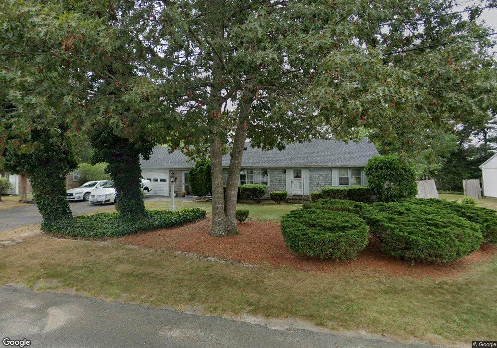
39 Captain Crocker Rd South Yarmouth, MA 02664
Estimated Value: $485,000 - $551,000
2
Beds
2
Baths
1,040
Sq Ft
$493/Sq Ft
Est. Value
About This Home
This home is located at 39 Captain Crocker Rd, South Yarmouth, MA 02664 and is currently estimated at $512,954, approximately $493 per square foot. 39 Captain Crocker Rd is a home located in Barnstable County with nearby schools including Dennis-Yarmouth Regional High School and St. Pius X. School.
Ownership History
Date
Name
Owned For
Owner Type
Purchase Details
Closed on
Nov 8, 2022
Sold by
Martinos Dimitrios M and Martinos Diane L
Bought by
Martinos Ret
Current Estimated Value
Purchase Details
Closed on
Sep 25, 1998
Sold by
Oconnell Lucille M
Bought by
Martinos Dimitrios M and Martinos Diane L
Home Financials for this Owner
Home Financials are based on the most recent Mortgage that was taken out on this home.
Original Mortgage
$65,000
Interest Rate
6.87%
Mortgage Type
Purchase Money Mortgage
Create a Home Valuation Report for This Property
The Home Valuation Report is an in-depth analysis detailing your home's value as well as a comparison with similar homes in the area
Home Values in the Area
Average Home Value in this Area
Purchase History
| Date | Buyer | Sale Price | Title Company |
|---|---|---|---|
| Martinos Ret | -- | None Available | |
| Martinos Dimitrios M | $90,000 | -- |
Source: Public Records
Mortgage History
| Date | Status | Borrower | Loan Amount |
|---|---|---|---|
| Previous Owner | Martinos Dimitrios M | $65,000 |
Source: Public Records
Tax History Compared to Growth
Tax History
| Year | Tax Paid | Tax Assessment Tax Assessment Total Assessment is a certain percentage of the fair market value that is determined by local assessors to be the total taxable value of land and additions on the property. | Land | Improvement |
|---|---|---|---|---|
| 2025 | $3,339 | $471,600 | $179,300 | $292,300 |
| 2024 | $3,099 | $419,900 | $151,600 | $268,300 |
| 2023 | $2,989 | $368,600 | $131,200 | $237,400 |
| 2022 | $2,825 | $307,700 | $119,300 | $188,400 |
| 2021 | $2,662 | $278,500 | $119,300 | $159,200 |
| 2020 | $8,084 | $260,900 | $119,300 | $141,600 |
| 2019 | $1,939 | $239,900 | $119,300 | $120,600 |
| 2018 | $2,286 | $222,200 | $101,600 | $120,600 |
| 2017 | $1,785 | $217,800 | $97,200 | $120,600 |
| 2016 | $2,085 | $208,900 | $88,300 | $120,600 |
| 2015 | $1,984 | $197,600 | $88,300 | $109,300 |
Source: Public Records
Map
Nearby Homes
- 147 Captain Bacon Rd
- 75 Captain York Rd
- 76 Captain Chase Rd
- 255 Long Pond Dr
- 338 Forest Rd
- 38 Autumn Dr
- 55 Lower Brook Rd
- 72 Quartermaster Row
- 33 Sparrow Way
- 9 Victory Ln
- 24 Fast Brook Rd
- 30 Quartermaster Row
- 3 Saturn Ln
- 17 Merganser Ln
- 0 Forsyth Ave
- 105 Webbers Path
- 26 Grouse Ln
- 22 Powhatan Rd
- 15 Sharon Rd
- 45 Captain Crocker Rd
- 35 Captain Crocker Rd
- 38 Captain Daniel Rd
- 44 Captain Daniel Rd
- 38 Captain Crocker Rd
- 38 Capt Crocker Rd
- 34 Captain Daniel Rd
- 44 Captain Crocker Rd
- 44 Capt Crocker Rd
- 29 Captain Crocker Rd
- 49 Capt Crocker Rd
- 49 Captain Crocker Rd
- 32 Captain Crocker Rd
- 28 Capt Daniel Rd
- 28 Captain Daniel Rd
- 48 Captain Daniel Rd
- 50 Captain Crocker Rd
- 33 Captain Daniel Rd
- 37 Captain Daniel Rd
- 37 Captain Noyes Rd