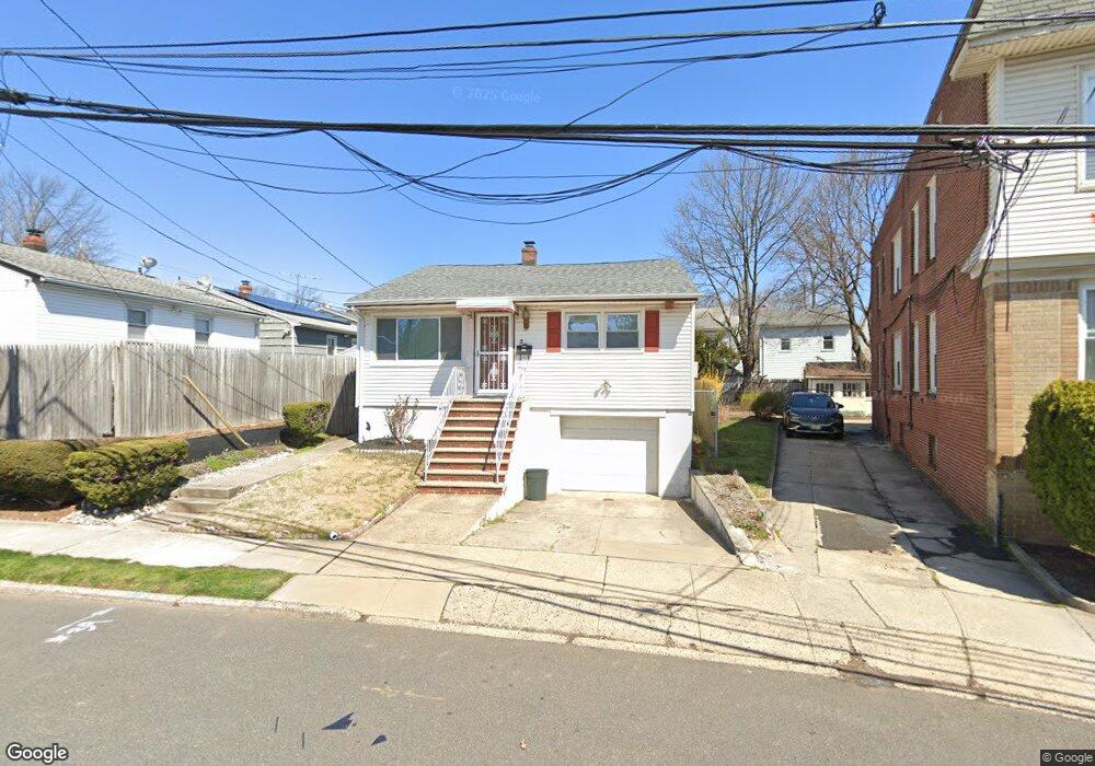
39 Colleen St Newark, NJ 07106
Lower Vailsburg NeighborhoodEstimated Value: $338,382 - $404,000
--
Bed
--
Bath
1,008
Sq Ft
$375/Sq Ft
Est. Value
About This Home
This home is located at 39 Colleen St, Newark, NJ 07106 and is currently estimated at $377,846, approximately $374 per square foot. 39 Colleen St is a home located in Essex County with nearby schools including Lincoln Elementary School, Mt. Vernon School, and Hawthorne Avenue Elementary School.
Ownership History
Date
Name
Owned For
Owner Type
Purchase Details
Closed on
Jun 20, 2007
Sold by
Jamison David and Jamison Ruth
Bought by
Mason Bianca E
Current Estimated Value
Home Financials for this Owner
Home Financials are based on the most recent Mortgage that was taken out on this home.
Original Mortgage
$223,973
Outstanding Balance
$137,419
Interest Rate
6.24%
Mortgage Type
Purchase Money Mortgage
Estimated Equity
$240,427
Purchase Details
Closed on
Aug 31, 1998
Sold by
Owens Wilbert
Bought by
Jamison David and Jamison Ruth
Home Financials for this Owner
Home Financials are based on the most recent Mortgage that was taken out on this home.
Original Mortgage
$104,908
Interest Rate
6.49%
Mortgage Type
FHA
Create a Home Valuation Report for This Property
The Home Valuation Report is an in-depth analysis detailing your home's value as well as a comparison with similar homes in the area
Home Values in the Area
Average Home Value in this Area
Purchase History
| Date | Buyer | Sale Price | Title Company |
|---|---|---|---|
| Mason Bianca E | $230,900 | None Available | |
| Jamison David | $108,000 | -- |
Source: Public Records
Mortgage History
| Date | Status | Borrower | Loan Amount |
|---|---|---|---|
| Open | Mason Bianca E | $223,973 | |
| Previous Owner | Jamison David | $104,908 |
Source: Public Records
Tax History Compared to Growth
Tax History
| Year | Tax Paid | Tax Assessment Tax Assessment Total Assessment is a certain percentage of the fair market value that is determined by local assessors to be the total taxable value of land and additions on the property. | Land | Improvement |
|---|---|---|---|---|
| 2025 | $3,747 | $100,500 | $19,800 | $80,700 |
| 2024 | $3,747 | $100,500 | $19,800 | $80,700 |
| 2022 | $3,755 | $100,500 | $19,800 | $80,700 |
| 2021 | $3,753 | $100,500 | $19,800 | $80,700 |
| 2020 | $3,819 | $100,500 | $19,800 | $80,700 |
| 2019 | $3,780 | $100,500 | $19,800 | $80,700 |
| 2018 | $3,711 | $100,500 | $19,800 | $80,700 |
| 2017 | $3,578 | $100,500 | $19,800 | $80,700 |
| 2016 | $3,457 | $100,500 | $19,800 | $80,700 |
| 2015 | $3,326 | $100,500 | $19,800 | $80,700 |
| 2014 | $3,117 | $100,500 | $19,800 | $80,700 |
Source: Public Records
Map
Nearby Homes
- 48 Adams St
- 50 Unity Ave
- 35 Bamford Place
- 27-29 Cleveland Ave
- 27 Cleveland Ave Unit 29
- 78 Valley St
- 239 Orange Ave
- 219-221 Stuyvesant Ave
- 228 Madison Ave
- 215-217 Orange Ave
- 220 Brookdale Ave
- 217 Orange Ave
- 83-85 Valley St
- 206-212 Brookdale Ave
- 10 Lenox St
- 82 W Rich St
- 86 Mead St
- 142 Delmar Place
- 240 W End Ave
- 197-199 Sunset Ave
- 35 Colleen St Unit 37
- 290 Stuyvesant Ave
- 292 Stuyvesant Ave Unit 294
- 286 Stuyvesant Ave Unit 288
- 31 Colleen St Unit 33
- 31 Colleen St Unit 2l
- 31 Colleen St Unit 4
- 31 Colleen St Unit 2R
- 42 Scofield St
- 44 Scofield St Unit 46
- 48 Scofield St Unit 50
- 40 Scofield St
- 42 Colleen St Unit 44
- 38 Colleen St Unit 40
- 280 Stuyvesant Ave Unit 282
- 46 Scofield St
- 46 Colleen St
- 34 Colleen St Unit 36
- 27-29 Colleen St
- 36 Scofield St