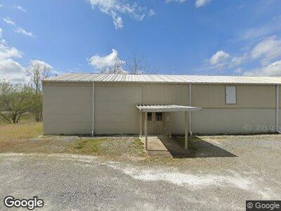
39 Community Rd Oneonta, AL 35121
Estimated Value: $583,000 - $757,492
--
Bed
1
Bath
4,020
Sq Ft
$167/Sq Ft
Est. Value
About This Home
This home is located at 39 Community Rd, Oneonta, AL 35121 and is currently estimated at $670,246, approximately $166 per square foot. 39 Community Rd is a home with nearby schools including Southeastern Elementary School.
Ownership History
Date
Name
Owned For
Owner Type
Purchase Details
Closed on
Jun 27, 2018
Bought by
Bailey Jeffery C
Current Estimated Value
Home Financials for this Owner
Home Financials are based on the most recent Mortgage that was taken out on this home.
Original Mortgage
$30,000
Interest Rate
4.57%
Purchase Details
Closed on
May 16, 2018
Sold by
Bailey Jeffery C and Bailey Staci L
Bought by
Fore Jamie and Fore Amber
Home Financials for this Owner
Home Financials are based on the most recent Mortgage that was taken out on this home.
Original Mortgage
$30,000
Interest Rate
4.57%
Create a Home Valuation Report for This Property
The Home Valuation Report is an in-depth analysis detailing your home's value as well as a comparison with similar homes in the area
Home Values in the Area
Average Home Value in this Area
Purchase History
| Date | Buyer | Sale Price | Title Company |
|---|---|---|---|
| Bailey Jeffery C | -- | -- | |
| Fore Jamie | -- | -- |
Source: Public Records
Mortgage History
| Date | Status | Borrower | Loan Amount |
|---|---|---|---|
| Open | Fore Amber M | $514,000 | |
| Closed | Bailey Jeffery C | $30,000 | |
| Closed | Bailey Jeffery C | -- | |
| Previous Owner | Bailey Jeffrey C | $30,000 | |
| Previous Owner | Bailey Jeffrey C | $85,500 |
Source: Public Records
Tax History Compared to Growth
Tax History
| Year | Tax Paid | Tax Assessment Tax Assessment Total Assessment is a certain percentage of the fair market value that is determined by local assessors to be the total taxable value of land and additions on the property. | Land | Improvement |
|---|---|---|---|---|
| 2024 | $2,049 | $64,840 | $10,020 | $54,820 |
| 2023 | $2,049 | $65,420 | $10,020 | $55,400 |
| 2022 | $1,774 | $56,360 | $9,720 | $46,640 |
| 2021 | $1,396 | $44,740 | $6,420 | $38,320 |
| 2020 | $215 | $6,580 | $6,420 | $160 |
| 2019 | $204 | $6,280 | $6,120 | $160 |
| 2018 | $202 | $6,200 | $6,040 | $160 |
| 2017 | $176 | $5,420 | $0 | $0 |
| 2015 | $176 | $5,420 | $0 | $0 |
| 2014 | $177 | $5,440 | $0 | $0 |
| 2013 | -- | $5,520 | $0 | $0 |
Source: Public Records
Map
Nearby Homes
- 120 Pine Hill Dr
- 109 Shadow Stone Ln
- 0 Oak Ridge Dr Unit entire parcel
- 236 Oak Ridge Dr
- Lot #6 Alabama 75 Unit 1
- Lot #5 Alabama 75 Unit 1
- Lot #4 Alabama 75 Unit 1
- Lot #3 Alabama 75 Unit 1
- Lot #2 Alabama 75 Unit 1
- Lot #1 Alabama 75 Unit 1
- 409 Industrial Park Rd
- 433 Saint Andrews Pkwy Unit 19
- 76 Woodard Dr
- 108 Oak Meadow Ln
- 0 Maynor Ln Unit 21 21403594
- 98 Greystone Dr
- 1410 Saint Andrews Pkwy Unit 80 & 81
- 0 Bellerive Cir Unit 158A 21390746
- 410 3rd Ave W
- 400 Ingram Ave W
- 39 Community Rd
- 29 Community Rd
- 0 County Road 15
- 0 Co Rd 15
- 42 Community Rd
- 0 County Road 20 Unit 1 410831
- 0 County Road 20 Unit 440616
- 0 County Road 20 Unit 1 481962
- 0 County Road 20 Unit 2AC
- 20 Community Rd
- 125 Cedar Dr
- 15 Cottonwood Dr
- 4334 Old Highway 75
- 55 Cedar Dr
- 74 Pine Hill Dr
- 28 Cottonwood Dr
- 28 Cottonwood Dr
- 100 Pine Hill Dr
- 181 Pine Hill Dr
- 4356 Old Highway 75