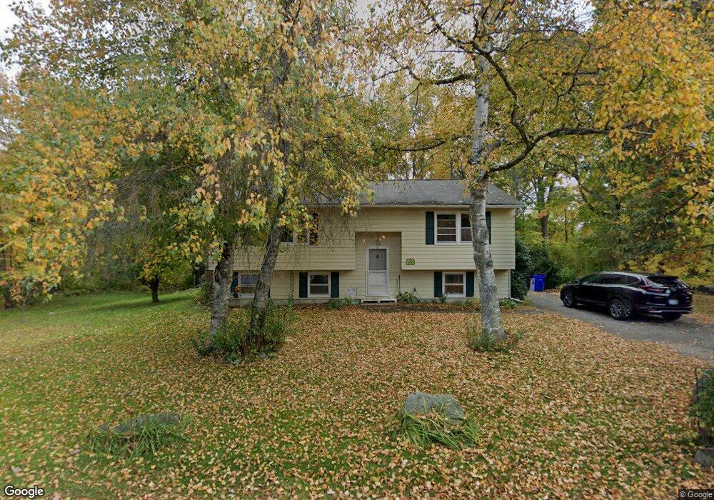
39 Crockett Dr Goffstown, NH 03045
Estimated Value: $453,422 - $497,000
3
Beds
2
Baths
1,149
Sq Ft
$415/Sq Ft
Est. Value
About This Home
This home is located at 39 Crockett Dr, Goffstown, NH 03045 and is currently estimated at $476,606, approximately $414 per square foot. 39 Crockett Dr is a home with nearby schools including Mountain View Middle School, Goffstown High School, and Polaris Charter School.
Ownership History
Date
Name
Owned For
Owner Type
Purchase Details
Closed on
Jul 2, 2004
Sold by
Nichols Charlene Y
Bought by
Neal Jon L and Neal Cheryl M
Current Estimated Value
Home Financials for this Owner
Home Financials are based on the most recent Mortgage that was taken out on this home.
Original Mortgage
$235,225
Outstanding Balance
$118,129
Interest Rate
6.3%
Mortgage Type
Purchase Money Mortgage
Estimated Equity
$358,477
Create a Home Valuation Report for This Property
The Home Valuation Report is an in-depth analysis detailing your home's value as well as a comparison with similar homes in the area
Home Values in the Area
Average Home Value in this Area
Purchase History
| Date | Buyer | Sale Price | Title Company |
|---|---|---|---|
| Neal Jon L | $242,500 | -- |
Source: Public Records
Mortgage History
| Date | Status | Borrower | Loan Amount |
|---|---|---|---|
| Open | Neal Jon L | $235,225 |
Source: Public Records
Tax History Compared to Growth
Tax History
| Year | Tax Paid | Tax Assessment Tax Assessment Total Assessment is a certain percentage of the fair market value that is determined by local assessors to be the total taxable value of land and additions on the property. | Land | Improvement |
|---|---|---|---|---|
| 2024 | $7,610 | $372,300 | $184,300 | $188,000 |
| 2023 | $7,022 | $372,300 | $184,300 | $188,000 |
| 2022 | $6,243 | $237,300 | $113,600 | $123,700 |
| 2021 | $5,890 | $237,300 | $113,600 | $123,700 |
| 2020 | $5,890 | $237,300 | $113,600 | $123,700 |
| 2019 | $5,806 | $236,200 | $113,600 | $122,600 |
| 2018 | $4,185 | $236,200 | $113,600 | $122,600 |
| 2017 | $5,511 | $208,500 | $94,000 | $114,500 |
| 2016 | $7,937 | $208,500 | $94,000 | $114,500 |
| 2015 | $5,415 | $192,300 | $88,000 | $104,300 |
| 2014 | $5,192 | $192,300 | $88,000 | $104,300 |
Source: Public Records
Map
Nearby Homes
- 52 Moreau St
- 35 Foch St
- 11 Oakwood Cir Unit 9
- 40 Tirrell Hill Rd
- 26 College Rd
- 2 Larch St Unit 22
- 21 Katherine St
- 46 Moose Club Park Rd
- 9 Edmond St
- 58 Violet St
- 2 Shore Dr
- Lot 6 Aisling Ln Unit Lot 6 - The Silverto
- 43 Bay St
- 155 New Boston Rd
- 1B Dearborn Cir
- 2B Dearborn Cir
- 2A Dearborn Cir
- 4 Chip St
- 3D Dearborn Cir
- 3C Dearborn Cir
- 40 Crockett Dr
- 34 Crockett Dr
- 33 Crockett Dr
- 169 Daniel Plummer Rd
- 31 Crockett Dr
- 24 Crockett Dr
- 27 Crockett Dr
- 165 Daniel Plummer Rd
- 20 Crockett Dr
- 21 Crockett Dr
- 159 Daniel Plummer Rd
- 16 Crockett Dr
- 15 Crockett Dr
- 155 Daniel Plummer Rd
- 12 Crockett Dr
- 25 Cross St
- 11 Crockett Dr
- 151 Daniel Plummer Rd
- 6 Crockett Dr
- 7 Crockett Dr