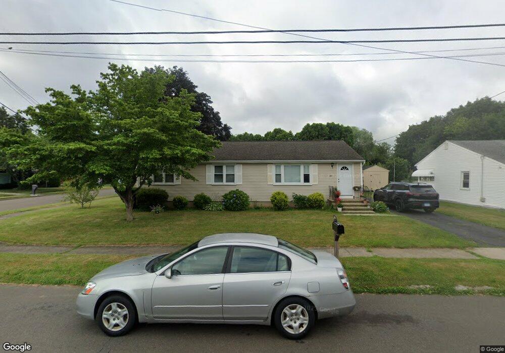
39 E Clover Cir Hamden, CT 06514
Estimated Value: $343,978 - $413,000
3
Beds
2
Baths
1,248
Sq Ft
$292/Sq Ft
Est. Value
About This Home
This home is located at 39 E Clover Cir, Hamden, CT 06514 and is currently estimated at $364,745, approximately $292 per square foot. 39 E Clover Cir is a home located in New Haven County with nearby schools including Dunbar Hill School, Hamden Middle School, and Hamden High School.
Ownership History
Date
Name
Owned For
Owner Type
Purchase Details
Closed on
Oct 26, 2011
Sold by
Massaro Vincent
Bought by
Digioia Maria
Current Estimated Value
Home Financials for this Owner
Home Financials are based on the most recent Mortgage that was taken out on this home.
Original Mortgage
$110,000
Outstanding Balance
$75,060
Interest Rate
4.11%
Estimated Equity
$289,685
Purchase Details
Closed on
Sep 2, 2010
Sold by
Us Bk
Bought by
Massaro Vincent
Purchase Details
Closed on
Aug 9, 2010
Sold by
Mullenix Melissa Ann
Bought by
Us Bk
Purchase Details
Closed on
May 28, 2004
Sold by
Saleh Tr Joseph M
Bought by
Mullenix Melissa A and Mullenix Sean M
Create a Home Valuation Report for This Property
The Home Valuation Report is an in-depth analysis detailing your home's value as well as a comparison with similar homes in the area
Home Values in the Area
Average Home Value in this Area
Purchase History
| Date | Buyer | Sale Price | Title Company |
|---|---|---|---|
| Digioia Maria | $210,000 | -- | |
| Massaro Vincent | $176,900 | -- | |
| Us Bk | -- | -- | |
| Mullenix Melissa A | $240,001 | -- |
Source: Public Records
Mortgage History
| Date | Status | Borrower | Loan Amount |
|---|---|---|---|
| Open | Mullenix Melissa A | $110,000 | |
| Previous Owner | Mullenix Melissa A | $62,000 | |
| Previous Owner | Mullenix Melissa A | $275,000 |
Source: Public Records
Tax History
| Year | Tax Paid | Tax Assessment Tax Assessment Total Assessment is a certain percentage of the fair market value that is determined by local assessors to be the total taxable value of land and additions on the property. | Land | Improvement |
|---|---|---|---|---|
| 2025 | $10,782 | $207,830 | $53,200 | $154,630 |
| 2024 | $7,408 | $133,210 | $33,880 | $99,330 |
| 2023 | $7,510 | $133,210 | $33,880 | $99,330 |
| 2022 | $7,390 | $133,210 | $33,880 | $99,330 |
| 2021 | $6,986 | $133,210 | $33,880 | $99,330 |
| 2020 | $6,466 | $124,390 | $53,690 | $70,700 |
| 2019 | $6,078 | $124,390 | $53,690 | $70,700 |
| 2018 | $5,966 | $124,390 | $53,690 | $70,700 |
| 2017 | $5,630 | $124,390 | $53,690 | $70,700 |
| 2016 | $5,642 | $124,390 | $53,690 | $70,700 |
| 2015 | $5,742 | $140,490 | $65,940 | $74,550 |
| 2014 | $5,610 | $140,490 | $65,940 | $74,550 |
Source: Public Records
Map
Nearby Homes
- 105 Ursini Dr
- 280 Lane St
- 12 Pond Rd
- 336 Circular Ave
- 33 Bank St
- 77 Blue Hills Ave
- 2 Village Cir Unit 2
- 50 Pleasant Dr
- 125 Pearl Ave
- 61 Reyna Rd
- 105 Building Brook Rd
- 191 Bradley Ave
- 126 W Helen St
- 33 W Helen St
- 1422 Dixwell Ave
- 1412 Dixwell Ave
- 160 Wilmot Rd
- 33 Newton St
- 365 Mather St Unit 198
- 365 Mather St Unit 63
- 29 E Clover Cir
- 116 Kathrine Dr
- 127 Kathrine Dr
- 23 E Clover Cir
- 38 E Clover Cir
- 108 Kathrine Dr
- 119 Kathrine Dr
- 28 E Clover Cir
- 50 E Clover Cir
- 111 Kathrine Dr
- 15 E Clover Cir
- 24 Fieldcrest Ln
- 20 E Clover Cir
- 149 Kathrine Dr
- 32 Fieldcrest Ln
- 167 Lane St
- 103 Kathrine Dr
- 156 Kathrine Dr
- 155 Kathrine Dr
- 64 Ursini Dr
Your Personal Tour Guide
Ask me questions while you tour the home.