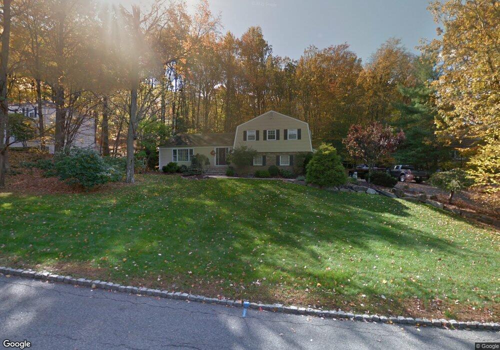
39 Forrest Rd Randolph, NJ 07869
Estimated Value: $828,000 - $935,000
About This Home
As of July 2015This home is located at 39 Forrest Rd, Randolph, NJ 07869 since 16 July 2015 and is currently estimated at $887,610, approximately $397 per square foot. This property was built in 1977. 39 Forrest Rd is a home located in Morris County with nearby schools including Randolph High School and Randolph Middle School.
Home Details
Home Type
- Single Family
Year Built
- Built in 1977
Lot Details
- 0.5 Acre Lot
Bedrooms and Bathrooms
- 4 Bedrooms
- 3 Bathrooms
Ownership History
Purchase Details
Home Financials for this Owner
Home Financials are based on the most recent Mortgage that was taken out on this home.Purchase Details
Home Financials for this Owner
Home Financials are based on the most recent Mortgage that was taken out on this home.Home Values in the Area
Average Home Value in this Area
Purchase History
| Date | Buyer | Sale Price | Title Company |
|---|---|---|---|
| Colasante Stephen | $496,000 | Chicago Title Insurance Co | |
| Mahon Robert | $601,000 | -- |
Mortgage History
| Date | Status | Borrower | Loan Amount |
|---|---|---|---|
| Open | Colasante Stephen | $49,600 | |
| Previous Owner | Mahon Robert | $340,000 |
Property History
| Date | Event | Price | List to Sale | Price per Sq Ft |
|---|---|---|---|---|
| 07/16/2015 07/16/15 | Sold | $496,000 | -- | $222 / Sq Ft |
Tax History
| Year | Tax Paid | Tax Assessment Tax Assessment Total Assessment is a certain percentage of the fair market value that is determined by local assessors to be the total taxable value of land and additions on the property. | Land | Improvement |
|---|---|---|---|---|
| 2025 | $14,588 | $534,000 | $244,900 | $289,100 |
| 2024 | $14,222 | $515,300 | $244,900 | $270,400 |
Map
Source: Garden State MLS
MLS Number: 3213898
APN: 32-00155-0000-00031
Disclaimer: Certain information contained herein is derived from information provided by parties other than Homes.com. All information provided is deemed reliable, but is not guaranteed to be accurate and should be independently verified.
![]() The data relating to real estate for sale on this website comes in part from the IDX Program of Garden State Multiple Listing Service, L.L.C. Real estate listings held by other brokerage firms are marked as IDX Listing.
The data relating to real estate for sale on this website comes in part from the IDX Program of Garden State Multiple Listing Service, L.L.C. Real estate listings held by other brokerage firms are marked as IDX Listing.
Information deemed reliable but not guaranteed.
Copyright © 2026 Garden State Multiple Listing Service, L.L.C. All rights reserved.
Notice: The dissemination of listings on this website does not constitute the consent required by N.J.A.C. 11:5.6.1 (n) for the advertisement of listings exclusively for sale by another broker. Any such consent must be obtained in writing from the listing broker.
This information is being provided for Consumers’ personal, non-commercial use and may not be used for any purpose other than to identify prospective properties Consumers may be interested in purchasing.
- 10 Lookout Rd
- 10 Bayberry Ln
- 10 Forrest Rd
- 29 Clover Ln
- 14 Fieldstone Ct
- 5 Elaine Ct
- 2 Chestnut Hill Rd
- 46 W Hanover Ave
- 8 Cherry Ln
- 4A Southview Rd
- 267 Washington Valley Rd
- 17 Ripplewood Dr
- 15 Southview Rd
- 1134 Sussex Turnpike
- 138 Shady Ln
- 24 Raynor Rd
- 46 Junard Dr
- 3 Starlight Dr
- 33 Shongum Rd
- 6 Woodlawn Terrace
- 41 Forrest Rd
- 37 Forrest Rd
- 46 Springhill Rd
- 33 Deer Run Dr
- 50 Forrest Rd
- 48 Forrest Rd
- 43 Forrest Rd
- 44 Springhill Rd
- 48 Springhill Rd
- 52 Forrest Rd
- 8 Echo Ridge Rd
- 44 Forrest Rd
- 45 Forrest Rd
- 42 Springhill Rd
- 31 Deer Run Dr
- 7 Spring Hill Ct
- 39 Springhill Rd
- 37 Springhill Rd
- 6 Echo Ridge Rd
- 9 Spring Hill Ct
Ask me questions while you tour the home.