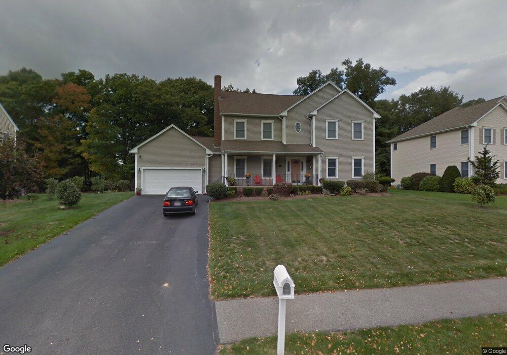
39 Hannah Niles Way Braintree, MA 02184
South Braintree NeighborhoodEstimated Value: $886,000 - $1,312,000
4
Beds
3
Baths
3,068
Sq Ft
$367/Sq Ft
Est. Value
About This Home
This home is located at 39 Hannah Niles Way, Braintree, MA 02184 and is currently estimated at $1,125,422, approximately $366 per square foot. 39 Hannah Niles Way is a home located in Norfolk County with nearby schools including Braintree High School, First Baptist Christian School, and Thayer Academy.
Ownership History
Date
Name
Owned For
Owner Type
Purchase Details
Closed on
Jan 2, 2018
Sold by
Moy Man Y and Moy Kint
Bought by
Moy Man Y and Moy Jeffrey
Current Estimated Value
Purchase Details
Closed on
Nov 19, 1999
Sold by
Simeone Homes Llc
Bought by
Moy Man Y and Moy David
Home Financials for this Owner
Home Financials are based on the most recent Mortgage that was taken out on this home.
Original Mortgage
$240,000
Interest Rate
7.76%
Mortgage Type
Purchase Money Mortgage
Create a Home Valuation Report for This Property
The Home Valuation Report is an in-depth analysis detailing your home's value as well as a comparison with similar homes in the area
Home Values in the Area
Average Home Value in this Area
Purchase History
| Date | Buyer | Sale Price | Title Company |
|---|---|---|---|
| Moy Man Y | -- | -- | |
| Moy Man Y | $440,508 | -- |
Source: Public Records
Mortgage History
| Date | Status | Borrower | Loan Amount |
|---|---|---|---|
| Previous Owner | Moy Man Y | $220,000 | |
| Previous Owner | Moy Man Y | $240,000 |
Source: Public Records
Tax History Compared to Growth
Tax History
| Year | Tax Paid | Tax Assessment Tax Assessment Total Assessment is a certain percentage of the fair market value that is determined by local assessors to be the total taxable value of land and additions on the property. | Land | Improvement |
|---|---|---|---|---|
| 2025 | $9,993 | $1,001,300 | $325,700 | $675,600 |
| 2024 | $9,163 | $966,600 | $294,200 | $672,400 |
| 2023 | $8,668 | $888,100 | $252,200 | $635,900 |
| 2022 | $8,627 | $867,000 | $231,100 | $635,900 |
| 2021 | $8,263 | $830,500 | $231,100 | $599,400 |
| 2020 | $8,189 | $830,500 | $231,100 | $599,400 |
| 2019 | $7,944 | $787,300 | $231,100 | $556,200 |
| 2018 | $7,838 | $743,600 | $210,100 | $533,500 |
| 2017 | $7,742 | $720,900 | $210,100 | $510,800 |
| 2016 | $7,582 | $690,500 | $210,100 | $480,400 |
| 2015 | $7,493 | $676,900 | $215,400 | $461,500 |
| 2014 | $7,127 | $624,100 | $188,100 | $436,000 |
Source: Public Records
Map
Nearby Homes
- 972 Liberty St
- 30 Thetford Ave
- 117 Amherst Rd
- 256 Evergreen Ave
- 61 Grove St
- 432 Grove St
- 441 Grove St
- 428 John Mahar Hwy Unit 301
- 115 Richard Rd
- 418 John Mahar Hwy Unit 408
- 414 John Mahar Hwy Unit 402
- 184 Richard Rd
- 501 Commerce Dr Unit 2310
- 501 Commerce Dr Unit 1111
- 501 Commerce Dr Unit 4206
- 501 Commerce Dr Unit 4308
- 501 Commerce Dr Unit 4306
- 44 Arlington Ave
- 1501 Liberty St
- 30 Bradford Commons Ln
- 31 Hannah Niles Way
- 51 Hannah Niles Way
- 21 Hannah Niles Way
- 61 Hannah Niles Way
- 193 Grove St
- 193 Grove St
- 40 Hannah Niles Way
- 30 Hannah Niles Way
- 50 Hannah Niles Way
- 71 Hannah Niles Way
- 20 Hannah Niles Way
- 60 Hannah Niles Way
- 11 Hannah Niles Way
- 219 Grove St
- 90 Hickory Rd
- 81 Hannah Niles Way
- 237 Grove St
- 85 Hickory Rd
- 245 Grove St
- 80 Hickory Rd