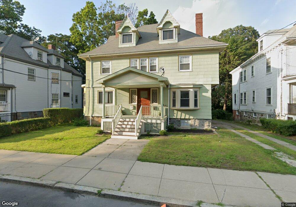
39 Howland St Dorchester, MA 02121
Washington Park NeighborhoodEstimated Value: $803,000 - $895,396
2
Beds
1
Bath
1,100
Sq Ft
$768/Sq Ft
Est. Value
About This Home
This home is located at 39 Howland St, Dorchester, MA 02121 and is currently estimated at $845,099, approximately $768 per square foot. 39 Howland St is a home located in Suffolk County with nearby schools including Bridge Boston Charter School and Mother Caroline Academy & Education Center.
Ownership History
Date
Name
Owned For
Owner Type
Purchase Details
Closed on
Aug 3, 2022
Sold by
Smith Marsha G
Bought by
Marsha G Smith T
Current Estimated Value
Purchase Details
Closed on
Jan 30, 2018
Sold by
Musa-Abdul Qaabid D and Thorpe Hattie P
Bought by
Smith Marsha G
Home Financials for this Owner
Home Financials are based on the most recent Mortgage that was taken out on this home.
Original Mortgage
$412,500
Interest Rate
3.93%
Mortgage Type
New Conventional
Create a Home Valuation Report for This Property
The Home Valuation Report is an in-depth analysis detailing your home's value as well as a comparison with similar homes in the area
Home Values in the Area
Average Home Value in this Area
Purchase History
| Date | Buyer | Sale Price | Title Company |
|---|---|---|---|
| Marsha G Smith T | -- | None Available | |
| Smith Marsha G | $550,000 | -- |
Source: Public Records
Mortgage History
| Date | Status | Borrower | Loan Amount |
|---|---|---|---|
| Previous Owner | Smith Marsha G | $412,500 |
Source: Public Records
Tax History Compared to Growth
Tax History
| Year | Tax Paid | Tax Assessment Tax Assessment Total Assessment is a certain percentage of the fair market value that is determined by local assessors to be the total taxable value of land and additions on the property. | Land | Improvement |
|---|---|---|---|---|
| 2025 | $7,910 | $683,100 | $285,400 | $397,700 |
| 2024 | $6,919 | $634,800 | $245,800 | $389,000 |
| 2023 | $6,373 | $593,400 | $229,800 | $363,600 |
| 2022 | $5,870 | $539,500 | $208,900 | $330,600 |
| 2021 | $5,379 | $504,100 | $195,200 | $308,900 |
| 2020 | $4,473 | $423,600 | $194,400 | $229,200 |
| 2019 | $3,970 | $376,700 | $144,500 | $232,200 |
| 2018 | $3,655 | $348,800 | $144,500 | $204,300 |
| 2017 | $3,551 | $335,300 | $144,500 | $190,800 |
| 2016 | $3,302 | $300,200 | $144,500 | $155,700 |
| 2015 | $3,009 | $248,500 | $95,000 | $153,500 |
| 2014 | $2,666 | $211,900 | $95,000 | $116,900 |
Source: Public Records
Map
Nearby Homes
- 28 Wabon St
- 164 Ruthven St Unit 1
- 7 Waumbeck St Unit 3
- 4 Wyoming St Unit 2
- 495 Warren St
- 214 Humboldt Ave
- 476 Warren St
- 75 Ruthven St
- 5 Glenburne St
- 99 Harrishof St
- 78 Hutchings St Unit 1
- 8 Weldon St
- 2 Otisfield St
- 12 Weldon St
- 151 Townsend St
- 9 Abbotsford St Unit 1
- 32 Hartwell St
- 352 Blue Hill Ave Unit 8
- 340 Blue Hill Ave
- 40 Devon St Unit 3
- 39 Howland St Unit 1
- 39 Howland St Unit 2
- 37 Howland St
- 37 Howland St Unit 2
- 41 Howland St
- 43 Howland St
- 35 Howland St
- 40 Howland St
- 40 Howland St Unit 2
- 38 Howland St
- 36 Howland St
- 69 Howland St
- 26 Waumbeck St
- 42 Howland St
- 33 Howland St
- 28 Waumbeck St
- 34 Howland St
- 34 Howland St Unit 2
- 30 Waumbeck St
- 24 Waumbeck St